
Beverly Hills is a southern suburb of Sydney, in the state of New South Wales, Australia. Beverly Hills is located 15 kilometres southwest of the Sydney central business district and is part of the St George area and is split between the local government areas of the Georges River Council and the City of Canterbury-Bankstown. The postcode is 2209, which it shares with neighbouring Narwee.
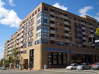
Hurstville is a suburb in Southern Sydney, New South Wales, Australia. It is 16 km (9.9 mi) south of the Sydney CBD and is part of the St George area. Hurstville is the administrative centre of the local government area of the Georges River Council.

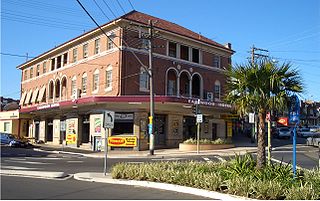
Kogarah is a suburb of Southern Sydney, in the state of New South Wales, Australia. Kogarah is located 14 kilometres south-west of the Sydney central business district and is considered to be the centre of the St George area.

Epiphany, also known as "Theophany" in Eastern Christian tradition, is a Christian feast day commemorating the visit of the Magi, the baptism of Jesus, and the wedding at Cana.
Rondebosch is one of the Southern Suburbs of Cape Town, South Africa. It is primarily a residential suburb, with shopping and business districts as well as the main campus of the University of Cape Town.

The Molopo River is one of the main rivers in Southern Africa. It has a length of approximately 960 kilometres and a catchment area of 367,201 km2 with Botswana, Namibia and South Africa sharing roughly about a third of the basin each.

The NossobRiver is a dry river bed in eastern Namibia and the Kalahari region of South Africa and Botswana. It covers a distance of 740 km and last flooded in 1989. The river also lends its name to Nossob camp 25°25′18″S20°35′47″E in the Kgalagadi Transfrontier Park.
The R360 is a Regional Route in the Northern Cape of South Africa that connects Upington with the Kalahari Gemsbok National Park and the Namibian border. It passes through Askham and Andriesvale.
Sans Souci is a Southern Sydney suburb in the state of New South Wales, Australia. Sans Souci is 17 kilometres south of the Sydney central business district and lies across the local government areas of the Bayside Council and the Georges River Council. It is part of the St George area.

George is the second largest city in the Western Cape province of South Africa. The city is a popular holiday and conference centre, as well as the administrative and commercial hub and the seat of the Garden Route District Municipality. It is named after the British Monarch George III.
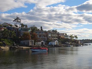
Sylvania is a suburb in southern Sydney, New South Wales, Australia, 22 kilometres south of the Sydney central business district in the Sutherland Shire. It is well known for its large waterfront properties and restaurants.

Oyster Bay is a suburb in Southern Sydney, in the state of New South Wales, Australia. It is located 26 kilometres south of the Sydney central business district in the local government area of the Sutherland Shire.
Earlwood is a suburb of Sydney, in the state of New South Wales, Australia. Earlwood is located 10 kilometres south-west of the Sydney central business district, and is part of the Canterbury-Bankstown area. It is in the local government area of the City of Canterbury-Bankstown.

Peakhurst Heights is a suburb in southern Sydney, in the state of New South Wales, Australia. Peakhurst Heights is located 22 kilometres south of the Sydney central business district and is part of the St George area. Peakhurst Heights is in the local government area of the Georges River Council.

Belfield is a suburb of Sydney, in the state of New South Wales, Australia. It is 8 miles (13 km) southwest of the Sydney central business district, in the local government area of the City of Canterbury-Bankstown and partly in the Municipality of Strathfield.

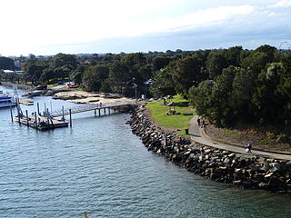
Bonnet Bay is a suburb in southern Sydney, in the state of New South Wales, Australia that is located 29 kilometres (18 mi) south of the Sydney central business district in the local government area of the Sutherland Shire. Its postcode is 2226, which it shares with neighbouring Jannali and Como. Bonnet Bay is located on the eastern bank of the Woronora River, which flows north into the Georges River.

Bugnara is a comune and village in the province of L'Aquila in the Abruzzo region of southern Italy. It is one of I Borghi più belli d'Italia.

Joubertina is a small town in the Kou-Kamma Local Municipality, Sarah Baartman District of the Eastern Cape province of South Africa.

The Grote rivieren, literally translated Great rivers, is a landform in the Netherlands. Also, the term is commonly used for a divide in Dutch culture linking to the broader Dutch-Flemish culture.

Lugarno is a suburb situated in the St George area of southern Sydney, in the state of New South Wales, Australia. It is located in the local government area of the Georges River Council, 23 kilometres south of the Sydney central business district.


