Brenda, Arizona

Last updated

Brenda, Arizona
La Paz County Arizona Incorporated and Unincorporated areas Brenda Highlighted 0407590.svg
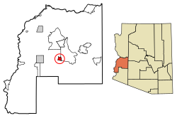
Location of Brenda in La Paz County, Arizona
USA Arizona location map.svg
Red pog.svg
Brenda
Usa edcp location map.svg
Red pog.svg
Brenda
Coordinates: 33°40′47″N113°56′41″W / 33.67972°N 113.94472°W / 33.67972; -113.94472
Country United States
State Arizona
County La Paz
Area
[1]
  Total6.91 sq mi (17.90 km2)
  Land6.91 sq mi (17.90 km2)
  Water0.00 sq mi (0.00 km2)
Elevation
1,375 ft (419 m)
Population
 (2020)
  Total466
  Density67.44/sq mi (26.04/km2)
Time zone UTC-7 (Mountain (MST))
Area code 928
GNIS feature ID 24335
FIPS code 04-07590

Brenda is a census-designated place (CDP) in La Paz County, Arizona, United States.

Contents

Description

The community is located approximately 16 kilometres (9.9 mi) east of Quartzsite and 4 miles (6 km) northeast of Interstate 10 on U.S. Route 60 (US 60). Its population was 466 as of the 2020 census. The community lies 5 miles (8 km) east of the Plomosa Mountains, and it is the closest community to the New Water Mountains Wilderness, five air miles to the south. Brenda is four miles northeast of the western terminus of US 60 (the last community on the highway westbound).

Demographics

Historical population
CensusPop.Note
2010 676
2020 466−31.1%
U.S. Decennial Census [2]

Brenda first appeared on the 2010 U.S. Census as a census-designated place (CDP). [3]

See also

Related Research Articles

Kaibab is an unincorporated community and census-designated place (CDP) in Mohave County, Arizona, United States. It is within the Kaibab Indian Reservation. The population of the CDP was 140 at the 2020 census.

<span class="mw-page-title-main">Canyon Day, Arizona</span> CDP in Gila County, Arizona

Canyon Day is a census-designated place (CDP) in Gila County, Arizona, United States, on the Fort Apache Indian Reservation. The population was 1,209 at the 2010 census.

<span class="mw-page-title-main">Claypool, Arizona</span> CDP in Gila County, Arizona

Claypool is a census-designated place (CDP) in Gila County, Arizona, United States. The population was 1,538 at the 2010 census, down from 1,794 at the 2000 census. It was named after W. D. Claypool, a member of both the State House of Representatives and State Senate in the 1910s and 1920s.

<span class="mw-page-title-main">Pine, Arizona</span> CDP in Gila County, Arizona

Pine is an unincorporated community and census-designated place (CDP) in Gila County, Arizona, United States. The population was 1,963 at the 2010 census. Pine was established by four Mormon families in 1879.

<span class="mw-page-title-main">Strawberry, Arizona</span> CDP in Gila County, Arizona

Strawberry is an unincorporated community and census-designated place (CDP) in Gila County, Arizona, United States. The population was 961 at the 2010 census.

<span class="mw-page-title-main">Salome, Arizona</span> CDP in La Paz County, Arizona

Salome is an unincorporated community and census-designated place (CDP) in La Paz County, Arizona, United States. The population was 1,530 at the 2010 census. It was established in 1904 by Dick Wick Hall, Ernest Hall and Charles Pratt, and was named after Pratt's wife, Grace Salome Pratt.

<span class="mw-page-title-main">Wenden, Arizona</span> Place in Arizona, United States

Wenden is an unincorporated community in La Paz County, Arizona, United States. The population was 728 at the 2010 census, up from 556 in 2000. For statistical purposes the United States Census Bureau has designated Wenden as a census-designated place (CDP).

<span class="mw-page-title-main">Rio Verde, Arizona</span> CDP in Maricopa County, Arizona

Rio Verde is a master-planned community just east of Scottsdale, in Arizona. It is also a census-designated place (CDP) in Maricopa County, Arizona, United States. The population was 2,210 as of the 2020 census, up from 1,811 at the 2010 census.

<span class="mw-page-title-main">Dolan Springs, Arizona</span> CDP in Mohave County, Arizona

Dolan Springs is an unincorporated community and census-designated place (CDP) in Mohave County, Arizona, United States. The population was 1,989 at the 2020 census, down from 2,033 at the 2010 census.

<span class="mw-page-title-main">Peach Springs, Arizona</span> CDP in Mohave County, Arizona

Peach Springs is a census-designated place (CDP) in Mohave County, Arizona, United States. The population was 1,098 at the 2020 census. Peach Springs serves as the administrative headquarters of the Hualapai people and is located on the Hualapai Reservation.

<span class="mw-page-title-main">Blackwater, Arizona</span> CDP in Pinal County, Arizona

Blackwater is a native village and census-designated place (CDP) on the Gila River Reservation in Pinal County, Arizona, United States. The population was 1,062 at the 2010 census, up from 504 in 2000.

<span class="mw-page-title-main">Queen Valley, Arizona</span> CPD in Pinal County, Arizona

Queen Valley is a census-designated place (CDP) in north central Pinal County, Arizona, United States. The population was 820 at the 2000 census.

<span class="mw-page-title-main">Aguila, Arizona</span> CDP in Maricopa County, Arizona

Aguila is an unincorporated community and census-designated place (CDP) in Maricopa County, Arizona, United States. It is located on U.S. Route 60, 25 miles (40 km) west of Wickenburg and 22 miles (35 km) northeast of Wenden. Major economic activities include cantaloupe farming and formerly included mining. It uses the same street numbering system as Phoenix. As of the 2020 census, the population of Aguila was 565, down from 798 in 2010.

<span class="mw-page-title-main">Morristown, Arizona</span> CDP in Maricopa County, Arizona

Morristown is an unincorporated community and census-designated place (CDP) in Maricopa County, Arizona, United States. It is 43 miles (69 km) northwest of Phoenix, at the junction of State Route 74 and U.S. Route 60. As of the 2020 census, it had a population of 186, down from 227 in 2010.

<span class="mw-page-title-main">Rio Rico, Arizona</span> CDP in Santa Cruz County, Arizona

Rio Rico is an unincorporated community and census-designated place (CDP) in Santa Cruz County, Arizona, United States. The population was 18,962 at the 2010 census. The Rio Rico CDP replaced the former CDP's of Rio Rico Northwest, Rio Rico Northeast, Rio Rico Southwest, and Rio Rico Southeast.

<span class="mw-page-title-main">Crystal Mountain, Michigan</span> Census-designated place & unincorporated community in Michigan, United States

Crystal Mountain is an unincorporated community and census-designated place in Benzie County in the U.S. state of Michigan. The population was 59 at the 2020 census. Crystal Mountain is located within Weldon Township.

<span class="mw-page-title-main">White Mountain Lake, Arizona</span> Unincorporated community in the state of Arizona, United States

White Mountain Lake is an unincorporated community and census-designated place in Navajo County, Arizona, United States. White Mountain Lake is 7.5 miles (12.1 km) north-northeast of Show Low. White Mountain Lake has a post office with ZIP code 85912.

Beyerville is a census-designated place (CDP) in Santa Cruz County, Arizona, United States. The population was 177 at the 2010 census.

Mead Ranch is a census-designated place (CDP) in Gila County, Arizona, United States. The population was 38 at the 2010 census.

Crozier is an unincorporated community and census-designated place (CDP) in Mohave County, Arizona, United States. The population was 21 at the 2020 census.

References

  1. "2020 U.S. Gazetteer Files". United States Census Bureau. Retrieved October 29, 2021.
  2. "Census of Population and Housing". Census.gov. Retrieved June 4, 2016.
  3. U.S. Census Bureau (October 2012). "Arizona: 2010 - Summary Population and Housing Characteristics" (PDF). U.S. Government Printing Office.

Commons-logo.svg Media related to Brenda, Arizona at Wikimedia Commons