Broadview, Montana

Last updated
Broadview, Montana
Broadview, MT 59015, USA - panoramio.jpg
Panoramio in Broadview
Yellowstone County Montana Incorporated and Unincorporated areas Broadview Highlighted.svg
Location of Broadview, Montana
Coordinates: 46°05′56″N108°52′34″W / 46.09889°N 108.87611°W / 46.09889; -108.87611
CountryUnited States
State Montana
County Yellowstone
Established1908
Incorporated 1917
Area
[1]
  Total0.26 sq mi (0.68 km2)
  Land0.26 sq mi (0.68 km2)
  Water0.00 sq mi (0.00 km2)
Elevation
[2]
3,881 ft (1,183 m)
Population
 (2020) [3]
  Total139
  Estimate 
(2022) [4]
139
  Density530.53/sq mi (204.89/km2)
Time zone UTC–7 (Mountain (MST))
  Summer (DST) UTC–6 (MDT)
ZIP Code
59015
Area code 406
FIPS code 30-09775
GNIS feature ID2411729 [2]

Broadview is a town in Yellowstone County, Montana, United States. The population was 139 at the 2020 census. [3]

Contents

The post office was established in 1908 [5] and the town was incorporated in 1917. [6]

Geography

According to the United States Census Bureau, the town has a total area of 0.26 square miles (0.67 km2), all land. [1]

Climate

According to the Köppen Climate Classification system, Broadview has a semi-arid climate, abbreviated "BSk" on climate maps. [7]

Demographics

Historical population
CensusPop.Note
1920 191
1930 26036.1%
1940 140−46.2%
1950 16417.1%
1960 160−2.4%
1970 123−23.1%
1980 120−2.4%
1990 13310.8%
2000 15012.8%
2010 19228.0%
2020 139−27.6%
2022 (est.)139 [4] 0.0%
U.S. Decennial Census [8]
2020 Census [3]

2020 census

As of the 2020 census, there were 139 people, 61 households, and 42 families living in the town. [9] There were 73 housing units.

2010 census

As of the 2010 census, there were 192 people, 66 households, and 47 families living in the town. The population density was 738.5 inhabitants per square mile (285.1/km2). There were 73 housing units at an average density of 280.8 per square mile (108.4/km2). The racial makeup of the town was 95.3% White, 1.0% Native American, 3.1% from other races, and 0.5% from two or more races. Hispanic or Latino of any race were 6.8% of the population.

There were 66 households, of which 34.8% had children under the age of 18 living with them, 57.6% were married couples living together, 7.6% had a female householder with no husband present, 6.1% had a male householder with no wife present, and 28.8% were non-families. 24.2% of all households were made up of individuals, and 18.2% had someone living alone who was 65 years of age or older. The average household size was 2.91 and the average family size was 3.43.

The median age in the town was 39.5 years. 31.2% of residents were under the age of 18; 5.8% were between the ages of 18 and 24; 21.9% were from 25 to 44; 25.1% were from 45 to 64; and 16.1% were 65 years of age or older. The gender makeup of the town was 52.6% male and 47.4% female.

2000 census

As of the 2000 census, there were 150 people, 64 households, and 41 families living in the town. The population density was 624.7 inhabitants per square mile (241.2/km2). There were 66 housing units at an average density of 274.9 per square mile (106.1/km2). The racial makeup of the town was 96.67% White, 0.67% Native American, and 2.67% from two or more races. Hispanic or Latino of any race were 2.67% of the population.

There were 64 households, out of which 31.3% had children under the age of 18 living with them, 53.1% were married couples living together, 4.7% had a female householder with no husband present, and 34.4% were non-families. 32.8% of all households were made up of individuals, and 17.2% had someone living alone who was 65 years of age or older. The average household size was 2.34 and the average family size was 2.95.

In the town, the population was spread out, with 28.0% under the age of 18, 6.0% from 18 to 24, 20.7% from 25 to 44, 27.3% from 45 to 64, and 18.0% who were 65 years of age or older. The median age was 42 years. For every 100 females, there were 80.7 males. For every 100 females age 18 and over, there were 86.2 males.

The median income for a household in the town was $29,500, and the median income for a family was $34,688. Males had a median income of $35,417 versus $16,250 for females. The per capita income for the town was $12,882. There were 6.4% of families and 9.8% of the population living below the poverty line, including 10.6% of under eighteens and 16.7% of those over 64.

Education

Broadview School District educates students from kindergarten through 12th grade. [10] The mascot for Broadview High School is the Pirates. [11]

Related Research Articles

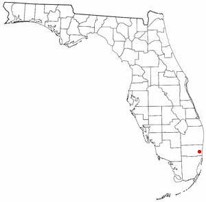
<span class="mw-page-title-main">Broadview Park, Florida</span> CDP in Florida, United States

Broadview Park is a census-designated place (CDP) in Broward County, Florida, United States. The population was 7,670 at the 2020 census.
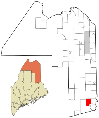
<span class="mw-page-title-main">Haynesville, Maine</span> Town in the state of Maine, United States

Haynesville is a town in Aroostook County, Maine, United States. The population was 97 at the 2020 census.

<span class="mw-page-title-main">Orient, Maine</span> Town in the state of Maine, United States

Orient is a town in Aroostook County, Maine, United States. The population was 156 at the 2020 census.

<span class="mw-page-title-main">Westfield, Maine</span> Town in the state of Maine, United States

Westfield is a town in Aroostook County, Maine, United States. The population was 455 at the 2020 census.
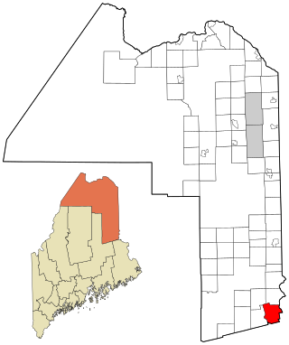
<span class="mw-page-title-main">Weston, Maine</span> Town in the state of Maine, United States

Weston is a town in Aroostook County, Maine, United States. The population was 245 at the 2020 census.

Alexander is a town in Washington County, Maine, United States. The population was 525 at the 2020 census. The town is named for Alexander Baring, 1st Baron Ashburton, the British negotiator of the Webster–Ashburton Treaty which ended the Aroostook War in 1838–1839.

Cooper is a town in Washington County, Maine, United States. The community was named after General John Cooper, a landowner. The population was 168 at the 2020 census.
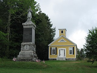
<span class="mw-page-title-main">Dennysville, Maine</span> Town in the state of Maine, United States

Dennysville is a town in Washington County, Maine, United States. The population was 300 at the 2020 census.

Meddybemps is a town in Washington County, Maine, United States. The population was 139 at the 2020 census.

Northfield is a town in Washington County, Maine, United States. The population was 178 at the 2020 census.

Princeton is a town in Washington County, Maine, United States. The town was named after Princeton, Massachusetts. The population was 745 at the 2020 census.

Roque Bluffs is a town in Washington County, Maine, United States. The population was 296 at the 2020 census. The town is home to Roque Bluffs State Park.

Wesley is a town in Washington County, Maine, United States. The town was named after John Wesley, founder of the English Methodist movement. The population was 122 at the 2020 census.

<span class="mw-page-title-main">Grass Range, Montana</span> Town in Montana, United States

Grass Range is a town in Fergus County, Montana, United States. The population was 110 in both the 2010 census and 2020 census.

<span class="mw-page-title-main">Winifred, Montana</span> Town in Montana, United States

Winifred is a small town in rural north-central Fergus County, Montana, United States. It was founded in 1913 and provides services for its region's populace. The town population was 172 at the 2020 census. The current mayor is Travis Willson.
<span class="mw-page-title-main">Sheridan, Montana</span> Town in Montana, United States

Sheridan is a town in Madison County, Montana, United States named after the Civil War general Philip Sheridan. The population was 694 at the 2020 census. Sheridan is known as the "heart of the Ruby Valley." Seven mountain ranges surround the town: Tobacco Root Mountains, Highland Mountains, McCartney Mountain, The Pioneers, The Ruby Range, The Gravelly Range and the Snowcrest Range. The Ruby River winds through the valley just west of the town.

<span class="mw-page-title-main">Brockton, Montana</span> Census-designated place in Montana, United States

Brockton is a census-designated place and former town in Roosevelt County, Montana, United States. The population was 358 at the 2020 census.
<span class="mw-page-title-main">Kevin, Montana</span> Town in Montana, United States

Kevin is a town in Toole County, Montana, United States. The population was 154 at the 2020 census, equal to the 2010 Census population. The town was named after Thomas Kevin, superintendent of the Alberta Railway & Irrigation Company. Locals pronounce Kevin with a long E, like Keevin.

<span class="mw-page-title-main">Nashua, Montana</span> Town in Montana, United States

Nashua is a town in Valley County, Montana, United States. The population was 301 at the 2020 census.

<span class="mw-page-title-main">Montana, Wisconsin</span> Town in Wisconsin, United States

Montana is a town in Buffalo County in the U.S. state of Wisconsin. The population was 284 at the 2010 census. The unincorporated community of Montana is located in the town.

References

  1. 1 2 "2023 U.S. Gazetteer Files". United States Census Bureau. Retrieved February 29, 2024.
  2. 1 2 U.S. Geological Survey Geographic Names Information System: Broadview, Montana
  3. 1 2 3 "Explore Census Data". United States Census Bureau . Retrieved March 1, 2024.
  4. 1 2 "City and Town Population Totals: 2020–2022". United States Census Bureau. March 1, 2024. Retrieved March 1, 2024.
  5. Carkeek Cheney, Roberta (1983). Names on the Face of Montana. Missoula, Montana: Mountain Press Publishing Company. ISBN   0-87842-150-5.
  6. "Montana Place Names Companion". Montana Historical Society. Retrieved July 29, 2017.
  7. "Broadview, Montana Climate Classification". Weatherbase. Retrieved 2024-04-29.
  8. "Census of Population and Housing". United States Census Bureau. Retrieved June 4, 2015.
  9. "US Census Bureau, Table P16: Household Type". United States Census Bureau. Retrieved March 1, 2024.
  10. "Broadview School District". Broadview School District. Retrieved April 19, 2021.
  11. "Member Schools". Montana High School Association. Retrieved April 19, 2021.