Elk Rapids is a village in the U.S. state of Michigan. The village is the largest incorporated community in Antrim County, with a population of 1,529 at the 2020 census. The village is located within Elk Rapids Township, in the southwest of Antrim County, and is on the shore of Grand Traverse Bay, a bay of Lake Michigan. Elk Rapids is located about 12 miles (19 km) southwest of Bellaire, the county seat, and about 13 miles (21 km) northeast of Traverse City, the largest city in Northern Michigan.

Ellsworth is a village in Antrim County in the U.S. state of Michigan. The population was 367 at the 2020 census. The village is located within Banks Township.

Benzonia Township is a civil township of Benzie County in the U.S. state of Michigan. As of the 2020 census, the township population was 1,870.

Elberta is a village in Benzie County in the U.S. state of Michigan. The population was 329 at the 2020 census. Located in Gilmore Township, Elberta overlooks Lake Michigan and lies across Betsie Lake from Frankfort. Elberta is part of Northern Michigan.

Lake Ann is a village in northeastern Benzie County in the U.S. state of Michigan. Part of Almira Township, Lake Ann is situated 10 miles (16 km) west of Traverse City, and largely dependent upon that city. The population of Lake Ann was 273 at the 2020 census.

Fife Lake is a village in southeastern Grand Traverse County in the U.S. state of Michigan. Its population was 456 at the 2020 census, up from 443 at the 2010 census. The village is part of the Traverse City metropolitan area, and lies upon the shore of the lake of the same name.

Kingsley is a village in Grand Traverse County in the U.S. state of Michigan. The population was 1,431 at the 2020 census. The village is located within Paradise Township and is part of the Traverse City metropolitan area.

Mayfield Township is a civil township of Grand Traverse County in the U.S. state of Michigan. The population was 1,786 at the 2020 census, an increase from 1,550 at the 2010 census.

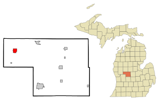
Kalkaska Township is a civil township of Kalkaska County in the U.S. state of Michigan. The population was 2,895 at the 2020 census. The township contains the village of Kalkaska, which serves as the county seat. The western half of the township was formerly a separate township, known as Wilson Township.

Cedar Springs is a city in Kent County in the U.S. state of Michigan. The population was 3,509 at the 2010 census. Cedar Springs is a northern city of the Grand Rapids metropolitan area and is about 20 miles (32.2 km) north of Grand Rapids.

Copemish is a village in Manistee County of the U.S. state of Michigan. The population was 195 at the 2020 census. The village is within Cleon Township.

Eastlake is a village in the U.S. state of Michigan. The population was 415 at the 2020 census. Located within Manistee County, the village sits across Manistee Lake from the city of Manistee.
Kaleva is a village in Manistee County in the U.S. state of Michigan. The population was 507 at the 2020 census.

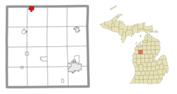
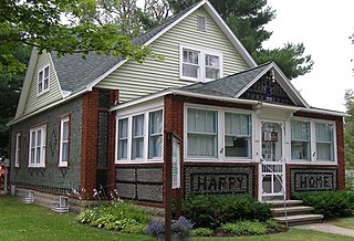
Morley is a village in Mecosta County in the U.S. state of Michigan. The population was 517 at the 2020 census.
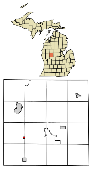
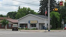
Stanwood is a village in Mecosta County of the U.S. state of Michigan. The population was 194 at the 2020 census. The village is within Mecosta Township.

Lake City is a city in the U.S. state of Michigan. It is the county seat of Missaukee County, and is the largest city within the county. The city is located in the Northern Lower Peninsula of Michigan. As of the 2020 census, the population of Lake City was 829. Lake City has been nicknamed "Michigan's Christmas Tree Capital", due to the high number of farms near the city.
Howard City is a village in Montcalm County in the U.S. state of Michigan. The population was 1,835 at the 2020 census. The village is within Reynolds Township.

Clam Lake Township is a civil township of Wexford County in the U.S. state of Michigan. The population was 2,325 at the 2020 census.

Hanover Township is a civil township of Wexford County in the U.S. state of Michigan. The population was 1,698 at the 2020 census.
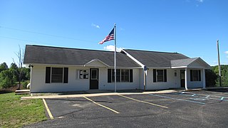
Springfield Township is a civil township of Kalkaska County in the U.S. state of Michigan. The population was 1,562 at the 2020 census.