
Halvergate is a village and civil parish in the English county of Norfolk, north of Reedham, between the Rivers Bure and Yare, within The Broads. To the east of the village is the hamlet of Wickhampton and the Halvergate Marshes, an area of drainage marsh which was the site of the first Environmentally Sensitive Area in the United Kingdom in 1987.

Cotes is a hamlet and very small civil parish near the town of Loughborough in Leicestershire, England. Cotes has a population of about 50. At the 2011 census the population remained less than 100 and was included in the civil parish of Burton on the Wolds.

Cossington is a village within the Soar Valley in Leicestershire, England. It lies between Sileby, Rothley, Ratcliffe-on-the-Wreake and Syston. The population of the civil parish at the 2011 census was 598.

North Leverton with Habblesthorpe is a village and civil parish in the English county of Nottinghamshire. It is about 5 miles or 8 km east of Retford. The population as at the 2011 Census was 1,047, and in the Census 2021 it had increased to 1,079.

Bleasby is a village and civil parish in Nottinghamshire, England, located 15 mi northeast of Nottingham. It has a population of 804 for the 2001 census, increasing to 824 at the 2011 census, and 840 at the 2021 census.

Stoke Bardolph is a village and civil parish in the Gedling district of Nottinghamshire. The population of the civil parish taken at the 2011 census was 170. It is to the east of Nottingham, and on the west bank of the River Trent. Nearby places include Burton Joyce and Radcliffe on Trent.

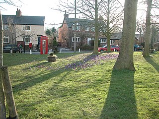
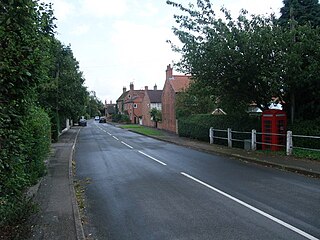
Burton Joyce is a large village and civil parish in the Gedling district of Nottinghamshire, England, 7 miles (11 km) east of Nottingham, between Stoke Bardolph to the south and Bulcote to the north-east. The A612 links it to Carlton and Netherfield to the south-west and Lowdham to the north-east. Initially the site of an Iron age fort, it was occupied by Norman nobility, who founded St Helen's Church. From being a farming community, Burton Joyce grew in the early Industrial Revolution, earning repute up to the 1920s for its textile products. Many of today's 3,443 inhabitants commute to work in Nottingham. It forms with Stoke Bardoph and Bulcote the Trent Valley ward of Gedling, with two councillors.

Walton on the Wolds is a village and civil parish in the Charnwood district of Leicestershire, England. In the United Kingdom Census 2011 the parish had a population of 288. It is near to Burton on the Wolds and Barrow upon Soar. It was the location of one series of Boon, starring Neil Morrissey. The series used the Tudor house, Kings Cote, as Boon's house.

Asby is a civil parish in the Eden district of Cumbria, England. Historically part of Westmorland, it includes the villages of Great Asby and Little Asby. According to the 2001 census the parish had a population of 280, and this had increased to 309 at the 2011 Census.

Barrow is a civil parish, in the unitary authority of Cheshire West and Chester and the ceremonial county of Cheshire, England. The civil parish contains the village of Great Barrow and the hamlets of Little Barrow, Broomhill and Stamford Bridge. Great Barrow is situated about 4.5 miles east-north-east of Chester, 6 miles north-west of Tarporley and 6 miles south of Frodsham.

Bathley is a village and civil parish in the Newark and Sherwood district of Nottinghamshire, England, north-west of Newark-on-Trent. According to the 2011 census it had a population of 246, this increased marginally to 247 in the 2021 census. Bathley is recorded in the Domesday Book as Badeleie.
Bevercotes is a hamlet and civil parish in the Bassetlaw district of Nottinghamshire, England, about six miles south of East Retford and five miles north-east of Ollerton. According to the 2001 census it had a population of 28. The population remained less than 100 at the 2011 Census and was included in the civil parish of Bothamsall. In 2021 it was reported as having 19 residents.

Broughton is a village and civil parish in North Yorkshire, England. Broughton is situated 1.5 miles (2.4 km) north-west of Malton. According to the 2011 census the parish had a population of 212, a reduction from the 2001 census when it stood at 233.

Bradenham is a village and civil parish, a conglomeration of East and West Bradenham, in the English county of Norfolk. It is situated some 5 miles (8.0 km) south-west of the town of East Dereham and 19 miles (31 km) west of the city of Norwich.
South Acre is a village and civil parish in the English county of Norfolk. The village has almost disappeared, but the remnants are located about 1 km (0.62 mi) south-west of Castle Acre, 8 km (5.0 mi) north of the town of Swaffham, 20 km (12 mi) east of the town of King's Lynn and 50 km (31 mi) west of the city of Norwich. The River Nar flows between South Acre and Castle Acre.
Puddington is a village and civil parish on the Wirral Peninsula, in the unitary authority of Cheshire West and Chester and the ceremonial county of Cheshire, England. It is located to the south east of the town of Neston and close to the border with Wales.

Warlaby is a small village and civil parish in the Hambleton District of North Yorkshire, England. The population of the civil parish taken at the 2011 Census was less than 100. Details are included in the civil parish of Ainderby Steeple. In 2015, North Yorkshire County Council estimated the population to be around 50 people. It is near the A684 and Morton-on-Swale. It is 1.6 miles (2.5 km) west of Northallerton.

Ickburgh is a village and civil parish in the English county of Norfolk. It is situated on the A1065 Mildenhall to Fakenham road, some 5.5 miles (8.9 km) north of Brandon and 9 miles (14 km) south of Swaffham. The village is 36 miles (58 km) from the city of Norwich and 89 miles (143 km) from London. The population and Didlington was 309 in 134 households at the 2011 Census. The parish has an area of 1,221 hectares and in the 2001 census had a population of 245 in 99 households. The parish shares boundaries with the adjacent parishes of Hilborough, Foulden, Didlington, Mundford, Lynford and Stanford. The parish falls within the district of Breckland. Local government responsibilities are shared between the parish, district and county councils.
Caythorpe is a village and civil parish in Nottinghamshire, England. It is situated 10 miles (16 km) north-east from Nottingham, close to the River Trent. According to the 2001 census, it had a population of 259, increasing to 271 at the time of the 2011 census,. and dropping to 257 at the 2021 census.

Shipdham is a village and civil parish in the Breckland district, in Norfolk, England, approximately 5 miles (8.0 km) south-south-west of Dereham. In the 2001 census the parish had a population of 2,145 in 899 households, falling at the 2011 Census to a population of 2,057 in 899 households. It covers an area of 18.69 km2 (7.22 sq mi). It is also known to be the longest village in Norfolk.


