Burton | |
---|---|
Country | Canada |
Province | New Brunswick |
County | Sunbury County |
Erected | 1786 |
Area | |
• Land | 258.39 km2 (99.76 sq mi) |
Population (2021) [1] | |
• Total | 5,176 |
• Density | 20.0/km2 (52/sq mi) |
• Change 2016-2021 | 1.1% |
• Dwellings | 2,074 |
Time zone | UTC-4 (AST) |
• Summer (DST) | UTC-3 (ADT) |
Figures do not include portions within the town of Oromocto and the Oromocto 26 Indian reserve |
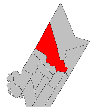
Burton is a geographic parish in Sunbury County, New Brunswick, Canada. [2]
Prior to the 2023 governance reform, for governance purposes it was divided between the town of Oromocto, the Indian reserve of Oromocto 26, CFB Gagetown, and the local service district of the parish of Burton. [3] The town and LSD were both members of Capital Region Service Commission (RSC11). [4]
The parish was named in honour of Ralph Burton, military commander-in-chief in Montreal at the time of its establishment as a township. [5]
Burton was first established in 1765 as a Nova Scotia township. [6]
Burton was erected in 1786 as one of the original parishes of Sunbury County. [7] The parish extended further inland than the township. [8]
In 1835 the rear of the parish was included in the newly erected Blissville Parish. [9]
In 1896 the boundary with Blissville was altered along the Nerepis Road. [10]
In 1949 the boundary with Blissville was changed back to its pre-1896 course. [11]
Burton Parish is bounded: [2] [12] [13] [14]
Communities at least partly within the parish; [12] [13] [14] bold indicates an incorporated municipality or Indian reserve; italics indicate a community expropriated for CFB Gagetown
Bodies of water [lower-alpha 2] at least partly in the parish: [12] [13] [14]
Islands in the parish: [12] [13] [14]
Parks, historic sites, and other noteworthy places in the parish. [12] [13] [14]
Parish population total does not include Oromocto 26 Indian reserve and area within 2021 boundaries of Oromocto. Revised census figures based on the 2023 local governance reforms have not been released.
Highways and numbered routes that run through the parish, including external routes that start or finish at the parish limits: [21]
|
|
|
|
Waterborough is a geographic parish in Queens County, New Brunswick, Canada.
Blissville is a geographic parish in Sunbury County, New Brunswick, Canada.
Hampstead is a geographic parish in Queens County, New Brunswick, Canada.
Northampton is a geographic parish in Carleton County, New Brunswick, Canada, sitting across the Saint John River from Woodstock.
Prince William is a geographic parish in York County, New Brunswick, Canada.
Manners Sutton is a geographic parish in York County, New Brunswick, Canada.
New Maryland is a geographic parish in York County, New Brunswick, Canada.
Douglas is a geographic parish in York County, New Brunswick, Canada.
Saint Marys is a geographic parish in York County, New Brunswick, Canada.
Maugerville is a geographic parish in Sunbury County, New Brunswick, Canada.
Lincoln is a geographic parish in Sunbury County, New Brunswick, Canada.
Oromocto is a Canadian town in Sunbury County, New Brunswick.
Harvey is a geographic parish in southern Albert County, New Brunswick, Canada.
Petersville is a geographic parish in Queens County, New Brunswick, Canada.
Clarendon is a geographic parish in Charlotte County, New Brunswick, Canada, located in the interior to the north of Point Lepreau and southwest of CFB Gagetown.
Gagetown is a geographic parish in Queens County, New Brunswick, Canada.
Canning is a geographic parish in Queens County, New Brunswick, Canada.
Sheffield is a geographic parish in Sunbury County, New Brunswick, Canada.
Chipman is a geographic parish in Queens County, New Brunswick, Canada.
Gladstone is a geographic parish in Sunbury County, New Brunswick, Canada.