Camanche North Shore, California

Last updated

Camanche North Shore
Amador County California Incorporated and Unincorporated areas Camanche North Shore Highlighted 0610042.svg
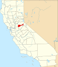
Location of Camanche North Shore in Amador County, California.
USA California location map.svg
Red pog.svg
Camanche North Shore
Position in California.
Coordinates: 38°14′40″N120°57′14″W / 38.24444°N 120.95389°W / 38.24444; -120.95389
Country Flag of the United States (23px).png  United States
State Flag of California.svg  California
County Amador
Area
[1]
  Total2.33 sq mi (6.04 km2)
  Land2.33 sq mi (6.04 km2)
  Water0.00 sq mi (0.00 km2)  0%
Elevation
[2]
308 ft (94 m)
Population
 (2020)
  Total1,070
  Density458.83/sq mi (177.18/km2)
Time zone UTC-8 (Pacific (PST))
  Summer (DST) UTC-7 (PDT)
GNIS feature ID 2582959
[3]

Camanche North Shore is a census-designated place in Amador County, California. Camanche North Shore sits at an elevation of 308 feet (94 m). The 2010 United States census reported Camanche North Shore's population was 979.

Demographics

Historical population
CensusPop.Note
2020 1,070
U.S. Decennial Census [4]
1850–1870 [5] [6] 1880-1890 [7]
1900 [8] 1910 [9] 1920 [10]
1930 [11] 1940 [12] 1950 [13]
1960 [14] 1970 [15] 1980 [16]
1990 [17] 2000 [18] 2010 [19]

The 2010 United States Census [20] reported that Camanche North Shore had a population of 979. The population density was 424.5 inhabitants per square mile (163.9/km2). The racial makeup of Camanche North Shore was 860 (87.8%) White, 3 (0.3%) African American, 14 (1.4%) Native American, 12 (1.2%) Asian, 3 (0.3%) Pacific Islander, 38 (3.9%) from other races, and 49 (5.0%) from two or more races. Hispanic or Latino of any race were 150 persons (15.3%).

The Census reported that 979 people (100% of the population) lived in households, 0 (0%) lived in non-institutionalized group quarters, and 0 (0%) were institutionalized.

There were 391 households, out of which 125 (32.0%) had children under the age of 18 living in them, 217 (55.5%) were opposite-sex married couples living together, 39 (10.0%) had a female householder with no husband present, 21 (5.4%) had a male householder with no wife present. There were 31 (7.9%) unmarried opposite-sex partnerships, and 3 (0.8%) same-sex married couples or partnerships. 87 households (22.3%) were made up of individuals, and 30 (7.7%) had someone living alone who was 65 years of age or older. The average household size was 2.50. There were 277 families (70.8% of all households); the average family size was 2.86.

The population was spread out, with 230 people (23.5%) under the age of 18, 67 people (6.8%) aged 18 to 24, 204 people (20.8%) aged 25 to 44, 344 people (35.1%) aged 45 to 64, and 134 people (13.7%) who were 65 years of age or older. The median age was 44.1 years. For every 100 females, there were 105.7 males. For every 100 females age 18 and over, there were 107.5 males.

There were 480 housing units at an average density of 208.1 per square mile (80.3/km2), of which 391 were occupied, of which 305 (78.0%) were owner-occupied, and 86 (22.0%) were occupied by renters. The homeowner vacancy rate was 4.4%; the rental vacancy rate was 9.5%. 736 people (75.2% of the population) lived in owner-occupied housing units and 243 people (24.8%) lived in rental housing units.

Related Research Articles

<span class="mw-page-title-main">Bayview, Humboldt County, California</span> Census-designated place in California, United States

Bayview is a census-designated place (CDP) located adjacent to the City of Eureka in Humboldt County, California, United States. Its population is 2,619 as of the 2020 census, up from 2,510 from the 2010 census. Many locals consider this area as part of "Pine Hill."

<span class="mw-page-title-main">Charter Oak, California</span> Census designated place in California, United States

Charter Oak is a census-designated place (CDP) in Los Angeles County, California, approximately 26 miles (42 km) east of downtown Los Angeles. The population was 9,310 at the 2010 census, up from 9,027 at the 2000 census.

<span class="mw-page-title-main">Bootjack, California</span> Unincorporated community in California, United States

Bootjack is an unincorporated community and census-designated place in Mariposa County, California, United States. The population was 661 at the 2020 census, down from 960 in 2010 and 1,588 in 2000, largely due to reductions in the area of the CDP.

<span class="mw-page-title-main">Alta Sierra, California</span> Census-designated place in Nevada County, California, U.S.

Alta Sierra is a census-designated place (CDP) in Nevada County, California, United States. The population was 6,911 at the 2010 census, up from 6,522 at the 2000 census.

<span class="mw-page-title-main">Blairsden, California</span> Census-designated place in California, United States

Blairsden is a census-designated place (CDP) in Plumas County, California, United States. Blairsden is located 20 miles (32.2 km) east-southeast of Quincy. It is located on the Feather River Route. The population was 39 at the 2010 census, down from 50 at the 2000 census.

<span class="mw-page-title-main">Big Bear City, California</span> Unincorporated community in California, United States

Big Bear City is an unincorporated community in San Bernardino County, California, United States along the east shore of Big Bear Lake and surrounded by the San Bernardino National Forest. It is 27 miles (43 km) northeast of the city of San Bernardino, and immediately east of the incorporated city of Big Bear Lake. For statistical purposes, the United States Census Bureau has defined Big Bear City as a census-designated place (CDP). Its population was 12,304 at the 2010 census, up from 5,779 at the 2000 census. Big Bear City is mostly residential, with smaller houses and cabins laid out in typical square block fashion. Big Bear is on the Pacific Crest Trail.

<span class="mw-page-title-main">Bluewater, California</span> Census-designated place in California, United States

Bluewater is a census-designated place (CDP) in San Bernardino County, California, United States. The population was 172 at the 2010 census, down from 265 at the 2000 census.

<span class="mw-page-title-main">Bodega, California</span> Unincorporated community in California, United States

Bodega is an unincorporated community and census-designated place (CDP) in Sonoma County in the U.S. state of California. The town had a population of 220 as of the 2010 Census.

<span class="mw-page-title-main">Carnelian Bay, California</span> Census-designated place in California, United States

Carnelian Bay is an unincorporated community on the shore of Lake Tahoe in Placer County, California, United States. The Cornelian Bay post office operated from 1883 to 1887 and from 1891 to 1893. The Carnelian Bay post office opened in 1908.

<span class="mw-page-title-main">Coulterville, California</span> Census-designated place in California, United States

Coulterville is a census-designated place in Mariposa County, California, United States. It is located on Maxwell Creek 20 miles (32 km) northwest of Mariposa, at an elevation of 1,699 feet (518 m). Coulterville had a population of 115 at the 2020 census, down from 201 at the 2010 census, when the CDP covered a much greater area. It is a mining town located in the foothills of the Sierra Nevada. The ZIP Code is 95311. The community is inside area code 209.

<span class="mw-page-title-main">Big Creek, California</span> Census-designated place in California, United States

Big Creek is a small census-designated place in Fresno County, California, located in the Sierra Nevada on the north bank of Big Creek. It lies at an elevation of 4,984 feet (1,519 m) above sea level. Its last population count was 175. The ZIP code is 93605, and the community is inside area code 559.

<span class="mw-page-title-main">Calpella, California</span> Census-designated place in California, United States

Calpella is an unincorporated community and census-designated place (CDP) in Mendocino County, California, United States. It is located on the Russian River, 6 miles (10 km) north of Ukiah. It is situated within the Ukiah Valley, at the intersection of U.S. Route 101 and State Route 20. The population was 799 at the 2020 census, up from 679 in 2010. The small town is the site of the Mendocino Redwood Company mill and offices, which controls ten percent of the private land in the county.

<span class="mw-page-title-main">Cohasset, California</span> Census-designated place in California, United States

Cohasset is a census-designated place in Butte County, California, United States, approximately 17.7 miles (28.5 km) NNE of Chico, California. Its main street is named Cohasset Road, which comes from the Algonquian Indian language and means "long rocky place". The population was 847 at the 2010 census.

<span class="mw-page-title-main">Ballico, California</span> Census-designated place in California, United States

Ballico is a census-designated place in Merced County, California, United States. It is located 9 miles (14 km) northwest of Atwater at an elevation of 151 feet. The population was 347 at the 2020 United States census, down from 406 in 2010.

<span class="mw-page-title-main">Camanche Village, California</span> Census-designated place in California, United States

Camanche Village is a census-designated place in Amador County, California. It lies at an elevation of 276 feet, and has a population of 847.

<span class="mw-page-title-main">Butte Valley, California</span> Unincorporated community in California, United States

Butte Valley is an unincorporated community and census-designated place (CDP) named for a former settlement in Butte County, California, United States. It is located 5.5 miles (8.9 km) southeast of Chico. A post office operated at Butte Valley from 1861 to 1871, when it was re-located to Durham. Butte Valley sits at an elevation of 351 feet. The 2010 United States census reported Butte Valley's population is 899.

Centerville is a census-designated place in Fresno County, California. It is located on the Atchison, Topeka and Santa Fe Railroad 16 miles (26 km) east of Fresno, at an elevation of 394 feet. At the 2010 census, it had a population of 392.

<span class="mw-page-title-main">Big Lagoon, California</span> Census-designated place in California, United States

Big Lagoon is a census-designated place in Humboldt County, California. It is located 7 miles (11 km) north of Trinidad, at an elevation of 56 feet (17 m). Its population is 161 as of the 2020 census, up from 93 from the 2010 census.

<span class="mw-page-title-main">Anchor Bay, California</span> Census-designated place in California, United States

Anchor Bay is a census-designated place in Mendocino County, California. It is located 3.5 miles (5.6 km) northwest of Gualala, at an elevation of 105 feet. The population was 473 at the 2020 census.

<span class="mw-page-title-main">Clay, California</span> Census-designated place in California, United States

Clay is a census-designated place in Sacramento County, California. Clay sits at an elevation of 135 feet (41 m). The 2010 United States census reported Clay's population was 1,195.

References

  1. "2020 U.S. Gazetteer Files". United States Census Bureau. Retrieved October 30, 2021.
  2. U.S. Geological Survey Geographic Names Information System: Camanche North Shore, California
  3. "Camanche North Shore Census Designated Place". Geographic Names Information System . United States Geological Survey, United States Department of the Interior.
  4. "Decennial Census by Decade". United States Census Bureau .
  5. "1870 Census of Population - Population of Civil Divisions less than Counties - California - Almeda County to Sutter County" (PDF). United States Census Bureau .
  6. "1870 Census of Population - Population of Civil Divisions less than Counties - California - Tehama County to Yuba County" (PDF). United States Census Bureau .
  7. "1890 Census of Population - Population of California by Minor Civil Divisions" (PDF). United States Census Bureau .
  8. "1900 Census of Population - Population of California by Counties and Minor Civil Divisions" (PDF). United States Census Bureau .
  9. "1910 Census of Population - Supplement for California" (PDF). United States Census Bureau .
  10. "1920 Census of Population - Number of Inhabitants - California" (PDF). United States Census Bureau .
  11. "1930 Census of Population - Number and Distribution of Inhabitants - California" (PDF). United States Census Bureau .
  12. "1940 Census of Population - Number of Inhabitants - California" (PDF). United States Census Bureau .
  13. "1950 Census of Population - Number of Inhabitants - California" (PDF). United States Census Bureau .
  14. "1960 Census of Population - General population Characteristics - California" (PDF). United States Census Bureau .
  15. "1970 Census of Population - Number of Inhabitants - California" (PDF). United States Census Bureau .
  16. "1980 Census of Population - Number of Inhabitants - California" (PDF). United States Census Bureau .
  17. "1990 Census of Population - Population and Housing Unit Counts - California" (PDF). United States Census Bureau .
  18. "2000 Census of Population - Population and Housing Unit Counts - California" (PDF). United States Census Bureau .
  19. "2010 Census of Population - Population and Housing Unit Counts - California" (PDF). United States Census Bureau .
  20. "2010 Census Interactive Population Search: CA - Camanche North Shore CDP". U.S. Census Bureau. Archived from the original on July 15, 2014. Retrieved July 12, 2014.