Cameron Airpark Estates, California

Last updated

Coordinates: 38°40′52″N120°59′19″W / 38.68111°N 120.98861°W / 38.68111; -120.98861

Geographic coordinate system Coordinate system

A geographic coordinate system is a coordinate system that enables every location on Earth to be specified by a set of numbers, letters or symbols. The coordinates are often chosen such that one of the numbers represents a vertical position and two or three of the numbers represent a horizontal position; alternatively, a geographic position may be expressed in a combined three-dimensional Cartesian vector. A common choice of coordinates is latitude, longitude and elevation. To specify a location on a plane requires a map projection.

Cameron Airpark Estates
Unincorporated community
California Locator Map with US.PNG
Red pog.svg
Cameron Airpark Estates
Location in California
Usa edcp location map.svg
Red pog.svg
Cameron Airpark Estates
Cameron Airpark Estates (the US)
Coordinates: 38°40′52″N120°59′19″W / 38.68111°N 120.98861°W / 38.68111; -120.98861
Country United States
State California
County El Dorado County
Elevation [1] 1,237 ft (377 m)

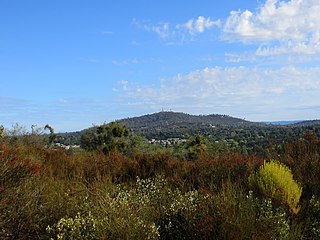
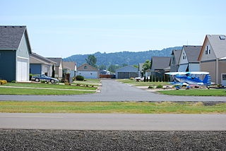
Cameron Airpark Estates is an unincorporated community in El Dorado County, California. [1] It is a fly-in community adjacent to Cameron Park, [2] at an elevation of 1237 ft (377 m). [1]

Unincorporated area Region of land not governed by own local government

In law, an unincorporated area is a region of land that is not governed by a local municipal corporation; similarly an unincorporated community is a settlement that is not governed by its own local municipal corporation, but rather is administered as part of larger administrative divisions, such as a township, parish, borough, county, city, canton, state, province or country. Occasionally, municipalities dissolve or disincorporate, which may happen if they become fiscally insolvent, and services become the responsibility of a higher administration. Widespread unincorporated communities and areas are a distinguishing feature of the United States and Canada. In most other countries of the world, there are either no unincorporated areas at all, or these are very rare; typically remote, outlying, sparsely populated or uninhabited areas.

El Dorado County, California County in California

El Dorado County, officially the County of El Dorado, is a county in the U.S. state of California. As of the 2010 census, the population was 181,058. The county seat is Placerville.

California State of the United States of America

California is a state in the Pacific Region of the United States. With 39.6 million residents, California is the most populous U.S. state and the third-largest by area. The state capital is Sacramento. The Greater Los Angeles Area and the San Francisco Bay Area are the nation's second and fifth most populous urban regions, with 18.7 million and 8.8 million residents respectively. Los Angeles is California's most populous city, and the country's second most populous, after New York City. California also has the nation's most populous county, Los Angeles County, and its largest county by area, San Bernardino County. The City and County of San Francisco is both the country's second-most densely populated major city after New York City and the fifth-most densely populated county, behind only four of the five New York City boroughs.

Related Research Articles

Cameron Park, California CDP in California, United States

Cameron Park is a census-designated place (CDP) in El Dorado County, California, United States and is part of the Sacramento metropolitan area. The population was 18,228 at the 2010 census, up from 14,549 at the 2000 census. Cameron Park is a community located in the Northern California Gold Country of the Sierra Nevada foothills, approximately 30 miles (50 km) east of Sacramento and 70 miles (110 km) west of South Lake Tahoe.

Jesus Maria, California Unincorporated community in California, United States

Jesus Maria is an unincorporated community in Calaveras County, California. It lies at an elevation of 1043 feet and is located at 38°17′08″N120°38′51″W. The community is in ZIP code 95222 and area code 209.

Cave City, California Unincorporated community in California, United States

Cave City is an unincorporated community in Calaveras County, California. It lies at an elevation of 1,617 feet (493 m) and is located at 38°12′09″N120°30′31″W. The community is in ZIP code 95222 and area code 209.

CKTI-FM

CKTI-FM is a First Nations community radio station in Canada, playing a mixture of country and classic rock music broadcasting at 107.7 FM in Kettle Point, Ontario. The station has an Alternative Country style to its music. The station began broadcasting in 2004 and is owned by Points Eagle Radio Inc.

Airpark

A residential airpark is also referred to as a "fly-in community". The word can also refer to a community specifically designed around an airport where the residents each would own their own airplane which they park in their hangar usually attached to the home or integrated into their home. The residential airpark or fly-in community features one or more runways with homes adjacent to the runway. Many fly-in communities feature a variety of amenities, such as golf course, equestrian facilities and more. Residential airparks or fly-in communities are usually privately owned and restricted to use by the property owners and their invited guests. Most do not include commercial operations or businesses. The communities have also become a niche real estate market, with some firms dedicated solely to these developments.

Rescue, California Unincorporated community in California, United States

Rescue is an unincorporated community in El Dorado County, California. It is located north-northwest of Shingle Springs and north-northeast of Cameron Park. The zip code is 95672, and Rescue is located in area code 530. The town lies at an elevation of 1214 feet. It has also been noted for its unusual place name. Formerly Green Valley, El Dorado County, California

Ranch House Estates, California Unincorporated community in California, United States

Ranch House Estates is an unincorporated community in Amador County, California. It lies at an elevation of 2546 feet.

Cedar Vista, California Unincorporated community in California, United States

Cedar Vista is an unincorporated community in Calaveras County, California. It lies at an elevation of 3317 feet. Cedar Vista is located at 38°10′10″N120°24′29″W.

Hams, California Unincorporated community in California, United States

Hams is an unincorporated community in Calaveras County, California. It lies at an elevation of 2976 feet. Hams is located at 38°22′27″N120°27′44″W.

Lilac Park, California Unincorporated community in California, United States

Lilac Park is an unincorporated community in Arnold, California in Calaveras County, California. Lilac Park Subdivision was approved by the CA Dept of Real Estate in February 1956. Arnold Lilac Park Homeowners Association (ALPHA) was incorporated on February 23, 1959. There are 205 home sites in ALPHA, not all are improved. The east side of Lilac Park sits atop Rocky Ridge and the west side follows SR 4. The community rests on a west facing slope.

Oak Park Estates, California Unincorporated community in California, United States

Oak Park Estates is an unincorporated community in Calaveras County, California. It lies at an elevation of 1125 feet.

Caldor, California Unincorporated community in California, United States

Caldor is an unincorporated community in El Dorado County, California. It lies at an elevation of 4442 feet. Caldor was linked to Diamond Springs by the Diamond and Caldor Railway. The community was named for the California Door Company.

Morrison, California Unincorporated community in California, United States

Morrison is an unincorporated community in El Dorado County, California. It lies at an elevation of 5279 feet. Morrison is located at 38°42′35″N120°19′28″W.

Tiger Lily, California Unincorporated community in California, United States

Tiger Lily is an unincorporated community in El Dorado County, California. It is located 3.5 miles (6 km) south-southeast of Placerville, at an elevation of 2080 feet.

Voss, California Unincorporated community in California, United States

Voss is an unincorporated community in El Dorado County, California. It lies at an elevation of 5499 feet. Voss is located at 38°39′26″N120°23′16″W.

Lone Star, Fresno County, California Unincorporated community in California, United States

Lone Star is an unincorporated community in Fresno County, California. It is located on the Atchison, Topeka and Santa Fe Railroad 3.25 miles (5 km) east-northeast of Malaga, at an elevation of 318 feet.

Grapit, California Unincorporated community in California, United States

Grapit is an unincorporated community in Glenn County, California. It is located on the Southern Pacific Railroad 4.5 miles (7.2 km) south of Orland, at an elevation of 220 feet. The name is a contraction of "gravel pit", several of which are in the area.

Gillivan, Ohio Unincorporated community in Ohio, United States

Gillivan is an unincorporated community in Jefferson Township, Madison County, Ohio, United States. It is located at 39°59′19″N83°20′13″W, along U.S. Route 42, north of its intersection with Ohio State Route 29.

Oakland is an unincorporated community in Caroline County, Maryland, United States.

Bonds, Indiana Unincorporated community in Indiana, United States

Bonds is an unincorporated community in Northwest Township, Orange County, in the U.S. state of Indiana.

References