Coordinates: 38°42′43″N121°06′34″W / 38.71194°N 121.10944°W
A geographic coordinate system is a coordinate system that enables every location on Earth to be specified by a set of numbers, letters or symbols. The coordinates are often chosen such that one of the numbers represents a vertical position and two or three of the numbers represent a horizontal position; alternatively, a geographic position may be expressed in a combined three-dimensional Cartesian vector. A common choice of coordinates is latitude, longitude and elevation. To specify a location on a plane requires a map projection.
Lakeridge Oaks | |
---|---|
Unincorporated community | |
Coordinates: 38°42′43″N121°06′34″W / 38.71194°N 121.10944°W | |
Country | United States |
State | California |
County | El Dorado County |
Elevation [1] | 476 ft (145 m) |
Lakeridge Oaks is an unincorporated community in El Dorado County, California. [1] It lies at an elevation of 476 feet (145 m). [1]
In law, an unincorporated area is a region of land that is not governed by a local municipal corporation; similarly an unincorporated community is a settlement that is not governed by its own local municipal corporation, but rather is administered as part of larger administrative divisions, such as a township, parish, borough, county, city, canton, state, province or country. Occasionally, municipalities dissolve or disincorporate, which may happen if they become fiscally insolvent, and services become the responsibility of a higher administration. Widespread unincorporated communities and areas are a distinguishing feature of the United States and Canada. In most other countries of the world, there are either no unincorporated areas at all, or these are very rare; typically remote, outlying, sparsely populated or uninhabited areas.
El Dorado County, officially the County of El Dorado, is a county in the U.S. state of California. As of the 2010 census, the population was 181,058. The county seat is Placerville.
California is a state in the Pacific Region of the United States. With 39.6 million residents, California is the most populous U.S. state and the third-largest by area. The state capital is Sacramento. The Greater Los Angeles Area and the San Francisco Bay Area are the nation's second and fifth most populous urban regions, with 18.7 million and 9.7 million residents respectively. Los Angeles is California's most populous city, and the country's second most populous, after New York City. California also has the nation's most populous county, Los Angeles County, and its largest county by area, San Bernardino County. The City and County of San Francisco is both the country's second-most densely populated major city after New York City and the fifth-most densely populated county, behind only four of the five New York City boroughs.
Uvas Canyon County Park is a 1,147-acre (464 ha) natural park located in upper Uvas Canyon on the eastern side of the Santa Cruz Mountains, west of Morgan Hill, California. The park has several small waterfalls, some of which flow perennially, that feed into tributaries confluent with Uvas Creek. The park is part of the Santa Clara County Parks System, and facilitates picnics, hiking and overnight camping. It is one of the few parks in the area that allows dogs in the campgrounds.
The Charles C. Jensen Botanical Gardens are botanical gardens located at 8520 Fair Oaks Boulevard, Carmichael, California. They are open during the daylight hours without charge.
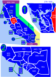
Area code 209 is the California telephone area code that was split from area code 415 on October 26, 1957. It covers Stockton, Modesto, Turlock, Merced, Winton, Atwater, Livingston, Manteca, Ripon, Tracy, Lodi, Galt, Sonora, Los Banos, San Andreas, Mariposa, and Yosemite, the northern San Joaquin Valley, and the Sierra Foothills.
The Lewes and Rehoboth Canal is a canal in Sussex County, Delaware, which connects the Broadkill River and the Delaware Bay to Rehoboth Bay. It forms a portion of the Intracoastal Waterway.
Cool, formerly known as Cave Valley, is a small unincorporated community in El Dorado County, California, about 40 miles (64 km) from Sacramento, the state capital. Cool is at an elevation of 1,532 feet.
Oak Valley is an unincorporated community in Yuba County, California. It is located 5.5 miles (8.9 km) south-southeast of Strawberry Valley, at an elevation of 3012 feet.
Oak Grove is a former settlement in Yuba County, California. It was located on Dry Creek, 2.5 miles (4.0 km) west-southwest of Oregon House, at an elevation of 1158 feet. The site is covered by the Virginia Ranch Reservoir.
Oak Grove is an unincorporated community in Butte County, California. It lies at an elevation of 128 feet.
Cambridge Oaks is an unincorporated community in El Dorado County, California. It lies at an elevation of 1158 feet.
Oak Creek Hills is an unincorporated community in El Dorado County, California. It lies at an elevation of 591 feet.
Oak Ridge Village is an unincorporated community in El Dorado County, California. It lies at an elevation of 804 feet.
Oak Tree Village is an unincorporated community in El Dorado County, California. It lies at an elevation of 646 feet.
Moonstone is an unincorporated community in Humboldt County, California. It is located 2.5 miles (4.0 km) southeast of Trinidad, at an elevation of 121 feet. For census purposes, it is aggregated in Westhaven-Moonstone, California. The area is sited adjacent to Pacific Ocean beach and the mouth of the Little River with views of the rugged coastline.
Kane Spring is an unincorporated community in Imperial County, California. It is located 1.9 km (1.2 mi) south-southwest of San Felipe Wash and 8 km (5 mi) west of the southwestern extension of the Salton Sea, at an elevation of 141 feet below sea level.
Taihe District is a district of the city of Jinzhou, Liaoning, People's Republic of China.
The California Exposition and State Fair is an independent state agency established by law in the California Food and Agriculture codes. Cal Expo is governed by an appointed 11-member Board of Directors and daily operations are managed by the chief executive officer. During the annual State Fair more than 2,000 seasonal temporary employees are hired. The California Exposition is a self-sufficient operation that receives no government funding but still has an estimated economic impact of more than $250 million on the region.
Edward F. Ricketts State Marine Conservation Area is one of four small marine protected areas located near the cities of Monterey and Pacific Grove, at the southern end of Monterey Bay on California’s central coast. The four areas together encompass 2.96 square miles (7.7 km2). Within SMCAs fishing and take of all living marine resources is prohibited except the recreational take of finfish by hook-and-line and the commercial take of giant and bull kelp under certain conditions.
Little Shasta is an unincorporated community in Siskiyou County, California.
Orcasitas is a ward (barrio) of Madrid belonging to the district of Usera.
Chimney Gulch is a valley and arroyo in the Diablo Range, in Santa Clara, California. Its mouth is at an elevation of 932 feet / 284 meters at its confluence with an unnamed creek tributary to East Fork Pacheco Creek that runs westward down below Hagerman Peak to join the East Fork about an eighth of a mile below its confluence with Chimney Gulch. The head of Chimney Gulch and the source of the stream, is a pond south of the Fifield Ranch on the northeast slope of Hagerman Peak at 37°06′52″N121°13′55″W.
This El Dorado County, California–related article is a stub. You can help Wikipedia by expanding it. |