Spring Creek, California

Last updated

Coordinates: 38°55′45″N120°03′54″W / 38.92917°N 120.06500°W / 38.92917; -120.06500

Geographic coordinate system Coordinate system

A geographic coordinate system is a coordinate system that enables every location on Earth to be specified by a set of numbers, letters or symbols. The coordinates are often chosen such that one of the numbers represents a vertical position and two or three of the numbers represent a horizontal position; alternatively, a geographic position may be expressed in a combined three-dimensional Cartesian vector. A common choice of coordinates is latitude, longitude and elevation. To specify a location on a plane requires a map projection.

Spring Creek
Unincorporated community
California Locator Map with US.PNG
Red pog.svg
Spring Creek
Location in California
Usa edcp location map.svg
Red pog.svg
Spring Creek
Spring Creek (the US)
Coordinates: 38°55′45″N120°03′54″W / 38.92917°N 120.06500°W / 38.92917; -120.06500
Country United States
State California
County El Dorado County
Elevation [1] 6,339 ft (1,932 m)

Spring Creek is an unincorporated community in El Dorado County, California. [1] It lies at an elevation of 6339 feet (1932 m). [1]

Unincorporated area Region of land not governed by own local government

In law, an unincorporated area is a region of land that is not governed by a local municipal corporation; similarly an unincorporated community is a settlement that is not governed by its own local municipal corporation, but rather is administered as part of larger administrative divisions, such as a township, parish, borough, county, city, canton, state, province or country. Occasionally, municipalities dissolve or disincorporate, which may happen if they become fiscally insolvent, and services become the responsibility of a higher administration. Widespread unincorporated communities and areas are a distinguishing feature of the United States and Canada. In most other countries of the world, there are either no unincorporated areas at all, or these are very rare; typically remote, outlying, sparsely populated or uninhabited areas.

El Dorado County, California County in California

El Dorado County, officially the County of El Dorado, is a county in the U.S. state of California. As of the 2010 census, the population was 181,058. The county seat is Placerville.

California State of the United States of America

California is a state in the Pacific Region of the United States. With 39.6 million residents, California is the most populous U.S. state and the third-largest by area. The state capital is Sacramento. The Greater Los Angeles Area and the San Francisco Bay Area are the nation's second and fifth most populous urban regions, with 18.7 million and 8.8 million residents respectively. Los Angeles is California's most populous city, and the country's second most populous, after New York. California also has the nation's most populous county, Los Angeles County, and its largest county by area, San Bernardino County. The City and County of San Francisco is both the country's second-most densely populated major city after New York and the fifth-most densely populated county, behind only four of the five New York City boroughs.

Related Research Articles

Rock Creek (California) may refer to:

Carson Hill, California ghost town in California, United States

Carson Hill is a ghost town in Calaveras County, California. It sits at an elevation of 1447 feet above sea level and is located at 38°01′42″N120°30′24″W, about 4 miles (6.4 km) south-southeast of Angels Camp. It was one of the most productive mining camps in the state, with nearly $26 million in gold and quartz found in the area. Carson Hill is registered as California Historical Landmark #274. The town was served by the Sierra Railway's branchline to Angels Camp until 1935.

Leucadia State Beach

Leucadia State Beach, also known as Beacon's Beach, is a protected beach of California, United States, in Encinitas. It is operated as Beacon’s Beach by the city under a 20-year agreement with California Department of Parks and Recreation. It's a popular spot for swimming, surfing, fishing, and other beach activities. The 10.6-acre (4.3 ha) site was established in 1949.

Flat is an unincorporated community in southern Phelps County, Missouri, United States. It is located approximately sixteen miles southwest of Rolla. The community is at the intersection of Missouri routes M and T. Edgar Springs lies about four miles to the southeast at the intersection of route M and U.S. Route 63. The headwaters of Mill Creek are just to the east of the community. The village lies within the boundaries of the Mark Twain National Forest.

Rural Municipality of Springfield rural municipality in Manitoba, Canada

Springfield is a rural municipality in Manitoba, Canada. It stretches from urban industrial development on the eastern boundary of the City of Winnipeg, through urban, rural residential, agricultural and natural landscapes, to the Agassiz Provincial Forest on the municipality's eastern boundary.

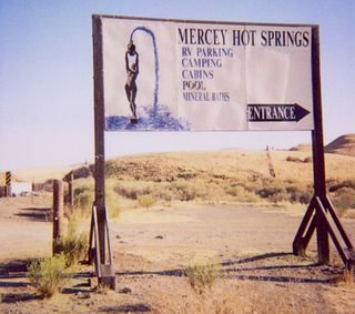
Mercey Hot Springs, California Unincorporated community in California, United States

Mercey Hot Springs is an unincorporated community in the Little Panoche Valley of Fresno County, central California, about 60 miles (97 km) west-southwest of Fresno. It is a resort along South Fork Little Panoche Creek and the Little Panoche Road located at the western edge of Fresno County.

Sunnybrook, California Unincorporated community in California, United States

Sunnybrook is an unincorporated community in Amador County, California. It is located on Mountain Spring Creek 3 miles (4.8 km) east of Ione. It lies at an elevation of 784 feet.

Blue Lake Springs, California Unincorporated community in California, United States

Blue Lake Springs is an unincorporated community in Calaveras County, California. It lies at an elevation of 4114 feet.

Cottage Springs, California Unincorporated community in California, United States

Cottage Springs is an unincorporated community in Calaveras County, California. It lies at an elevation of 5827 feet.

Indian Creek, California Unincorporated community in California, United States

Indian Creek is an unincorporated community in Calaveras County, California. It lies at an elevation of 2979 feet.

Snowshoe Springs, California Unincorporated community in California, United States

Snowshoe Springs is an unincorporated community in Calaveras County, California. It lies at an elevation of 4885 feet.

Tamarack Springs, California Unincorporated community in California, United States

Tamarack Springs is an unincorporated community in Calaveras County, California. It lies at an elevation of 7047 feet.

Frenchtown, El Dorado County, California Unincorporated community in California, United States

Frenchtown is an unincorporated community in El Dorado County, California. It is located on French Creek 2 miles (3.2 km) south-southeast of Shingle Springs, at an elevation of 1165 feet.

Raffetto, California Unincorporated community in California, United States

Raffetto is an unincorporated community in El Dorado County, California. It is located 6.25 miles (10 km) north of Riverton and some 20 miles northeast of Placerville at an elevation of 4,701 feet (1,433 m).

Sierra Springs, California Unincorporated community in California, United States

Sierra Springs is an unincorporated community in El Dorado County, California. It lies at an elevation of 3323 feet.

Spring Valley, El Dorado County, California Unincorporated community in California, United States

Spring Valley is an unincorporated community in El Dorado County, California. It is located 3 miles (4.8 km) east-northeast of Pollock Pines, at an elevation of 3779 feet.

Skelly is a former settlement in Humboldt County, California. It was located 3.5 miles (5.6 km) south of Holmes. It is now known as Larabee.

Jackson, Ripley County, Indiana Unincorporated community in Indiana, United States

Jackson is an unincorporated community in Otter Creek Township, Ripley County, in the U.S. state of Indiana.

Iron Springs, originally Cedar Springs, was a spring in the bed of Iron Springs Creek in what is now Iron County, Utah. The creek originally drained the western side of Cedar Valley before it was settled. Cedar Springs was located in the gap where the creek passed between the mountains of The Three Peaks and Granite Mountain. Cedar Springs was a camp for early travelers on the Mormon Road, after they had made the arduous passage from Johnson's Springs across the marshy and wooded Coal Creek. It was difficult to cross with wagons at that point in Cedar Valley. The road crossed Coal Creek midway across the valley between Johnson Springs and Cedar Springs. The travelers guide, Mormon Waybill described Cedar Spring "... wood plenty food short, Good camp". When Cedar City was established on the upper reach of Coal Creek in 1851, the road was diverted to the easy crossing there and then proceeded across the valley to Iron springs, a longer route but less arduous.

Cottonwood Creek, originally Arroyo Alamos, a tributary stream of San Luis Creek, in Merced County, California. Its mouth, before the San Luis Dam was built across the course of San Luis Creek, originally was at its confluence with San Luis Creek at 37°03′54″N121°05′25″W at approximately 250 feet / 76 meters. Today its mouth is located in the foothills of the Diablo Range, where Cottonwood Creek enters the north side of San Luis Reservoir at an elevation 548 feet / 167 meters. The source of the creek is at 37°07′29″N121°11′24″W at an elevation of 2080 feet / 634 meters on the east slope of Red Hill, a summit on the eastern slope of the Diablo Range.

References