
Calaveritas is an unincorporated community in Calaveras County, California. It sits on the banks of the Calaveritas Creek at an elevation of 1,109 feet above sea level and is located at 38°09′29″N120°36′36″W. The community is in ZIP code 95249 and area code 209.
Campo Seco is an unincorporated community in Calaveras County, California. It sits at an elevation of 564 feet above sea level and is located at 38°13′38″N120°51′12″W. The community is in ZIP code 95226 and area code 209.
Milton is an unincorporated community in Calaveras County, California. It lies at an elevation of 394 feet and is located at 38°01′55″N120°51′08″W. The community is in ZIP code 95684 and area code 209.
Jesus Maria is an unincorporated community in Calaveras County, California. It lies at an elevation of 1043 feet and is located at 38°17′08″N120°38′51″W. The community is in ZIP code 95222 and area code 209.
Paloma is an unincorporated community in Calaveras County, California. It lies at an elevation of 1362 feet and is located at 38°15′34″N120°45′48″W. The community is in ZIP code 95252 and area code 209.
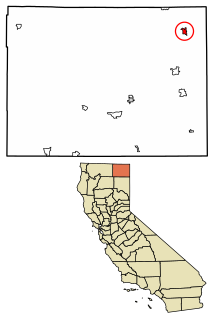
Cave City is an unincorporated community in Calaveras County, California. It lies at an elevation of 1,617 feet (493 m) and is located at 38°12′09″N120°30′31″W. The community is in ZIP code 95222 and area code 209.
Honeydew is an unincorporated community in Humboldt County, California. It is located 17 miles (27 km) south of Scotia, at an elevation of 322 feet, 15 miles (24 km) from the Pacific Ocean in the Lost Coast, near the King Range. It has a general store, elementary school, post office, and a few houses nearby. Many of the locals live in the hills surrounding the Mattole valley, named after the Mattole River which runs through the valley. The ZIP code is 95545 and the community is inside area code 707.
Fort Bidwell is a census-designated place in Modoc County, California. It is located 32 miles (51 km) northeast of Alturas, at an elevation of 4564 feet. The population was 173 at the 2010 census.

Cool, formerly known as Cave Valley, is a small unincorporated community in El Dorado County, California, about 40 miles (64 km) from Sacramento, the state capital. Cool is at an elevation of 1,532 feet.
Sciots Camp is a small unincorporated community in El Dorado County, California. It is located on the South Fork of the American River 4 miles (6.4 km) south of Pyramid Peak, at an elevation of 5659 feet. The ZIP code is 95610. The community is inside area code 530.
Little Norway is a small unincorporated community in El Dorado County, California. It is located 14 kilometres (9 mi) west of Meyers, at an elevation of 2233m. The ZIP code is 95721. The community is inside area code 530.
Nebelhorn is a small unincorporated community in El Dorado County, California, United States. It lies at an elevation of 7401 feet. Nebelhorn is just southwest of Echo Summit. The ZIP code is 95735. The community is inside area code 530.
Pacific is a small unincorporated community in El Dorado County, California. It is located 3.25 miles (5 km) east of Pollock Pines, at an elevation of 3396 feet. It lies along U.S. Highway 50. The ZIP code is 95726. The community is inside area code 530.
Fresh Pond is a small unincorporated community in El Dorado County, California. It is located 3 miles (4.8 km) east of Pollock Pines, at an elevation of 3606 feet. The ZIP code is 95726. The community is inside area code 530. It is nestled along Highway 50 and offers a convenient gas station by the road.
Hathaway Pines is an unincorporated community in Calaveras County, California, 8 km (5 mi) south of Arnold and 20 km (12.5 mi) northeast of Angels Camp. It lies at an elevation of 3323 feet. Hathaway Pines' post office was established in 1943; it has the zip code 95233.
Wilseyville is an unincorporated community in Calaveras County, California. It lies at an elevation of 2769 feet. Wilseyville's post office was established in 1947; it has the zip code 95257. Wilseyville was named after Lawrence A. Wilsey, an executive at the American Forest Products Company.
Diamondville is a former settlement in Butte County, California, United States. It was located 4 miles (6.4 km) west of Paradise. The town was named for James Diamond. In the 1870s, Diamondville was on the stage coach route to Chico, 11 miles (18 km) distant; fares averaged 10 cents per mile. Cretaceous fossils were reported to be found from Butte Creek below Diamondville. In an 1884 report published by the United States government on the production of precious metals in the United States, Diamondville was described as "an old mining town. .. occupied by one or two ranchers and only mined by Chinese."
Kelsey is an unincorporated community in El Dorado County, California. It is located 2 miles (3.2 km) north of Chili Bar, at an elevation of 1923 feet.
Latrobe is an unincorporated community in El Dorado County, California. It is located 15 miles (24 km) southwest of Placerville, at an elevation of 761 feet.
Broadview Farms is an unincorporated community in Fresno County, California. It lies at an elevation of 190 feet.


