Oak Ridge Village, California

Last updated

Coordinates: 38°40′46″N121°04′35″W / 38.67944°N 121.07639°W / 38.67944; -121.07639

Geographic coordinate system Coordinate system

A geographic coordinate system is a coordinate system that enables every location on Earth to be specified by a set of numbers, letters or symbols. The coordinates are often chosen such that one of the numbers represents a vertical position and two or three of the numbers represent a horizontal position; alternatively, a geographic position may be expressed in a combined three-dimensional Cartesian vector. A common choice of coordinates is latitude, longitude and elevation. To specify a location on a plane requires a map projection.

Oak Ridge Village
Unincorporated community
California Locator Map with US.PNG
Red pog.svg
Oak Ridge Village
Location in California
Usa edcp location map.svg
Red pog.svg
Oak Ridge Village
Oak Ridge Village (the US)
Coordinates: 38°40′46″N121°04′35″W / 38.67944°N 121.07639°W / 38.67944; -121.07639
Country United States
State California
County El Dorado County
Elevation [1] 804 ft (245 m)

Oak Ridge Village is an unincorporated community in El Dorado County, California. [1] It lies at an elevation of 804 feet (245 m). [1]

Unincorporated area Region of land not governed by own local government

In law, an unincorporated area is a region of land that is not governed by a local municipal corporation; similarly an unincorporated community is a settlement that is not governed by its own local municipal corporation, but rather is administered as part of larger administrative divisions, such as a township, parish, borough, county, city, canton, state, province or country. Occasionally, municipalities dissolve or disincorporate, which may happen if they become fiscally insolvent, and services become the responsibility of a higher administration. Widespread unincorporated communities and areas are a distinguishing feature of the United States and Canada. In most other countries of the world, there are either no unincorporated areas at all, or these are very rare; typically remote, outlying, sparsely populated or uninhabited areas.

El Dorado County, California County in California

El Dorado County, officially the County of El Dorado, is a county in the U.S. state of California. As of the 2010 census, the population was 181,058. The county seat is Placerville.

California State of the United States of America

California is a state in the Pacific Region of the United States. With 39.6 million residents, California is the most populous U.S. state and the third-largest by area. The state capital is Sacramento. The Greater Los Angeles Area and the San Francisco Bay Area are the nation's second- and fifth-most populous urban regions, with 18.7 million and 9.7 million residents respectively. Los Angeles is California's most populous city, and the country's second-most populous, after New York City. California also has the nation's most populous county, Los Angeles County, and its largest county by area, San Bernardino County. The City and County of San Francisco is both the country's second-most densely populated major city after New York City and the fifth-most densely populated county, behind only four of the five New York City boroughs.

Related Research Articles

Lake is a place located in St. Louis County in the State of Missouri in the United States of America. It is located at latitude 38°40'46" North, longitude 90°31'12" West.

Oak Ridge in Santa Clara County, California, is a ridge forming the east canyon wall of Arroyo Hondo, which drains into Calaveras Reservoir. Black Mountain is its highest point. The first known white settlers on Oak Ridge were the Parks family, who ran cattle on the ridge. Now owned by the San Francisco Water Department, the ridge is private property and is off-limits to most people.

Blossom Valley is a neighborhood in the southern region of San Jose, California, northeast of the Los Capitancillos Ridge that separates it from Almaden Valley. It is located east of Cambrian and northeast of Almaden neighborhoods. It is just northeast of the Santa Teresa Hills and the Almaden Valley. Neighborhoods within Blossom Valley include Erikson, Thousand Oaks, and Pinehurst at, respectively, the southwest, northwest, and northeast quadrants of Pearl Avenue and Branham Lane.

The Dry Creek Joint Elementary School District began in 1876, with only a few students in a one-room schoolhouse. It is now among the fastest growing school districts in the State of California. The District has constructed new elementary schools in the past four years. Creekview Ranch Middle School was the most recent school to open in the district, first serving students for the 2008-2009 school year. It is anticipated that the District will continue to grow for the next 10 years, serving approximately 8,500 K-8 students.

Area code 209 area codes in the United States

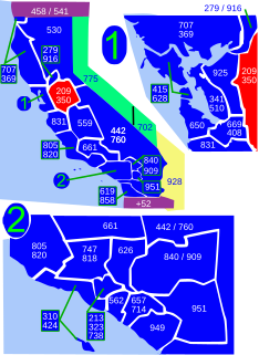
Area code 209 is the California telephone area code that was split from area code 415 on October 26, 1957. It covers Stockton, Modesto, Turlock, Merced, Winton, Atwater, Livingston, Manteca, Ripon, Tracy, Lodi, Galt, Sonora, Los Banos, San Andreas, Mariposa, and Yosemite, the northern San Joaquin Valley, and the Sierra Foothills.

Dodge Place, California Unincorporated community in California, United States

Dodge Place is an unincorporated community in Butte County, California. It lies at an elevation of 1873 feet.

Oak Grove, Butte County, California Unincorporated community in California, United States

Oak Grove is an unincorporated community in Butte County, California. It lies at an elevation of 128 feet.

Cambridge Oaks, California Unincorporated community in California, United States

Cambridge Oaks is an unincorporated community in El Dorado County, California. It lies at an elevation of 1158 feet.

Crescent Ridge Village, California Unincorporated community in California, United States

Crescent Ridge Village is an unincorporated community in El Dorado County, California. It lies at an elevation of 709 feet.

Equestrian Village, California Unincorporated community in California, United States

Equestrian Village is an unincorporated community in El Dorado County, California. It lies at an elevation of 646 feet.

Governors Village, California Unincorporated community in California, United States

Governors Village is an unincorporated community in El Dorado County, California. It lies at an elevation of 751 feet.

La Cresta Village, California Unincorporated community in California, United States

La Cresta Village is an unincorporated community in El Dorado County, California. It lies at an elevation of 932 feet.

Lakeridge Oaks, California Unincorporated community in California, United States

Lakeridge Oaks is an unincorporated community in El Dorado County, California. It lies at an elevation of 476 feet.

Oak Creek Hills, California Unincorporated community in California, United States

Oak Creek Hills is an unincorporated community in El Dorado County, California. It lies at an elevation of 591 feet.

Oak Tree Village, California Unincorporated community in California, United States

Oak Tree Village is an unincorporated community in El Dorado County, California. It lies at an elevation of 646 feet.

Park Village, El Dorado County, California Unincorporated community in California, United States

Park Village is an unincorporated community in El Dorado County, California. It lies at an elevation of 709 feet.

Ridgeview Village, California Unincorporated community in California, United States

Ridgeview Village is an unincorporated community in El Dorado County, California. It lies at an elevation of 1066 feet.

Summit Village, California Unincorporated community in California, United States

Summit Village is an unincorporated community in El Dorado County, California. It lies at an elevation of 633 feet.

Waterford Village, California Unincorporated community in California, United States

Waterford Village is an unincorporated community in El Dorado County, California. It lies at an elevation of 669 feet.

Winterhaven Village, California Unincorporated community in California, United States

Winterhaven Village is an unincorporated community in El Dorado County, California. It lies at an elevation of 666 feet.

References