Old Fort Jim, California

Last updated

Coordinates: 38°42′38″N120°43′08″W / 38.71056°N 120.71889°W / 38.71056; -120.71889

Geographic coordinate system Coordinate system

A geographic coordinate system is a coordinate system that enables every location on Earth to be specified by a set of numbers, letters or symbols. The coordinates are often chosen such that one of the numbers represents a vertical position and two or three of the numbers represent a horizontal position; alternatively, a geographic position may be expressed in a combined three-dimensional Cartesian vector. A common choice of coordinates is latitude, longitude and elevation. To specify a location on a plane requires a map projection.

Old Fort Jim
Unincorporated community
California Locator Map with US.PNG
Red pog.svg
Old Fort Jim
Location in California
Usa edcp location map.svg
Red pog.svg
Old Fort Jim
Old Fort Jim (the US)
Coordinates: 38°42′38″N120°43′08″W / 38.71056°N 120.71889°W / 38.71056; -120.71889
Country United States
State California
County El Dorado County
Elevation [1] 2,247 ft (685 m)
Population (2010)
  Total 43

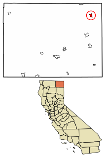
Old Fort Jim (formerly, Fort Jim) is an unincorporated community in El Dorado County, California. [1] It is located 3 miles (4.8 km) southwest of Camino, [2] at an elevation of 2247 feet (685 m). [1]

Unincorporated area Region of land not governed by own local government

In law, an unincorporated area is a region of land that is not governed by a local municipal corporation; similarly an unincorporated community is a settlement that is not governed by its own local municipal corporation, but rather is administered as part of larger administrative divisions, such as a township, parish, borough, county, city, canton, state, province or country. Occasionally, municipalities dissolve or disincorporate, which may happen if they become fiscally insolvent, and services become the responsibility of a higher administration. Widespread unincorporated communities and areas are a distinguishing feature of the United States and Canada. In most other countries of the world, there are either no unincorporated areas at all, or these are very rare; typically remote, outlying, sparsely populated or uninhabited areas.

El Dorado County, California County in California

El Dorado County, officially the County of El Dorado, is a county in the U.S. state of California. As of the 2010 census, the population was 181,058. The county seat is Placerville.

California State of the United States of America

California is a state in the Pacific Region of the United States. With 39.6 million residents, California is the most populous U.S. state and the third-largest by area. The state capital is Sacramento. The Greater Los Angeles Area and the San Francisco Bay Area are the nation's second- and fifth-most populous urban regions, with 18.7 million and 9.7 million residents respectively. Los Angeles is California's most populous city, and the country's second-most populous, after New York City. California also has the nation's most populous county, Los Angeles County, and its largest county by area, San Bernardino County. The City and County of San Francisco is both the country's second-most densely populated major city after New York City and the fifth-most densely populated county, behind only four of the five New York City boroughs.

Related Research Articles

Milton, California Unincorporated community in California, United States

Milton is an unincorporated community in Calaveras County, California. It lies at an elevation of 394 feet and is located at 38°01′55″N120°51′08″W. The community is in ZIP code 95684 and area code 209.

Glencoe, California Unincorporated community in California, United States

Glencoe is an unincorporated community in Calaveras County, California. It lies at an elevation of 2749 feet and is located at 38°21′15″N120°35′06″W. The community is in ZIP code 95232 and area code 209.

Paloma, California Unincorporated community in California, United States

Paloma is an unincorporated community in Calaveras County, California. It lies at an elevation of 1362 feet and is located at 38°15′34″N120°45′48″W. The community is in ZIP code 95252 and area code 209.

Fort Bidwell, California census-designated place in California, United States

Fort Bidwell is a census-designated place in Modoc County, California. It is located 32 miles (51 km) northeast of Alturas, at an elevation of 4564 feet. The population was 173 at the 2010 census.

El Dorado, California Unincorporated community in California, United States

El Dorado, not to be confused with the nearby El Dorado Hills, is an unincorporated community in El Dorado County, California. It is located 4 miles (6.4 km) southwest of Placerville, at an elevation of 1608 feet. The population was 4,096 at the 2000 census. The town is registered as California Historical Landmark #486. The ZIP code is 95623. The community is inside area code 530.

Whitewater, California census-designated place in California, United States

Whitewater is a census-designated place in Riverside County, California. It is directly off Interstate 10 halfway between North Palm Springs and Cabazon on the way from Palm Springs to Los Angeles. It is known as the site of the San Gorgonio Pass Wind Farm. The ZIP Code is 92282, and the community is inside area code 760. The population was 859 at the 2010 census. The elevation is 1,575 feet (480 m).

Mentor, Indiana Unincorporated community in Indiana, United States

Mentor is an unincorporated community in Jefferson Township, Dubois County, in the U.S. state of Indiana.

New Blinzing, California Former settlement in California, United States

New Blinzing is a former settlement in Butte County, California, United States. It was located 5.25 miles north of Berry Creek and about 1 mile (1.6 km) northwest of Blinzing, on the Western Pacific Railroad, at an elevation of 942 feet. It still appeared on maps as of 1948.

Fort Jones, Calaveras County, California Unincorporated community in California, United States

Fort Jones is an unincorporated community in Calaveras County, California. It lies at an elevation of 2933 feet.

Bryants, California Unincorporated community in California, United States

Bryants is an unincorporated community in El Dorado County, California. It lies at an elevation of 4429 feet.

Old Pino, California Unincorporated community in California, United States

Old Pino is an unincorporated community in El Dorado County, California. It is located 5 miles (8 km) northwest of Pollock Pines, at an elevation of 3156 feet.

Conejo, California Unincorporated community in California, United States

Conejo is an unincorporated community in Fresno County, California. It is located 7.25 miles (11.7 km) west-southwest of Selma, at an elevation of 262 feet.

The Twenty-Nine Palms Band of Mission Indians of California is a federally recognized tribe of Mission Indians with two reservations, one located near the cities of Indio and Coachella in Riverside County, and the other in the city of Twentynine Palms in San Bernardino County, California. While many scholars regard the tribe as being Luiseño, the tribe itself identifies as being Chemehuevi.

Brokenburg is an unincorporated community in Spotsylvania County, in the U.S. state of Virginia.

Elsmere is an unincorporated community northwest of Cimarron Hills in El Paso County, Colorado.

Grant, Ohio human settlement in Ohio, United States of America

Grant is an unincorporated community in Hardin County, in the U.S. state of Ohio.

Conant is an unincorporated community in Allen County, in the U.S. state of Ohio.

Dixie is an unincorporated community in Callaway County, in the U.S. state of Missouri.

Callville Wash is an ephemeral stream or wash in Clark County, Nevada. It was named for Callville the riverport settlement founded in 1866, at its mouth where it had its original confluence with the Colorado River.

McFarland is an extinct town in Taney County, in the U.S. state of Missouri.

References

  1. 1 2 3 U.S. Geological Survey Geographic Names Information System: Old Fort Jim, California
  2. Durham, David L. (1998). California's Geographic Names: A Gazetteer of Historic and Modern Names of the State. Clovis, Calif.: Word Dancer Press. p. 532. ISBN   1-884995-14-4.