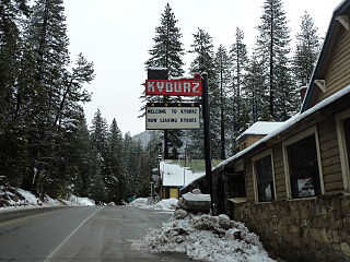
Lakewood Sierra, California

Last updated

Coordinates: 38°44′25″N120°34′09″W / 38.74028°N 120.56917°W / 38.74028; -120.56917

Geographic coordinate system Coordinate system

A geographic coordinate system is a coordinate system that enables every location on Earth to be specified by a set of numbers, letters or symbols. The coordinates are often chosen such that one of the numbers represents a vertical position and two or three of the numbers represent a horizontal position; alternatively, a geographic position may be expressed in a combined three-dimensional Cartesian vector. A common choice of coordinates is latitude, longitude and elevation. To specify a location on a plane requires a map projection.

Lakewood Sierra
Unincorporated community
California Locator Map with US.PNG
Red pog.svg
Lakewood Sierra
Location in California
Usa edcp location map.svg
Red pog.svg
Lakewood Sierra
Lakewood Sierra (the US)
Coordinates: 38°44′25″N120°34′09″W / 38.74028°N 120.56917°W / 38.74028; -120.56917
Country United States
State California
County El Dorado County
Elevation [1] 3,904 ft (1,190 m)

Lakewood Sierra is an unincorporated community in El Dorado County, California. [1] It lies at an elevation of 3904 feet (1190 m). [1]

Unincorporated area Region of land not governed by own local government

In law, an unincorporated area is a region of land that is not governed by a local municipal corporation; similarly an unincorporated community is a settlement that is not governed by its own local municipal corporation, but rather is administered as part of larger administrative divisions, such as a township, parish, borough, county, city, canton, state, province or country. Occasionally, municipalities dissolve or disincorporate, which may happen if they become fiscally insolvent, and services become the responsibility of a higher administration. Widespread unincorporated communities and areas are a distinguishing feature of the United States and Canada. In most other countries of the world, there are either no unincorporated areas at all, or these are very rare; typically remote, outlying, sparsely populated or uninhabited areas.

El Dorado County, California County in California

El Dorado County, officially the County of El Dorado, is a county in the U.S. state of California. As of the 2010 census, the population was 181,058. The county seat is Placerville.

California State of the United States of America

California is a state in the Pacific Region of the United States. With 39.6 million residents, California is the most populous U.S. state and the third-largest by area. The state capital is Sacramento. The Greater Los Angeles Area and the San Francisco Bay Area are the nation's second and fifth most populous urban regions, with 18.7 million and 9.7 million residents respectively. Los Angeles is California's most populous city, and the country's second most populous, after New York City. California also has the nation's most populous county, Los Angeles County, and its largest county by area, San Bernardino County. The City and County of San Francisco is both the country's second-most densely populated major city after New York City and the fifth-most densely populated county, behind only four of the five New York City boroughs.

Related Research Articles

Sawtooth Range, Sawtooth Ridge, and Sawtooth Mountains may refer to:

Carson Hill, California ghost town in California, United States

Carson Hill is a ghost town in Calaveras County, California. It sits at an elevation of 1447 feet above sea level and is located at 38°01′42″N120°30′24″W, about 4 miles (6.4 km) south-southeast of Angels Camp. It was one of the most productive mining camps in the state, with nearly $26 million in gold and quartz found in the area. Carson Hill is registered as California Historical Landmark #274. The town was served by the Sierra Railway's branchline to Angels Camp until 1935.

California Caverns cave in United States of America

California Cavern is a Limestone cave in the Sierra Nevada foothills, in Cave City, Calaveras County, California.

Echo Lake, California Unincorporated community in California, United States

Echo Lake is a small unincorporated community in El Dorado County, California, United States, along U.S. Route 50 in the mountains of the Sierra Nevada. It is 1.5 miles (2.4 km) north-northwest of Echo Summit. Echo Lake's nearest neighboring town is Little Norway. The ZIP code is 95721. The community is inside area code 530. The elevation of Echo Lake is 7539 feet. The average snowpack per year is 10.5 feet, with over 15 feet of snow depositing in certain areas. Precipitation and accumulation at Echo Lake can be found in California Data Exchange Center stations located at Echo Peak (EP5) and Echo Summit (ECS).

Tamarack, California Unincorporated community in California, United States

Tamarack, formerly known as Camp Tamarack, is an unincorporated community in Calaveras County, California, in the United States. It was founded in the 1920s. A nearby weather station, located across the Alpine County line, has been the site of several United States meteorological records.

Emigrant Pass may refer to:

Strawberry, El Dorado County, California Unincorporated community in California, United States

Strawberry is a small unincorporated community on the South Fork American River, 3.25 miles (5 km) south-southwest of Pyramid Peak, along U.S. Route 50 in the foothills of the Sierra Nevada. The sign on the highway reads population 50.

Phillips, California Unincorporated community in California, United States

Phillips is a small unincorporated community in El Dorado County, California. It is located on the South Fork of the American River, 2.5 miles (4 km) west of Echo Summit, at an elevation of 6,873 feet. It is the site of the Sierra-at-Tahoe ski resort. The ZIP code is 95720. The community is inside area code 530.

Kyburz, California Unincorporated community in California, United States

Kyburz is a small unincorporated community in El Dorado County, California. It is located along the South Fork of the American River and U.S. Route 50, and is surrounded by the Eldorado National Forest. Its elevation is 4058 feet above sea level.

Fresh Pond, California Unincorporated community in California, United States

Fresh Pond is a small unincorporated community in El Dorado County, California. It is located 3 miles (4.8 km) east of Pollock Pines, at an elevation of 3606 feet. The ZIP code is 95726. The community is inside area code 530. It is nestled along Highway 50 and offers a convenient gas station by the road.

Burson, California Unincorporated community in California, United States

Burson is an unincorporated community in Calaveras County, California. It lies at an elevation of 413 feet. Although unincorporated, Burson has the ZIP code of 95225.

Camp Richardson, California Unincorporated community in California, United States

Camp Richardson is an unincorporated community at Lake Tahoe, in El Dorado County, California. It lies at an elevation of 6250 feet in the Sierra Nevada.

Emerald Bay, El Dorado County, California Unincorporated community in California, United States

Emerald Bay is an unincorporated community on Lake Tahoe, in El Dorado County, California.

Sierra Springs, California Unincorporated community in California, United States

Sierra Springs is an unincorporated community in El Dorado County, California. It lies at an elevation of 3323 feet.

Mundo, California Unincorporated community in California, United States

Mundo is an unincorporated community in Imperial County, California. It is located on the Southern Pacific Railroad 7.5 miles (12 km) southeast of Frink, at an elevation of 190 feet below sea level.

Placerville Speedway is a 1/4 mile dirt track located in Placerville, in the Sierra Nevada foothills of eastern California. Placerville Speedway is often known as "Knoxville on the Hill", referring to the Knoxville Raceway in Knoxville, Iowa.

Selig is an unincorporated community in Adams County, in the U.S. state of Ohio.

Round Top or Roundtop is the name of several summits, notably:

Bliss is an unincorporated community in Washington County, in the U.S. state of Missouri.

Joaquin Ridge is a ridge in the Diablo Range in Fresno County, California. The ridge is named for Joaquin Murietta (1830-1853), a California Gold Rush bandit, leader of the Five Joaquins Gang, who used this region as a rendezvous and camp that overlooked the gangs base at the Rancho de Cantua. The ridge is ten miles long, running from its high point at 36°19′48″N120°34′09″W, east of Spanish Lake, eastward to Joaquin Rocks 36°19′11″N120°27′32″W, and then southwestward to 36°18′15″N120°24′11″W near Black Mountain the high point on Anticline Ridge. Joaquin Ridge is bound on the northeast by the Big Blue Hills and on the southwest by Portuguese Canyon. Its highest elevation 4,701 feet / 1,433 meters, is 0.64 km east of Spanish Lake.

References