Cape Conway, Queensland

Last updated

Cape Conway
Queensland
Australia Queensland location map.svg
Red pog.svg
Cape Conway
Coordinates 20°21′10″S148°44′59″E / 20.3527°S 148.7497°E / -20.3527; 148.7497 Coordinates: 20°21′10″S148°44′59″E / 20.3527°S 148.7497°E / -20.3527; 148.7497
Postcode(s) 4800
Area 331.4 km2 (128.0 sq mi)
LGA(s) Whitsunday Region
State electorate(s) Whitsunday
Federal Division(s) Dawson
Suburbs around Cape Conway:
Cannonvale
Cannon Valley
Brandy Creek
Airlie Beach
Jubilee Pocket
Mandalay
Flametree
Mount Rooper
Mount Marlow
Preston
Palm Grove
Cape Conway Whitsundays
Conway
Conway Beach
Coral Sea Coral Sea

Cape Conway is a locality in the Whitsunday Region, Queensland, Australia. [1]

Suburbs and localities are the names of geographic subdivisions in Australia, used mainly for address purposes. The term locality is used in rural areas, while the term suburb is used in urban areas. Australian postcodes closely align with the boundaries of localities and suburbs.

Whitsunday Region Local government area in Queensland, Australia

The Whitsunday Region is a local government area located in North Queensland, Australia. Established in 2008, it was preceded by two previous local government areas with a history extending back to the establishment of regional local government in Queensland in 1879.

Queensland North-east state of Australia

Queensland is the second-largest and third-most populous state in the Commonwealth of Australia. Situated in the north-east of the country, it is bordered by the Northern Territory, South Australia and New South Wales to the west, south-west and south respectively. To the east, Queensland is bordered by the Coral Sea and Pacific Ocean. To its north is the Torres Strait, with Papua New Guinea located less than 200 km across it from the mainland. The state is the world's sixth-largest sub-national entity, with an area of 1,852,642 square kilometres (715,309 sq mi).

History

The locality name derives from the geographic feature Cape Conway which was named on 3 June 1770 by Lieutenant James Cook on the HM Bark Endeavour after Henry Seymour Conway, the Secretary of State for the Southern Department from 1765 to 1766 and Secretary of State for the Northern Department from 1766 to 1768. [1]

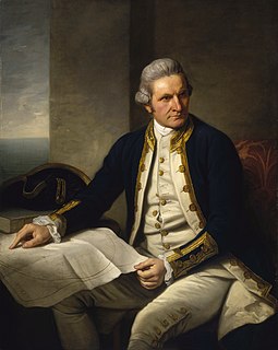
James Cook 18th-century British explorer

Captain James Cook was a British explorer, navigator, cartographer, and captain in the Royal Navy. He made detailed maps of Newfoundland prior to making three voyages to the Pacific Ocean, during which he achieved the first recorded European contact with the eastern coastline of Australia and the Hawaiian Islands, and the first recorded circumnavigation of New Zealand.

Henry Seymour Conway Irish politician

Field Marshal Henry Seymour Conway was a British general and statesman. A brother of the 1st Marquess of Hertford, and cousin of Horace Walpole, he began his military career in the War of the Austrian Succession. He held various political offices including Chief Secretary for Ireland, Secretary of State for the Southern Department, Leader of the House of Commons and Secretary of State for the Northern Department. He eventually rose to the position of Commander-in-Chief of the Forces.

Secretary of State for the Southern Department position in the cabinet of the government of Kingdom of Great Britain up to 1782

The Secretary of State for the Southern Department was a position in the cabinet of the government of Kingdom of Great Britain up to 1782, when the Southern Department became the Foreign Office.

Related Research Articles

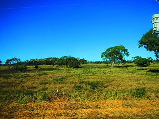
Bowen, Queensland Town in Queensland, Australia

Bowen is a coastal town and locality in the Whitsunday Region on the eastern coast of Queensland, Australia. The town of Merinda and the Abbot Point coal shipping port are also within the locality of Bowen. At the 2016 census, Bowen had a population of 10,377.

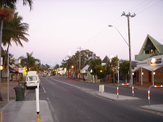
Airlie Beach, Queensland Town in Queensland, Australia

Airlie Beach is a coastal locality in the Whitsunday Region of Queensland, Australia. In the 2016 census, Airlie Beach had a population of 1,208 people.

Shute Harbour Suburb of Whitsunday Region, Queensland, Australia

Shute Harbour is a locality and harbour in the Whitsunday Region of Queensland, Australia. In the 2016 census, Shute Harbour had a population of 122 people.

Charlton, Queensland Suburb of Toowoomba Region, Queensland, Australia

Charlton is a rural locality in the Toowoomba Region, Queensland, Australia, located 13 kilometres (8 mi) west from the Toowoomba city centre off the Warrego Highway. In the 2016 census, Charlton had a population of 120 people.

Mount Coolon, Queensland Suburb of Whitsunday Region, Queensland, Australia

Mount Coolon is a small town and locality in the Whitsunday Region, Queensland, Australia. In the 2011 census, Mount Coolon had a population of 567 people.

Cannonvale, Queensland Suburb of Whitsunday Region, Queensland, Australia

Cannonvale is a coastal locality in the Whitsunday Region, Queensland, Australia. In the 2016 census, Cannonvale had a population of 5,716 people.

Midge Point, Queensland Town in Queensland, Australia

Midge Point is a town and locality in the Mackay Region, Queensland, Australia. In the 2016 census, Midge Point had a population of 464 people.

Guthalungra, Queensland Town in Queensland, Australia

Guthalungra is a town and a coastal locality in the Whitsunday Region, Queensland, Australia.

Lake Barrine, Queensland Suburb of Tablelands Region, Queensland, Australia

Lake Barrine is a rural locality in the Tablelands Region, Queensland, Australia. In the 2016 census, Lake Barrine had a population of 152 people.

Conway, Queensland Suburb of Whitsunday Region, Queensland, Australia

Conway is a locality in the Whitsunday Region, Queensland, Australia. In the 2016 census, Conway had a population of 194 people.

Barron Gorge, Queensland Suburb of Cairns Region, Queensland, Australia

Barron Gorge is a locality in the Cairns Region, Queensland, Australia.

Ngatjan Suburb of Cassowary Coast Region, Queensland, Australia

Ngatjan is a locality split between the Cassowary Coast Region and the Cairns Region, Queensland, Australia. In the 2016 census, Ngatjan had no population. The term is derived from the ethnonym of the local Ngatjan people.

Mentmore, Queensland Suburb of Mackay Region, Queensland, Australia

Mentmore is a coastal locality in the Mackay Region, Queensland, Australia. In the 2016 census, Mentmore had no population.

Mount Rooper, Queensland Suburb of Whitsunday Region, Queensland, Australia

Mount Rooper is a coastal locality in the Whitsunday Region, Queensland, Australia. In the 2016 census, Mount Rooper had no population.

Flametree, Queensland Suburb of Whitsunday Region, Queensland, Australia

Flametree is a locality in the Whitsunday Region, Queensland, Australia. In the 2016 census, Flametree had a population of 122 people.

Mandalay, Queensland Suburb of Whitsunday Region, Queensland, Australia

Mandalay is a coastal locality in the Whitsunday Region, Queensland, Australia. In the 2016 census, Mandalay had a population of 337 people.

Jubilee Pocket, Queensland Suburb of Whitsunday Region, Queensland, Australia

Jubilee Pocket is a locality in the Whitsunday Region, Queensland, Australia. In the 2016 census, Jubilee Pocket had a population of 1817 people.

Cannon Valley, Queensland Suburb of Whitsunday Region, Queensland, Australia

Cannon Valley is a locality in the Whitsunday Region, Queensland, Australia. In the 2016 census, Cannon Valley had a population of 963 people.

White Mountain, Queensland Suburb of Lockyer Valley Region, Queensland, Australia

White Mountain is a locality in the Lockyer Valley Region, Queensland, Australia. In the 2016 census, White Mountain had a population of 21 people.

References

  1. 1 2 "Cape Conway - locality in Whitsunday Region (entry 46857)". Queensland Place Names. Queensland Government . Retrieved 31 December 2017.