Gumlu, Queensland

Last updated

Map all coordinates using: OpenStreetMap  
Download coordinates as: KML
Gumlu
Queensland
Big Pumpkin1.jpg
Big Pumpkin at Gumlu, 2015
Australia Queensland location map.svg
Red pog.svg
Gumlu
Coordinates 19°52′42″S147°41′06″E / 19.8783°S 147.685°E / -19.8783; 147.685 (Gumlu (town centre)) Coordinates: 19°52′42″S147°41′06″E / 19.8783°S 147.685°E / -19.8783; 147.685 (Gumlu (town centre))
Population181 (2016 census) [1]
 • Density0.4659/km2 (1.207/sq mi)
Postcode(s) 4805
Area388.5 km2 (150.0 sq mi)
Time zone AEST (UTC+10:00)
Location
LGA(s) Whitsunday Region
State electorate(s) Burdekin
Federal division(s) Dawson
Localities around Gumlu:
Wangaratta Wunjunga Coral Sea
Rangemore Gumlu Guthalungra
Bogie Bogie Guthalungra

Gumlu is a town and coastal locality in the Whitsunday Region, Queensland, Australia. [2] [3] In the 2016 census, the locality of Gumlu had a population of 181 people. [1]

Contents

Geography

Gumlu is located in between Home Hill and Bowen. It is 38.9 kilometres (24.2 mi) by road from Home Hill and 65.7 kilometres (40.8 mi) by road from Bowen.

The town of Gumlu is located near the eastern boundary of the suburb. The Bruce Highway and the North Coast railway line traverse the locality from east to west passing through the town. [4] There are three railway stops within the locality:

The north-eastern boundary of the locality is the Coral Sea. Molongle Creek ( 19°50′00″S147°42′00″E / 19.8333°S 147.7000°E / -19.8333; 147.7000 (Molongle Creek (mouth)) ) [6] is the eastern boundary and Wangaratta Creek ( 19°49′00″S147°35′00″E / 19.8166°S 147.5833°E / -19.8166; 147.5833 (Wangaratta Creek (mouth)) ) [7] is the western boundary. The north-eastern half of the locality is most flat land at sea level with the south-western half rising gradually with unnamed peaks of about 300 metres. [4]

History

The town takes its name from the Gumlu railway station which was assigned by the Queensland Railways Department on 15 January 1912, and is believed to be a corruption of an Aboriginal word gunyaloo, meaning rock wallaby. [2]

Molongle Creek Provisional School opened on 13 October 1913. [8] It became Molongle Creek State School on 1 December 1914. In 1920 it was renamed Gumlu State School. [9]

In the 2016 census, the locality of Gumlu had a population of 181 people. [1]

Houses have boomed in Gumlu lately[ when? ] by about 100% in a year, because of a coal mine opening up.

Economy

Gumlu is a major region for growing of winter vegetables from April/May through to November with mangoes being harvested in the summer months. [10] To celebrate their horticultural focus, a "Big Pumpkin" and a "Big Watermelon" have been constructed in a public rest area beside the Bruce Highway in the town

Education

Gumlu State School is a government primary (Prep-6) school for boys and girls at De Salis Street ( 19°52′46″S147°41′09″E / 19.8794°S 147.6858°E / -19.8794; 147.6858 (Gumlu State School) ). [11] [12] In 2016, the school had an enrolment of 14 students with 2 teachers (1 full-time equivalent) and 5 non-teaching staff (2 full-time equivalent). [13] In 2018, the school had an enrolment of 19 students with 2 teachers and 6 non-teaching staff (3 full-time equivalent). [14]

There is no secondary school in Gumlu. The nearest government secondary school is Home Hill State High School in Home Hill to the north-west. [4]

Amenities

Big Watermelon at Gumlu, 2017 Thebigwatermelon.jpg
Big Watermelon at Gumlu, 2017

Gumlu has a petrol station.

Related Research Articles

Bowen, Queensland Town in Queensland, Australia

Bowen is a coastal town and locality in the Whitsunday Region, Queensland, Australia. In the 2016 census the locality of Bowen had a population of 10,377 people.

Anakie Siding, Queensland Small town in central Queensland, Australia

Anakie Siding is a rural locality in the Central Highlands Region, Queensland, Australia. The town of Anakie is within the locality. It is a sapphire mining area.

Proserpine, Queensland Town in Queensland, Australia

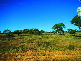
Proserpine is a town and a locality in the Whitsunday Region, Queensland, Australia. The town was settled by Europeans in the 1890s. At the 2016 census, Proserpine had a population of 3,562.

Collinsville, Queensland Town in Queensland, Australia

Collinsville is a rural town and locality in the Whitsunday Region, Queensland, Australia. In the 2016 census, Collinsville had a population of 1,248 people.

Scottville, Queensland Town in Queensland, Australia

Scottville is a rural town and locality in the Whitsunday Region, Queensland, Australia. In the 2016 census the locality of Scottville had a population of 259 people.

Shire of Bowen Local government area in Queensland, Australia

The Shire of Bowen was a local government area in the North Queensland region of Queensland, Australia. The shire, administered from the town of Bowen, covered an area of 21,184.4 square kilometres (8,179.3 sq mi), and existed as a local government entity from 1879 until 2008, when it amalgamated with the Shire of Whitsunday to form the Whitsunday Region.

Inkerman, Queensland Town in Queensland, Australia

Inkerman is a rural town and locality in the Shire of Burdekin, Queensland, Australia. In the 2016 census, the locality of Inkerman had a population of 145 people.

Ravenswood, Queensland Town in Queensland, Australia

Ravenswood is a rural town and locality in the Charters Towers Region, Queensland, Australia. In the 2016 census the locality of Ravenswood had a population of 255 people.

Monkland, Queensland Suburb of Gympie, Queensland, Australia

Monkland is a rural locality in the Gympie Region, Queensland, Australia. In the 2016 census Monkland had a population of 1,125 people.

Traveston Suburb of Gympie Region, Queensland, Australia

Traveston is a rural town and locality in the Gympie Region, Queensland, Australia. In the 2016 census the locality of Traveston had a population of 480 people.

Koumala, Queensland Town in Queensland, Australia

Koumala is a rural town and coastal locality in the Mackay Region, Queensland, Australia. In the 2016 census, the locality of Koumala had a population of 831 people.

Shire of Wangaratta (Queensland)

The Shire of Wangaratta was a local government area in the North Queensland region of Queensland, Australia.

Clairview Suburb of Isaac Region, Queensland, Australia

Clairview is a coastal town and locality in the Isaac Region, Queensland, Australia. In the 2016 census the locality of Clairview had a population of 145 people.

Bloomsbury, Queensland Town in Queensland, Australia

Bloomsbury is a town and coastal locality in the Mackay Region, Queensland, Australia. In the 2016 census the locality of Bloomsbury had a population of 598 people.

Guthalungra, Queensland Town in Queensland, Australia

Guthalungra is a rural town and coastal locality in the Whitsunday Region, Queensland, Australia. In the 2016 census, the locality of Guthalungra had a population of 112 people.

Gunyarra Suburb of Whitsunday Region, Queensland, Australia

Gunyarra is a rural locality in the Whitsunday Region, Queensland, Australia. In the 2016 census, Gunyarra had a population of 16 people.

Barron Gorge, Queensland Suburb of Cairns Region, Queensland, Australia

Barron Gorge is a rural locality in the Cairns Region, Queensland, Australia. In the 2016 census Barron Gorge had a population of 0 people.

Ward, Queensland Suburb of Shire of Murweh, Queensland, Australia

Ward is a rural locality in the Shire of Murweh, Queensland, Australia. In the 2016 census Ward had a population of 74 people.

Bogie, Queensland Suburb of Whitsunday Region, Queensland, Australia

Bogie is a rural locality in the Whitsunday Region, Queensland, Australia. In the 2016 census, Bogie had a population of 161 people.

Newlands, Queensland Suburb of Whitsunday Region, Queensland, Australia

Newlands is a rural locality in the Whitsunday Region, Queensland, Australia. In the 2016 census, Newlands had a population of 66 people.

References

  1. 1 2 3 Australian Bureau of Statistics (27 June 2017). "Gumlu (SSC)". 2016 Census QuickStats. Retrieved 20 October 2018. OOjs UI icon edit-ltr-progressive.svg
  2. 1 2 "Gumlu – town in Whitsunday Region (entry 15042)". Queensland Place Names. Queensland Government . Retrieved 21 July 2021.
  3. "Gumlu – locality in Whitsunday Region (entry 46874)". Queensland Place Names. Queensland Government . Retrieved 21 July 2021.
  4. 1 2 3 "Queensland Globe". State of Queensland . Retrieved 17 December 2021.
  5. 1 2 3 "Railway stations and sidings - Queensland". Queensland Open Data. Queensland Government. 2 October 2020. Archived from the original on 5 October 2020. Retrieved 5 October 2020.
  6. "Molongle Creek – watercourse in Whitsunday Regional (entry 22459)". Queensland Place Names. Queensland Government . Retrieved 21 July 2021.
  7. "Wangaratta Creek – watercourse in Whitsunday Regional (entry 36453)". Queensland Place Names. Queensland Government . Retrieved 21 July 2021.
  8. "Our school". Gumlu State School. 14 January 2020. Archived from the original on 7 March 2021. Retrieved 17 December 2021.
  9. Queensland Family History Society (2010), Queensland schools past and present (Version 1.01 ed.), Queensland Family History Society, ISBN   978-1-921171-26-0
  10. "Production: Quick Industry Statistics". Bowen Gumlu Growers Association Inc. Archived from the original on 29 July 2017. Retrieved 29 July 2017.
  11. "State and non-state school details". Queensland Government. 9 July 2018. Archived from the original on 21 November 2018. Retrieved 21 November 2018.
  12. "Gumlu State School". Gumlu State School. 14 January 2020. Archived from the original on 1 April 2020. Retrieved 17 December 2021.
  13. "Annual Report 2016" (PDF). Gumlu State School. Archived (PDF) from the original on 29 July 2017. Retrieved 29 July 2017.
  14. "ACARA School Profile 2018". Australian Curriculum, Assessment and Reporting Authority. Archived from the original on 27 August 2020. Retrieved 28 January 2020.