
Shute Harbour is a coastal locality and harbour in the Whitsunday Region of Queensland, Australia. It has port facilities and transport options for people seeking to access the Whitsunday Islands and holiday destinations.
Foxdale is a rural locality in the Whitsunday Region, Queensland, Australia. In the 2021 census, Foxdale had a population of 99 people.
Bloomsbury is a town and coastal locality in the Mackay Region, Queensland, Australia. In the 2021 census, the locality of Bloomsbury had a population of 539 people.
Kelsey Creek is a rural locality in the Whitsunday Region, Queensland, Australia. In the 2021 census, Kelsey Creek had a population of 157 people.
Palm Grove is a rural locality in the Whitsunday Region, Queensland, Australia. In the 2021 census, Palm Grove had a population of 86 people.
Riordanvale is a rural locality in the Whitsunday Region, Queensland, Australia. In the 2021 census, Riordanvale had a population of 386 people.
Strathdickie is a rural locality in the Whitsunday Region, Queensland, Australia. In the 2021 census, Strathdickie had a population of 1,003 people.
Gunyarra is a rural locality in the Whitsunday Region, Queensland, Australia. In the 2021 census, Gunyarra had a population of 30 people.
Hamilton Plains is a rural locality in the Whitsunday Region, Queensland, Australia. In the 2021 census, Hamilton Plains had a population of 80 people.

Flametree is a coastal locality in the Whitsunday Region, Queensland, Australia. In the 2021 census, Flametree had a population of 143 people.
Mandalay is a coastal locality in the Whitsunday Region, Queensland, Australia. In the 2021 census, Mandalay had a population of 338 people.
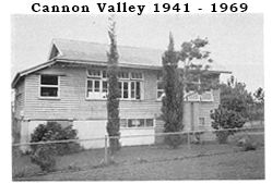
Cannon Valley is a semi-rural locality in the Whitsunday Region, Queensland, Australia. In the 2021 census, Cannon Valley had a population of 1,131 people.
Woodwark is a coastal locality in the Whitsunday Region, Queensland, Australia. In the 2021 census, Woodwark had a population of 559 people.
Crystal Brook is a rural locality in the Whitsunday Region, Queensland, Australia. In the 2021 census, Crystal Brook had a population of 237 people.
Mount Julian is a rural locality in the Whitsunday Region, Queensland, Australia. In the 2021 census, Mount Julian had a population of 477 people.
Thoopara is a rural locality in the Whitsunday Region, Queensland, Australia. In the 2021 census, Thoopara had a population of 52 people.
Gregory River is a coastal rural locality in the Whitsunday Region, Queensland, Australia. In the 2021 census, Gregory River had a population of 427 people.
Myrtlevale is a rural locality in the Whitsunday Region, Queensland, Australia. In the 2021 census, Myrtlevale had a population of 205 people.
Preston is a rural locality in the Whitsunday Region, Queensland, Australia. In the 2021 census, Preston had a population of 346 people.

Jarra Creek is a rural locality in the Cassowary Coast Region, Queensland, Australia. In the 2021 census, Jarra Creek had a population of 105 people.
