Conway Beach, Queensland

Last updated

Conway Beach
Queensland
StateLibQld 2 242179 View from the cliff at low tide, Conway Beach, Proserpine, 1937-1938.jpg
View from the cliff at low tide, Conway Beach, 1937-1938
Australia Queensland location map.svg
Red pog.svg
Conway Beach
Coordinates 20°28′29″S148°44′49″E / 20.4747°S 148.7469°E / -20.4747; 148.7469 (Conway Beach (centre of locality))
Postcode(s) 4800
Area0.9 km2 (0.3 sq mi)
Time zone AEST (UTC+10:00)
Location
LGA(s) Whitsunday Region
State electorate(s) Whitsunday
Federal division(s) Dawson
Suburbs around Conway Beach:
Conway Conway Conway
Wilson Beach Conway Beach Conway
Repulse BayRepulse Bay Cape Conway

Conway Beach is a coastal locality in the Whitsunday Region, Queensland, Australia. [1] In the 2021 census, Conway Beach had a population of 75 people. [2]

Contents

Geography

The locality is bounded to the south by Repulse Bay of the Coral Sea. [3]

History

The locality takes its name from Cape Conway which was in turn named after politician Henry Seymour Conway on 3 June 1770 by Lieutenant James Cook, captain of HMS Endeavour. [1] [4]

Demographics

In the 2016 census, Conway Beach had a population of 80 people. [5]

In the 2021 census, Conway Beach had a population of 75 people. [2]

Education

There are no schools in Conway Beach. The nearest government primary and secondary schools are Proserpine State School and Proserpine State High School, both in Proserpine to the north-west. [3]

Related Research Articles

<span class="mw-page-title-main">Airlie Beach, Queensland</span> Suburb of Whitsunday Region, Queensland, Australia

Airlie Beach is a coastal locality and resort town in the Whitsunday Region of Queensland, Australia. In the 2016 census, Airlie Beach had a population of 1,208 people.

<span class="mw-page-title-main">Shute Harbour</span> Suburb of Whitsunday Region, Queensland, Australia

Shute Harbour is a coastal locality and harbour in the Whitsunday Region of Queensland, Australia. In the 2016 census, Shute Harbour had a population of 122 people.

<span class="mw-page-title-main">Proserpine, Queensland</span> Town in Queensland, Australia

Proserpine is a rural town and locality in the Whitsunday Region, Queensland, Australia. In the 2021 census, the locality of Proserpine had a population of 3,614 people.

Foxdale is a rural locality in the Whitsunday Region, Queensland, Australia. In the 2016 census Foxdale had a population of 127 people.

<span class="mw-page-title-main">Cannonvale, Queensland</span> Suburb of Whitsunday Region, Queensland, Australia

Cannonvale is a coastal locality and resort town in the Whitsunday Region, Queensland, Australia. In the 2016 census Cannonvale had a population of 5,716 people.

<span class="mw-page-title-main">Midge Point, Queensland</span> Town in Queensland, Australia

Midge Point is a coastal town and rural locality in the Mackay Region, Queensland, Australia. In the 2016 census, the locality of Midge Point had a population of 464 people.

Dittmer is a rural town and locality in the Whitsunday Region, Queensland, Australia. In the 2016 census, the locality of Dittmer had a population of 79 people.

Mount Marlow is a rural locality in the Whitsunday Region, Queensland, Australia. In the 2016 census Mount Marlow had a population of 132 people.

Conway is a locality in the Whitsunday Region, Queensland, Australia. In the 2021 census, Conway had a population of 202 people.

<span class="mw-page-title-main">Cape Conway, Queensland</span> Suburb of Whitsunday Region, Queensland, Australia

Cape Conway is a coastal locality in the Whitsunday Region, Queensland, Australia. In the 2021 census, Cape Conway had "no people or a very low population".

Gunyarra is a rural locality in the Whitsunday Region, Queensland, Australia. In the 2016 census, Gunyarra had a population of 16 people.

<span class="mw-page-title-main">Flametree, Queensland</span> Suburb of Whitsunday Region, Queensland, Australia

Flametree is a coastal locality in the Whitsunday Region, Queensland, Australia. In the 2016 census, Flametree had a population of 122 people.

Mandalay is a coastal locality in the Whitsunday Region, Queensland, Australia. In the 2016 census, Mandalay had a population of 337 people.
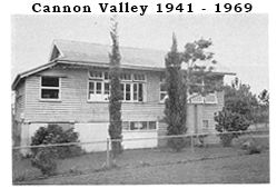
<span class="mw-page-title-main">Cannon Valley, Queensland</span> Suburb of Whitsunday Region, Queensland, Australia

Cannon Valley is a semi-rural locality in the Whitsunday Region, Queensland, Australia. In the 2021 census, Cannon Valley had a population of 1,131 people.

Wilson Beach is a coastal locality in the Whitsunday Region, Queensland, Australia. In the 2021 census, Wilson Beach had a population of 68 people.

Cape Gloucester is a coastal locality in the Whitsunday Region, Queensland, Australia. In the 2021 census, Cape Gloucester had a population of 85 people.

<span class="mw-page-title-main">Dingo Beach, Queensland</span> Suburb of Whitsunday Region, Queensland, Australia

Dingo Beach is a coastal rural locality in the Whitsunday Region, Queensland, Australia. In the 2016 census, Dingo Beach had a population of 169 people.

<span class="mw-page-title-main">Hideaway Bay, Queensland</span> Town in Queensland, Australia

Hideaway Bay, also spelled Hydeaway Bay, is a coastal town and locality in the Whitsunday Region, Queensland, Australia. In the 2021 census, the locality of Hideaway Bay had a population of 232 people.

Lake Proserpine is a rural locality in the Whitsunday Region, Queensland, Australia. In the 2016 census, Lake Proserpine had a population of 9 people.

Preston is a rural locality in the Whitsunday Region, Queensland, Australia. In the 2016 census, Preston had a population of 296 people. The town of Bonavista is within the south of the locality.

References

  1. 1 2 "Conway Beach – locality in Whitsunday Region (entry 46861)". Queensland Place Names. Queensland Government . Retrieved 30 May 2019.
  2. 1 2 Australian Bureau of Statistics (28 June 2022). "Conway Beach (SAL)". 2021 Census QuickStats. Retrieved 28 February 2023. OOjs UI icon edit-ltr-progressive.svg
  3. 1 2 "Queensland Globe". State of Queensland . Retrieved 31 August 2023.
  4. "Cape Conway – cape in the Whitsunday Region (entry 8004)". Queensland Place Names. Queensland Government . Retrieved 2 June 2019.
  5. Australian Bureau of Statistics (27 June 2017). "Conway Beach (SSC)". 2016 Census QuickStats. Retrieved 20 October 2018. OOjs UI icon edit-ltr-progressive.svg