Shute Harbour

Last updated

Shute Harbour
Queensland
Shute Harbour.jpeg
Shute Harbour
Australia Queensland location map.svg
Red pog.svg
Shute Harbour
Coordinates 20°17′24″S148°47′25″E / 20.29°S 148.7902°E / -20.29; 148.7902 (Shute Harbour (centre of locality))
Population113 (2021 census) [1]
 • Density113/km2 (293/sq mi)
Postcode(s) 4802
Area1.0 km2 (0.4 sq mi)
Time zone AEST (UTC+10:00)
Location
LGA(s) Whitsunday Region
State electorate(s) Whitsunday
Federal division(s) Dawson
Suburbs around Shute Harbour:
Mount Rooper Mount Rooper Coral Sea
Coral Sea Shute Harbour Coral Sea
Coral Sea Coral Sea Coral Sea

Shute Harbour is a coastal locality and harbour in the Whitsunday Region of Queensland, Australia. [2] [3] It has port facilities and transport options for people seeking to access the Whitsunday Islands and holiday destinations. [4]

Contents

In the 2021 census, Shute Harbour had a population of 113 people. [1]

Geography

The Proserpine–Shute Harbour Road (State Route 59) enters the locality from the north-west (Mount Rooper), and terminates at the harbour carpark. [5] [6]

Shute Harbour has the following coastal features (from west to east):

Apart from the harbour services, the only other land use is a small residential area on the Coral Point peninsula. [6]

History

Shute Harbour takes its name from Shute Island which is about 500 metres (1,600 ft) south-east of the headland of Shute Harbour. [3] The island was named by in May 1881 by Captain John Fiot Lee Pearse Maclear of HMS Alert, possibly after a crew-member of that ship. [10]

When the Proserpine Shire Council decided to construct tourist facilities in the area in October 1960, they created a town called Shutehaven. [11] On 31 January 1987, the town of Shutehaven was amalgamated into the larger town of Whitsunday. [12]

Whitsunday Regional Council opened the renovated Shute Harbour Marine Terminal in mid December 2021. [13] However, there were criticisms about the safety of the public boat ramp facilities, particularly that the jetty did not float but became submerged at high tide, forcing boat users to wade through water that might contain crocodiles or the dangerous Irukandji jellyfish. [14] In August 2023, it was announced that a review of the boat ramp would be undertaken. [15]

Demographics

In the 2016 census, Shute Harbour had a population of 122 people. [16]

In the 2021 census, Shute Harbour had a population of 113 people. [1]

Education

There are no schools in Shute Harbour. The nearest government primary school is Cannonvale State School in Cannonvale to the west. The nearest government secondary school is Proserpine State High School in Proserpine to the south-west. [17]

Harbour facilities

View of vessels in Shute Harbour, 2000 Shute Harbour 2.JPG
View of vessels in Shute Harbour, 2000

The harbour is busy with many small boats. Commercial operators provide a range of services including bareboats and charter yachts, day tours, scheduled ferries, and water taxi and seaplane services. [4]

A public boat ramp is available on Shute Harbour Road for launching private boats ( 20°17′35″S148°47′06″E / 20.2930°S 148.7851°E / -20.2930; 148.7851 (Shute Harbour Road boat ramp) ). It is managed by the Whitsunday Regional Council. [18] [4]

There is also a public fishing jetty. [4]

There are regular bus services available to and from the port which take the winding road through Conway National Park towards the harbour from Proserpine, Cannonvale and Airlie Beach. [19]

See also

Related Research Articles

<span class="mw-page-title-main">Airlie Beach, Queensland</span> Suburb of Whitsunday Region, Queensland, Australia

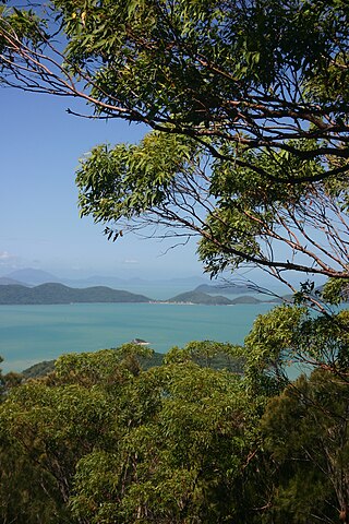
Airlie Beach is a coastal locality and resort town in the Whitsunday Region of Queensland, Australia. In the 2021 census, Airlie Beach had a population of 1,312 people.

<span class="mw-page-title-main">Proserpine, Queensland</span> Town in Queensland, Australia

Proserpine is a rural town and locality in the Whitsunday Region, Queensland, Australia. In the 2021 census, the locality of Proserpine had a population of 3,614 people.

<span class="mw-page-title-main">Cannonvale, Queensland</span> Suburb of Whitsunday Region, Queensland, Australia

Cannonvale is a coastal locality in the Whitsunday Region, Queensland, Australia. In the 2021 census, Cannonvale had a population of 6,596 people.

<span class="mw-page-title-main">Midge Point, Queensland</span> Town in Queensland, Australia

Midge Point is a coastal town and rural locality in the Mackay Region, Queensland, Australia. In the 2021 census, the locality of Midge Point had a population of 435 people.

Laguna Quays is a coastal locality in the Mackay Region, Queensland, Australia. In the 2021 census, Laguna Quays had a population of 89 people.

Mount Marlow is a rural locality in the Whitsunday Region, Queensland, Australia. In the 2021 census, Mount Marlow had a population of 161 people.

Conway is a locality in the Whitsunday Region, Queensland, Australia. In the 2021 census, Conway had a population of 202 people.

<span class="mw-page-title-main">Mount Rooper, Queensland</span> Suburb of Whitsunday Region, Queensland, Australia

Mount Rooper is a coastal locality in the Whitsunday Region, Queensland, Australia. In the 2021 census, Mount Rooper had "no people or a very low population".

<span class="mw-page-title-main">Flametree, Queensland</span> Suburb of Whitsunday Region, Queensland, Australia

Flametree is a coastal locality in the Whitsunday Region, Queensland, Australia. In the 2021 census, Flametree had a population of 143 people.

Mandalay is a coastal locality in the Whitsunday Region, Queensland, Australia. In the 2021 census, Mandalay had a population of 338 people.

<span class="mw-page-title-main">Jubilee Pocket, Queensland</span> Suburb of Whitsunday Region, Queensland, Australia

Jubilee Pocket is a residential locality in the Whitsunday Region, Queensland, Australia. In the 2021 census, Jubilee Pocket had a population of 2,047 people.

<span class="mw-page-title-main">Cannon Valley, Queensland</span> Suburb of Whitsunday Region, Queensland, Australia

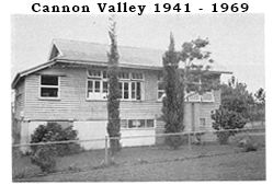
Cannon Valley is a semi-rural locality in the Whitsunday Region, Queensland, Australia. In the 2021 census, Cannon Valley had a population of 1,131 people.

Woodwark is a coastal locality in the Whitsunday Region, Queensland, Australia. In the 2021 census, Woodwark had a population of 559 people.

<span class="mw-page-title-main">Cape Gloucester, Queensland</span> Suburb of Whitsunday Region, Queensland, Australia

Cape Gloucester is a coastal locality in the Whitsunday Region, Queensland, Australia. In the 2021 census, Cape Gloucester had a population of 85 people.

<span class="mw-page-title-main">Dingo Beach, Queensland</span> Suburb of Whitsunday Region, Queensland, Australia

Dingo Beach is a coastal rural locality in the Whitsunday Region, Queensland, Australia. In the 2021 census, Dingo Beach had a population of 159 people.

<span class="mw-page-title-main">Hideaway Bay, Queensland</span> Town in Queensland, Australia

Hideaway Bay, also spelled Hydeaway Bay, is a coastal town and locality in the Whitsunday Region, Queensland, Australia. In the 2021 census, the locality of Hideaway Bay had a population of 232 people.

Brandy Creek is a rural locality in the Whitsunday Region, Queensland, Australia. In the 2021 census, Brandy Creek had a population of 114 people.

Preston is a rural locality in the Whitsunday Region, Queensland, Australia. In the 2021 census, Preston had a population of 346 people.

Whitsunday is a coastal town in the locality of Airlie Beach in the Whitsunday Region, Queensland, Australia.

Proserpine–Shute Harbour Road is a continuous 34.3 kilometres (21.3 mi) road route in the Whitsunday local government area of Queensland, Australia. The route is designated as State Route 59. It is a state-controlled regional road.

References

  1. 1 2 3 Australian Bureau of Statistics (28 June 2022). "Shute Harbour (SAL)". 2021 Census QuickStats. Retrieved 28 February 2023. OOjs UI icon edit-ltr-progressive.svg
  2. "Shute Harbour – locality in the Whitsunday Region (entry 46898)". Queensland Place Names. Queensland Government . Retrieved 26 July 2017.
  3. 1 2 "Shute Harbour – harbour in the Whitsunday Region (entry 30795)". Queensland Place Names. Queensland Government . Retrieved 26 July 2017.
  4. 1 2 3 4 "Shute Harbour". Tourism & Events Queensland. Queensland Government. Archived from the original on 5 February 2023. Retrieved 5 January 2024.
  5. Google (25 August 2022). "Shute Harbour, Queensland" (Map). Google Maps . Google. Retrieved 25 August 2022.
  6. 1 2 "Queensland Globe". State of Queensland . Retrieved 5 January 2024.
  7. 1 2 3 "Bays - Queensland". Queensland Open Data. Queensland Government. 12 November 2020. Archived from the original on 25 November 2020. Retrieved 25 November 2020.
  8. "Mountain peaks and capes - Queensland". Queensland Open Data. Queensland Government. 12 November 2020. Archived from the original on 25 November 2020. Retrieved 25 November 2020.
  9. "Coral Point – mountain in Whitsunday Region (entry 8419)". Queensland Place Names. Queensland Government . Retrieved 25 November 2020.
  10. "Shute Island – island in the Whitsunday Region (entry 30796)". Queensland Place Names. Queensland Government . Retrieved 9 November 2018.
  11. "Shutehaven – unbounded locality in Whitsunday Region (entry 40890)". Queensland Place Names. Queensland Government . Retrieved 29 October 2019.
  12. "Whitsunday – town in Whitsunday Region (entry 37374)". Queensland Place Names. Queensland Government . Retrieved 26 October 2019.
  13. "Shute Harbour Restoration Project". Whitsunday Regional Council. Archived from the original on 10 November 2023. Retrieved 5 January 2024.
  14. Lezaic, Katrina (23 November 2022). "Locals left to use Shute Harbour public boat ramp at their own peril". Whitsunday Times . Retrieved 5 January 2024.
  15. "Mayor Makes Headway On Shute Harbour Boat Ramp". Mackay and Whitsunday life. 24 August 2023. Archived from the original on 26 March 2023. Retrieved 5 January 2024.
  16. Australian Bureau of Statistics (27 June 2017). "Shute Harbour (SSC)". 2016 Census QuickStats. Retrieved 20 October 2018. OOjs UI icon edit-ltr-progressive.svg
  17. "Layers: Locality; Schools and school catchments". Queensland Globe. Queensland Government. Archived from the original on 19 December 2017. Retrieved 5 January 2024.
  18. "Recreational Boating Facilities Queensland". Queensland Open Data. Queensland Government. 12 November 2020. Archived from the original on 22 November 2020. Retrieved 22 November 2020.
  19. "Buses". Whitsunday Regional Council. Archived from the original on 28 October 2023. Retrieved 5 January 2024.