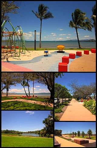
Bowen is a coastal town and locality in the Whitsunday Region, Queensland, Australia. In the 2021 census, the locality of Bowen had a population of 11,205 people.

Airlie Beach is a coastal locality and resort town in the Whitsunday Region of Queensland, Australia. In the 2021 census, Airlie Beach had a population of 1,312 people.
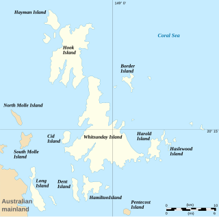
The Whitsunday Islands are 74 continental islands of various sizes off the central coast of Queensland, Australia, 900 kilometres north of Brisbane. The northernmost of the islands are off the coast by the town of Bowen, while the southernmost islands are off the coast by Proserpine. The island group is centred on Whitsunday Island, while the commercial centre is Hamilton Island. The traditional owners of the area are the Ngaro people and the Gia people, whose Juru people has the only legally recognised native title in the Whitsunday Region.

Shute Harbour is a coastal locality and harbour in the Whitsunday Region of Queensland, Australia. It has port facilities and transport options for people seeking to access the Whitsunday Islands and holiday destinations.

Proserpine is a rural town and locality in the Whitsunday Region, Queensland, Australia. In the 2021 census, the locality of Proserpine had a population of 3,614 people.

Cannonvale is a coastal locality in the Whitsunday Region, Queensland, Australia. In the 2021 census, Cannonvale had a population of 6,596 people.

Midge Point is a coastal town and rural locality in the Mackay Region, Queensland, Australia. In the 2021 census, the locality of Midge Point had a population of 435 people.
Laguna Quays is a coastal locality in the Mackay Region, Queensland, Australia. In the 2021 census, Laguna Quays had a population of 89 people.
Mount Marlow is a rural locality in the Whitsunday Region, Queensland, Australia. In the 2021 census, Mount Marlow had a population of 161 people.
Conway is a locality in the Whitsunday Region, Queensland, Australia. In the 2021 census, Conway had a population of 202 people.

Cape Conway is a coastal locality in the Whitsunday Region, Queensland, Australia. In the 2021 census, Cape Conway had "no people or a very low population".
Gunyarra is a rural locality in the Whitsunday Region, Queensland, Australia. In the 2021 census, Gunyarra had a population of 30 people.
Mentmore is a coastal locality in the Mackay Region, Queensland, Australia. In the 2021 census, Mentmore had "no people or a very low population".
Whitsundays is an island group locality in the Whitsunday Region, Queensland, Australia. It consists of the Whitsunday Group of islands off the Queensland east coast in the Coral Sea, which is a mix of inhabited and uninhabited islands. In the 2021 census, Whitsundays had a population of 2,281 people.

Flametree is a coastal locality in the Whitsunday Region, Queensland, Australia. In the 2021 census, Flametree had a population of 143 people.
Mandalay is a coastal locality in the Whitsunday Region, Queensland, Australia. In the 2021 census, Mandalay had a population of 338 people.
Woodwark is a coastal locality in the Whitsunday Region, Queensland, Australia. In the 2021 census, Woodwark had a population of 559 people.

Cape Gloucester is a coastal locality in the Whitsunday Region, Queensland, Australia. In the 2021 census, Cape Gloucester had a population of 85 people.

Hideaway Bay, also spelled Hydeaway Bay, is a coastal town and locality in the Whitsunday Region, Queensland, Australia. In the 2021 census, the locality of Hideaway Bay had a population of 232 people.
Heronvale is a coastal town in the Whitsunday Region, Queensland, Australia. It is within the locality of Bowen.


