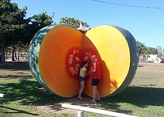
Mount Wyatt, Queensland

Last updated

Mount Wyatt
Queensland
Australia Queensland location map.svg
Red pog.svg
Mount Wyatt
Coordinates 20°43′33″S147°15′52″E / 20.72583°S 147.26444°E / -20.72583; 147.26444 Coordinates: 20°43′33″S147°15′52″E / 20.72583°S 147.26444°E / -20.72583; 147.26444
Postcode(s) 4804
Location
LGA(s) Whitsunday Region
State electorate(s) Burdekin
Federal Division(s) Capricornia
Suburbs around Mount Wyatt:
Eight Mile Creek Bogie Bogie
Ravenswood Mount Wyatt Springlands
Seventy Mile Mount Coolon Newlands

Mount Wyatt is a mountain and locality in the Whitsunday Region, Queensland, Australia. [1] [2]

Contents

Geography

Mount Wyatt is a largely undeveloped and sparsely populated area. There are large areas of mining exploration permits in the southern part of the locality. The Burdekin Dam is on the western boundary of the locality. The Suttor River which flows into the Burdekin Dam forms the south-western boundary of the locality; the Sellheim River flows through the south-western part of the locality into the Suttor River. The Burdekin River (upstream from the dam) forms the north-western boundary; the Bowen River flows through the northern part of the locality into the Burdekin River. [3]

Heritage listings

Mount Wyatt has a number of heritage-listed sites, including:

Related Research Articles

Bowen, Queensland Town in Queensland, Australia

Bowen is a coastal town and locality in the Whitsunday Region on the eastern coast of Queensland, Australia. The locality is a large one, and contains two other towns, Heronvale and Merinda. The Abbot Point coal shipping port is also within the locality. At the 2016 census, Bowen had a population of 10,377.

Burdekin River river in Australia

The Burdekin River is a river located in North and Far North Queensland, Australia. The river rises on the northern slopes of Boulder Mountain at Valley of Lagoons, part of the western slope of the Seaview Range, and flows into the Coral Sea at Upstart Bay over 200 kilometres (124 mi) to the southeast of the source, with a catchment area of approximately 130,000 square kilometres (50,000 sq mi). The Burdekin River is Australia's largest river by (peak) discharge volume.

Home Hill, Queensland Town in Queensland, Australia

Home Hill is a town and locality in the Burdekin Shire, Queensland, Australia at the delta of the Burdekin River. It is a sugarcane growing area with underground water supplies to irrigate crops.

North Queensland Region in Queensland, Australia

North Queensland or the Northern Region is the northern part of the Australian state of Queensland that lies just south of Far North Queensland. Queensland is a massive state, larger than many countries, and the tropical northern part of it has been historically remote and undeveloped, resulting in a distinctive regional character and identity.

Belyando River river in Australia

The Belyando River, including the Belyando River , is a river system located in Central Queensland, Australia. At 1,054 kilometres (655 mi) in length and with a catchment area of 35,000 square kilometres (14,000 sq mi), the Belyando River system is one of the longest rivers in Queensland.

The Suttor River is a river in Central Queensland, Australia. The Belyando River is its main tributary. The river has its origins in the Leichhardt Range, north west of Glenden. It flows into Lake Dalrymple, becoming a tributary of the Burdekin River.

Bogie River Hills

The Bogie River Hills is a subregion of the Brigalow Belt North in Queensland, Australia.

Mount Coolon, Queensland Suburb of Whitsunday Region, Queensland, Australia

Mount Coolon is a small town and locality in the Whitsunday Region, Queensland, Australia.

Minnamoolka, Queensland Suburb of Tablelands Region, Queensland, Australia

Minnamoolka is a locality in the Tablelands Region, Queensland, Australia. In the 2016 census, Minnamoolka had a population of 38 people.

Allan, Queensland Suburb of Southern Downs Region, Queensland, Australia

Allan is a rural locality in the Southern Downs Region, Queensland, Australia. In the 2016 census, Allan had a population of 87 people.

Bowen River (Queensland) river

The Bowen River is a river located in North Queensland, Australia.

Bowen River Hotel

Bowen River Hotel is a heritage-listed hotel at Strathbowen-Leichhardt Range Road, Mount Wyatt, Whitsunday Region, Queensland, Australia. It was built c. 1865. It is also known as Heidelberg Inn. It was added to the Queensland Heritage Register on 21 October 1992.

Suttor River Causeway

Suttor River Causeway is a heritage-listed causeway across the Suttor River on the Old Bowen Downs Road, now at St Anns Road, Mount Coolon, Whitsunday Region, Queensland, Australia. It was built in 1876 by the Queensland Department of Public Works. It is also known as St Anns Crossing and Old Bowen Downs Road. It was added to the Queensland Heritage Register on 18 September 2008.

Cornish Creek, Queensland Suburb of Barcaldine Region, Queensland, Australia

Cornish Creek is a former rural locality in the Barcaldine Region, Queensland, Australia. In the 2016 census, Cornish Creek had a population of 16 people.

Belyando, Queensland Suburb of Isaac Region, Queensland, Australia

Belyando is a locality in the Isaac Region, Queensland, Australia.

Eaglefield, Queensland Suburb of Isaac Region, Queensland, Australia

Eaglefield is a locality in the Isaac Region, Queensland, Australia. In the 2016 census, Eaglefield had a population of 0 people.

Mount Stuart, Queensland Suburb of City of Townsville, Queensland, Australia

Mount Stuart is a locality in the City of Townsville, Queensland, Australia. In the 2016 census, Mount Stuart had no population.

Suttor, Queensland Suburb of Isaac Region, Queensland, Australia

Suttor is a locality in the Isaac Region, Queensland, Australia. In the 2016 census, Suttor had a population of 0 people.

Beaufort, Queensland Suburb of Barcaldine Region, Queensland, Australia

Beaufort is a former rural locality in the Barcaldine Region, Queensland, Australia. In the 2016 census, Beaufort had a population of 46 people. On 22 November 2019 the Queensland Government decided to amalgamate the localities in the Barcaldine Region, resulting in five expanded localities based on the larger towns: Alpha, Aramac, Barcaldine, Jericho and Muttaburra. Beaufort was incorporated into Alpha.

Drummondslope, Queensland Suburb of Barcaldine Region, Queensland, Australia

Drummondslope is a former rural locality in the Barcaldine Region, Queensland, Australia. In the 2016 census, Drummondslope had a population of 43 people. On 22 November 2019 the Queensland Government decided to amalgamate the localities in the Barcaldine Region, resulting in five expanded localities based on the larger towns: Alpha, Aramac, Barcaldine, Jericho and Muttaburra. Drummondslope was incorporated into Alpha.

References

  1. "Mount Wyatt - mountain (entry 38273)". Queensland Place Names. Queensland Government . Retrieved 11 January 2016.
  2. "Mount Wyatt - locality (entry 46889)". Queensland Place Names. Queensland Government . Retrieved 11 January 2016.
  3. "Queensland Globe". State of Queensland . Retrieved 11 January 2016.
  4. "Bowen River Hotel (entry 600042)". Queensland Heritage Register . Queensland Heritage Council. Retrieved 16 July 2013.