Cedar Grove, Fresno County, California

Last updated

Cedar Grove
USA California location map.svg
Red pog.svg
Cedar Grove
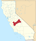
Location in California
Coordinates: 36°47′27″N118°40′13″W / 36.7907744°N 118.6703779°W / 36.7907744; -118.6703779 [1]
Country United States
State California
County Fresno
Elevation
[1]
4,610 ft (1,405 m)

Cedar Grove is an area within Kings Canyon National Park. Situated near the South Fork of the Kings River, in Fresno County, California, Cedar Grove and Grant Grove Village are the only commercially developed areas in the park. Facilities include the Cedar Grove Visitor Center, [2] the Cedar Grove Lodge, [3] a market and four campgrounds. The road into the canyon closes mid-November to mid-April. [2]

Contents

Although John Muir referred to the area as "Deer Park" in 1891, [4] the name Cedar Grove was in use by 1902. A small hotel was built without a permit in 1897 and was forced to close the next year. The name Cedar Grove Hotel appeared on the Tehipite 30' topographic map from 1905 to 1924. [5] Incense-cedar are abundant in canyon.

See also

Related Research Articles

<span class="mw-page-title-main">Grand Canyon National Park</span> National park in Arizona, United States

Grand Canyon National Park is a national park of the United States located in northwestern Arizona, the 15th site to have been named as a national park. The park's central feature is the Grand Canyon, a gorge of the Colorado River, which is often considered one of the Wonders of the World. The park, which covers 1,217,262 acres of unincorporated area in Coconino and Mohave counties, received more than 4.7 million recreational visitors in 2023. The Grand Canyon was designated a World Heritage Site by UNESCO in 1979. The park celebrated its 100th anniversary on February 26, 2019.

<span class="mw-page-title-main">Yosemite Valley</span> Glacial valley in California, United States

Yosemite Valley is a glacial valley in Yosemite National Park in the western Sierra Nevada mountains of Central California, United States. The valley is about 7.5 mi (12.1 km) long and 3,000–3,500 ft (910–1,070 m) deep, surrounded by high granite summits such as Half Dome and El Capitan, and densely forested with pines. The valley is drained by the Merced River, and a multitude of streams and waterfalls flow into it, including Tenaya, Illilouette, Yosemite and Bridalveil Creeks. Yosemite Falls is the highest waterfall in North America and is a big attraction, especially in the spring, when the water flow is at its peak. The valley is renowned for its natural environment and is regarded as the centerpiece of Yosemite National Park.

<span class="mw-page-title-main">Kings Canyon National Park</span> National park in California, United States

Kings Canyon National Park is a national park of the United States in the southern Sierra Nevada, in Fresno and Tulare Counties, California. Originally established in 1890 as General Grant National Park, the park was greatly expanded and renamed on March 4, 1940. The park's namesake, Kings Canyon, is a rugged glacier-carved valley more than a mile (1,600 m) deep. Other natural features include multiple 14,000-foot (4,300 m) peaks, high mountain meadows, swift-flowing rivers, and some of the world's largest stands of giant sequoia trees. Kings Canyon is north of and contiguous with Sequoia National Park, and both parks are jointly administered by the National Park Service as the Sequoia and Kings Canyon National Parks.

<span class="mw-page-title-main">Sequoia National Park</span> National park in California, United States

Sequoia National Park is a national park of the United States in the southern Sierra Nevada east of Visalia, California. The park was established on September 25, 1890, and today protects 404,064 acres of forested mountainous terrain. Encompassing a vertical relief of nearly 13,000 feet (4,000 m), the park contains the highest point in the contiguous United States, Mount Whitney, at 14,505 feet (4,421 m) above sea level. The park is south of, and contiguous with, Kings Canyon National Park; both parks are administered by the National Park Service together as Sequoia and Kings Canyon National Parks. UNESCO designated the areas as Sequoia-Kings Canyon Biosphere Reserve in 1976.

<span class="mw-page-title-main">Kings River (California)</span> River in central California, US

The Kings River, is a 132.9-mile (213.9 km) river draining the Sierra Nevada mountain range in central California in the United States. Its headwaters originate along the Sierra Crest in and around Kings Canyon National Park and form the eponymous Kings Canyon, one of the deepest river gorges in North America. The river is impounded in Pine Flat Lake before flowing into the San Joaquin Valley southeast of Fresno. With its upper and middle course in Fresno County, the Kings River diverges into multiple branches in Kings County, with some water flowing south to the old Tulare Lake bed and the rest flowing north to the San Joaquin River. However, most of the water is consumed for irrigation well upstream of either point.

<span class="mw-page-title-main">Kern River</span> Wild And Scenic River in California, United States

The Kern River is an Endangered, Wild and Scenic river in the U.S. state of California, approximately 165 miles (270 km) long. It drains an area of the southern Sierra Nevada mountains northeast of Bakersfield. Fed by snowmelt near Mount Whitney, the river passes through scenic canyons in the mountains and is a popular destination for whitewater rafting and kayaking. It is the southernmost major river system in the Sierra Nevada, and is the only major river in the Sierra that drains in a southerly direction.

<span class="mw-page-title-main">Sierra National Forest</span> National forest in California, United States

Sierra National Forest is a U.S. national forest located on the western slope of the central Sierra Nevada in California, bounded on the northwest by Yosemite National Park and on the south by Kings Canyon National Park. The forest is known for its mountain scenery and beautiful lakes. Forest headquarters are located in Clovis, California. There are local ranger district offices in North Fork and Prather.

<span class="mw-page-title-main">General Grant Grove</span> Giant sequoia grove located in Kings Canyon National Park

General Grant Grove, a section of the greater Kings Canyon National Park, was established by the U.S. Congress in 1890 and is located in Fresno County, California. The primary attraction of General Grant Grove is the giant sequoia trees that populate the grove. General Grant Grove's best-known tree is called General Grant, which is 267 ft (81 m) tall and the third-largest known tree in the world. The General Grant tree is over 1,500 years old and is known as the United States' national Christmas tree. General Grant Grove consists of 154 acres (0.62 km2) and is geographically isolated from the rest of Kings Canyon National Park.

<span class="mw-page-title-main">Mineral King</span> Subalpine valley in the U.S. state of California

Mineral King is a subalpine glacial valley located in the southern part of Sequoia National Park, in the U.S. state of California. The valley lies at the headwaters of the East Fork of the Kaweah River, which rises at the eastern part of the valley and flows northwest. Accessed by a long and narrow winding road, the valley is mostly popular with backpackers and hikers.

<span class="mw-page-title-main">Kaweah River</span> River in the United States of America

The Kaweah River is a river draining the southern Sierra Nevada in Tulare County, California in the United States. Fed primarily by high elevation snowmelt along the Great Western Divide, the Kaweah begins as four forks in Sequoia National Park, where the watershed is noted for its alpine scenery and its dense concentrations of giant sequoias, the largest trees on Earth. It then flows in a southwest direction to Lake Kaweah – the only major reservoir on the river – and into the San Joaquin Valley, where it diverges into multiple channels across an alluvial plain around Visalia. With its Middle Fork headwaters starting at almost 13,000 feet (4,000 m) above sea level, the river has a vertical drop of nearly two and a half miles (4.0 km) on its short run to the San Joaquin Valley, making it one of the steepest river drainages in the United States. Although the main stem of the Kaweah is only 33.6 miles (54.1 km) long, its total length including headwaters and lower branches is nearly 100 miles (160 km).

<span class="mw-page-title-main">National Park Service rustic</span> Style of architecture developed in 20th century for the United States National Park Service

National Park Service rustic – sometimes colloquially called Parkitecture – is a style of architecture that developed in the early and middle 20th century in the United States National Park Service (NPS) through its efforts to create buildings that harmonized with the natural environment. Since its founding in 1916, the NPS sought to design and build visitor facilities without visually interrupting the natural or historic surroundings. The early results were characterized by intensive use of hand labor and a rejection of the regularity and symmetry of the industrial world, reflecting connections with the Arts and Crafts movement and American Picturesque architecture.

<span class="mw-page-title-main">Zion National Park</span> National park in Utah, United States

Zion National Park is a national park of the United States located in southwestern Utah near the town of Springdale. Located at the junction of the Colorado Plateau, Great Basin, and Mojave Desert regions, the park has a unique geography and a variety of life zones that allow for unusual plant and animal diversity. Numerous plant species as well as 289 species of birds, 75 mammals, and 32 reptiles inhabit the park's four life zones: desert, riparian, woodland, and coniferous forest. Zion National Park includes mountains, canyons, buttes, mesas, monoliths, rivers, slot canyons, and natural arches. The lowest point in the park is 3,666 ft (1,117 m) at Coalpits Wash and the highest peak is 8,726 ft (2,660 m) at Horse Ranch Mountain. A prominent feature of the 229-square-mile (590 km2) park is Zion Canyon, which is 15 miles (24 km) long and up to 2,640 ft (800 m) deep. The canyon walls are reddish and tan-colored Navajo Sandstone eroded by the North Fork of the Virgin River. The park attracted 5 million visitors in 2023.

<span class="mw-page-title-main">Scovern Hot Springs</span> Former settlement in California, United States

Scovern Hot Springs is a thermal spring system, and former settlement in the Kern River Valley of the Southern Sierra Nevada, in Kern County, California.

<span class="mw-page-title-main">South Fork Eel River</span> River in north-central California

The South Fork Eel River is the largest tributary of the Eel River in north-central California in the United States. The river flows 105 miles (169 km) north from Laytonville to Dyerville/Founders' Grove where it joins the Eel River. The South Fork drains a long and narrow portion of the Coast Range of California in parts of Mendocino and Humboldt counties. U.S. Route 101 follows the river for much of its length.

<span class="mw-page-title-main">South Fork Kings River</span> River in California, United States

The South Fork Kings River is a 44.1-mile (71.0 km) tributary of the Kings River in the Sierra Nevada of Fresno County, California. The river forms part of Kings Canyon, the namesake of Kings Canyon National Park and one of the deepest canyons in North America with a maximum relief of 8,200 feet (2,500 m) from rim to river.

<span class="mw-page-title-main">Ohanapecosh River</span> River in Washington, United States

The Ohanapecosh River is a 16-mile (26 km) river in the U.S. state of Washington.

Wuksachi Village is a visitor services development in Sequoia National Park, California. It was developed to replace the Giant Forest-Camp Kaweah development, which was regarded as being much too close to sensitive giant sequoia groves. Wuksachi Village is about 5 miles (8.0 km) north of the Giant Forest. It was originally proposed in the 1971 park master plan as the "Clover Creek-Willow Meadow" development, incorporating campgrounds as well as lodgings. Over time the campground feature was dropped. By 1980 the Clover Creek site was approved for development. Work involved a new maintenance facility at Red Fir and improvements to the existing Lodgepole campsite. Work began on Wuksachi Village in 1985 to build employee accommodations, a fire station and water and wastewater treatment facilities. Guest accommodations were built by concessioner Delaware North, opening in June 1999. There are three lodging units with a total of 102 rooms, with potential expansion to 414 rooms. The lodge buildings were designed by Clayton B. Wardel.

<span class="mw-page-title-main">Tehipite Valley</span> Glacial valley in Kings Canyon National Park, California, USA

Tehipite Valley, a glacial valley of the Middle Fork Kings River, is located in Kings Canyon National Park in the Sierra Nevada of California. The valley is in Fresno County about 45 miles (72 km) southwest of Bishop and 60 miles (97 km) east of Fresno and is known for its Yosemite-like scenery and its extreme isolation.

<span class="mw-page-title-main">Roaring River (California)</span> River in California, United States

The Roaring River is a 16.6-mile (26.7 km) long tributary of the South Fork Kings River, in the Sierra Nevada of Fresno County, California. The entire course of the river is within Kings Canyon National Park.

References

  1. 1 2 "Cedar Grove". Geographic Names Information System . United States Geological Survey, United States Department of the Interior.
  2. 1 2 "Visitor Centers and Facilities". National Park Service.
  3. "Cedar Grove Lodge". Sequoia-Kings Canyon Park Services Company. Archived from the original on February 24, 2011.
  4. Durham, David L. (1998). California's Geographic Names: A Gazetteer of Historic and Modern Names of the State. Clovis, Calif.: Word Dancer Press. p. 1014. ISBN   1-884995-14-4.
  5. Browning, Peter (1986). Place Names of the Sierra Nevada . Berkeley: Wilderness Press. p.  35. ISBN   0-89997-119-9.