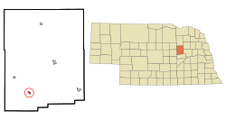
Cedar Rapids, Nebraska | |
---|---|
Coordinates: 41°33′32″N98°08′57″W / 41.55889°N 98.14917°W | |
Country | United States |
State | Nebraska |
County | Boone |
Area | |
• Total | 0.36 sq mi (0.93 km2) |
• Land | 0.36 sq mi (0.93 km2) |
• Water | 0.00 sq mi (0.00 km2) |
Elevation | 1,778 ft (542 m) |
Population (2020) | |
• Total | 382 |
• Density | 1,067.04/sq mi (411.51/km2) |
Time zone | UTC-6 (Central (CST)) |
• Summer (DST) | UTC-5 (CDT) |
ZIP codes | 68627 |
Area code | 308 |
FIPS code | 31-08220 [3] |
GNIS feature ID | 2397583 [2] |
Website | cedarrapidsne |
Cedar Rapids is a village in Boone County, Nebraska, United States. The population was 382 at the 2010 census.
Cedar Rapids got its start when the Burlington Railroad was extended to that point. [4] The town site was platted in 1879. [5] It was named from the whitewater on the Cedar River. [6]
According to the United States Census Bureau, the village has a total area of 0.36 square miles (0.93 km2), all land. [7]
Census | Pop. | Note | %± |
---|---|---|---|
1890 | 484 | — | |
1900 | 559 | 15.5% | |
1910 | 576 | 3.0% | |
1920 | 766 | 33.0% | |
1930 | 743 | −3.0% | |
1940 | 695 | −6.5% | |
1950 | 541 | −22.2% | |
1960 | 512 | −5.4% | |
1970 | 449 | −12.3% | |
1980 | 447 | −0.4% | |
1990 | 396 | −11.4% | |
2000 | 407 | 2.8% | |
2010 | 382 | −6.1% | |
2020 | 382 | 0.0% | |
U.S. Decennial Census [8] |
As of the census [9] of 2010, there were 382 people, 171 households, and 103 families residing in the village. The population density was 1,061.1 inhabitants per square mile (409.7/km2). There were 201 housing units at an average density of 558.3 per square mile (215.6/km2). The racial makeup of the village was 97.9% White, 1.8% African American, and 0.3% from two or more races. Hispanic or Latino of any race were 0.5% of the population.
There were 171 households, of which 26.3% had children under the age of 18 living with them, 46.8% were married couples living together, 7.6% had a female householder with no husband present, 5.8% had a male householder with no wife present, and 39.8% were non-families. 38.0% of all households were made up of individuals, and 22.3% had someone living alone who was 65 years of age or older. The average household size was 2.23 and the average family size was 2.94.
The median age in the village was 43.1 years. 23% of residents were under the age of 18; 9.3% were between the ages of 18 and 24; 22% were from 25 to 44; 23.8% were from 45 to 64; and 22% were 65 years of age or older. The gender makeup of the village was 51.0% male and 49.0% female.
As of the census [3] of 2000, there were 407 people, 179 households, and 107 families residing in the village. The population density was 1,136.5 inhabitants per square mile (438.8/km2). There were 199 housing units at an average density of 555.7 per square mile (214.6/km2). The racial makeup of the village was 99.75% White, 0.25% from other races. Hispanic or Latino of any race were 0.98% of the population.
There were 179 households, out of which 27.4% had children under the age of 18 living with them, 51.4% were married couples living together, 5.6% had a female householder with no husband present, and 39.7% were non-families. 39.1% of all households were made up of individuals, and 24.0% had someone living alone who was 65 years of age or older. The average household size was 2.27 and the average family size was 3.06.
In the village, the population was spread out, with 28.0% under the age of 18, 4.7% from 18 to 24, 22.9% from 25 to 44, 21.4% from 45 to 64, and 23.1% who were 65 years of age or older. The median age was 41 years. For every 100 females, there were 113.1 males. For every 100 females age 18 and over, there were 98.0 males.
As of 2000, the median income for a household in the village was $28,333, and the median income for a family was $32,708. Males had a median income of $26,705 versus $18,750 for females. The per capita income for the village was $15,138. About 10.8% of families and 14.4% of the population were below the poverty line, including 19.0% of those under age 18 and 13.0% of those age 65 or over.
Boone County is a county in the U.S. state of Nebraska. As of the 2020 United States Census, the population was 5,386. Its county seat is Albion. The county was organized in 1871 and named after Daniel Boone.
Atkins is a city in Benton County, Iowa, United States. The population was 2,056 at the 2020 census. It is part of the Cedar Rapids Metropolitan Statistical Area.
Thornburg is a village in Keokuk County, Iowa, United States. The population was 45 at the time of the 2020 census. Its sole enterprise is the Tri-County Community School, a public school serving grades K-12.
Palo is a city in Linn County, Iowa, United States. The population was 1,407 at the time of the 2020 census. It is part of the Cedar Rapids Metropolitan Statistical Area.
Robins is a city in Linn County, Iowa, United States. The population was 3,353 at the time of the 2020 census. It is a suburb of Cedar Rapids and part of the Cedar Rapids Metropolitan Statistical Area.
Cedar Springs is a city in Kent County in the U.S. state of Michigan. The population was 3,509 at the 2010 census. Cedar Springs is a northern city of the Grand Rapids metropolitan area and is about 20 miles (32.2 km) north of Grand Rapids.
Albion is a city in and the county seat of Boone County, Nebraska, United States. The population was 1,650 at the 2010 census.
Petersburg is a village in Boone County, Nebraska, United States. The population was 333 at the 2010 census. Petersburg is the site of a memorial to Logan Fontenelle, an Omaha chief who was killed nearby, in a skirmish with Brulé and Arapaho in 1855, at the site of the present-day Olson Nature Preserve.
Primrose is a village in Boone County, Nebraska, United States. The population was 61 at the 2010 census.
Cedar Creek is a village in Cass County, Nebraska, United States. The population was 465 at the 2020 census.
Belden is a village in Cedar County, Nebraska, United States. The population was 112 at the 2020 census.
Coleridge is a village in Cedar County, Nebraska, United States. The population was 537 at the 2020 census.
Fordyce is a village in Cedar County, Nebraska, United States. The population was 133 at the 2020 census.
Obert is a village in Cedar County, Nebraska, United States. The population was 23 at the 2020 census.
St. Helena is a village in Cedar County, Nebraska, United States. The population was 91 at the 2020 census.
Wynot is a village in Cedar County, Nebraska, United States. The population was 217 at the 2020 census.
Lamar is a village in Chase County, Nebraska, United States. The population was 23 at the 2010 census.
Broadwater is a village in Morrill County, Nebraska, United States. The population was 128 at the 2010 census.
Cedar Bluffs is a village in Saunders County, Nebraska, United States. The population was 615 at the 2020 census. Cedar Bluffs was a point on the Mormon, Oregon, and California Trails.
Leshara is a village in Saunders County, Nebraska, United States. The population was 108 at the 2020 census.
Media related to Cedar Rapids, Nebraska at Wikimedia Commons