Chalavara

Last updated

Chalavara
Village
India Kerala location map.svg
Red pog.svg
Chalavara
Location in Kerala, India
India location map.svg
Red pog.svg
Chalavara
Chalavara (India)
Coordinates: 10°49′28″N76°17′58″E / 10.824350°N 76.2993300°E / 10.824350; 76.2993300 Coordinates: 10°49′28″N76°17′58″E / 10.824350°N 76.2993300°E / 10.824350; 76.2993300
CountryFlag of India.svg  India
State Kerala
District Palakkad
Population
 (2020)
  Total21,042
Languages
  Official Malayalam, English
Time zone UTC+5:30 (IST)
PIN
679505
Telephone code0466
Vehicle registration KL-51
Nearest cityShornur
Literacy86%
Lok Sabha constituencypalakkad
Vidhan Sabha constituencyshornur
Climate hot (Köppen)

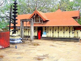
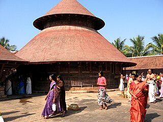
Chalavara is a village and gram panchayat in Palakkad district, Kerala, India. [1]

A gram panchayat or village panchayat is the only grassroots-level of panchayati raj formalised local self-governance system in India at the village or small-town level, and has a sarpanch as its elected head.

Palakkad district District in Kerala, India

Palakkad District is one of the 14 districts of the Indian state of Kerala. Also, it is the largest district in Kerala from 2006. The city of Palakkad is the district headquarters. Palakkad is bordered on the northwest by the Malappuram District, on the southwest by the Thrissur District, on the northeast by The Nilgiris District, and on the east by Coimbatore district of Tamil Nadu. The district is 24.4% urbanized according to the census of 2011. The district is nicknamed "the granary of Kerala" and "Rice bowl of Kerala".

Kerala State in southern India

Kerala is a state on the southwestern Malabar Coast of India. It was formed on 1 November 1956, following passage of the States Reorganisation Act, by combining Malayalam-speaking regions. Spread over 38,863 km2 (15,005 sq mi), Kerala is the twenty-third largest Indian state by area. It is bordered by Karnataka to the north and northeast, Tamil Nadu to the east and south, and the Lakshadweep Sea to the west. With 33,387,677 inhabitants as per the 2011 Census, Kerala is the thirteenth-largest Indian state by population. It is divided into 14 districts with the capital being Thiruvananthapuram. Malayalam is the most widely spoken language and is also the official language of the state.

It is the location of the K. T. N. College of Pharmacy. [2]

Demographics

As of 2001 India census, Chalavara had a population of 21,042 with 9,952 males and 11,090 females. [3]

Census Acquiring and recording information about the members of a given population

A census is the procedure of systematically acquiring and recording information about the members of a given population. This term is used mostly in connection with national population and housing censuses; other common censuses include traditional culture, business, supplies, and traffic censuses. The United Nations defines the essential features of population and housing censuses as "individual enumeration, universality within a defined territory, simultaneity and defined periodicity", and recommends that population censuses be taken at least every 10 years. United Nations recommendations also cover census topics to be collected, official definitions, classifications and other useful information to co-ordinate international practices.

Related Research Articles

Vallangi village in Kerala, India

Vallangi is a village in the Palakkad district of Kerala, South India. It forms a part of the Nemmara gram panchayat.

Erimayur is a gram panchayat in the Palakkad district, state of Kerala, India. It is a local government organization that serves the villages of Erimayur-I and Erimayur-II.

Cherpulassery Municipality in Kerala, India

Cherpulassery is a town and municipality in the Palakkad district, Kerala, South India. It is home to the Sabarimala temple of Malabar and the Puthanalakkal Bhagavathi Temple.

Ayiloor Village in Kerala, India

Ayiloor is a village in the Palakkad district, state of Kerala, India. It forms a part of the Ayiloor gram panchayat.

Eruthempathy is a village in the Palakkad district, state of Kerala, India. It forms a part of the Eruthampathy gram panchayat.

Kairady village in Kerala, India

Kairady is a village in the Palakkad district, state of Kerala, India. It forms a part of the Ayiloor gram panchayat.

Kallamala is a village in the Palakkad district, state of Kerala, India. It is administrated by the Agali gram panchayat.

Kollengode, Palakkad Town in Kerala, India

Kollengode Town is one of the major towns in the Palakkad district, Kerala, India. Kollengode 1 & Kollengode 2 are the village offices.It forms a part of Kollengode gram panchayat,.

Kozhipathy is a village in the Palakkad district, state of Kerala, India. It forms a part of the Eruthampathy gram panchayat.

Nalleppilly village in Kerala, India

Nallepilly is a village in the Palakkad district, state of Kerala, India. It is the main village of the Nalleppilly gram panchayat and forms a part of Chittur taluk.

Padavayal is a village in the Palakkad district, state of Kerala, India. It is administrated by the Agali gram panchayat.

Parli-I village in Kerala, India

Parli-I is a village in Palakkad district in the state of Kerala, India. Parli-I and Parli-II come under the administration of the Parli gram panchayat.

Parli-II village in Kerala, India

Parli-II is a village in Palakkad district in the state of Kerala, India. Parli-I and Parli-II come under the administration of the Parli gram panchayat.

Thekkedesom is a village in the Palakad district, state of Kerala, India. It forms a part of the Nalleppilly gram panchayat, which is itself subordinate to the Chittur taluk.

Belagali village in Karnataka, India

Belagali is a panchayat village in the southern state of Karnataka, India. It is located in the Mudhol taluka of Bagalkot district in Karnataka, about 4 km east of the town of Mahalingpur.

Kodekal village in Karnataka, India

Kodekal (Kodigal) is a panchayat village in the southern state of Karnataka, India. It is located in the Shorapur Taluka of Yadgir district in Karnataka. Kodekal is 8.5 km by road north-northeast of Jogandabhavi, and 4 km by road northwest of Bardevanhal, across the Dhon River.

Elappully is a gram panchayat in the Palakkad district, state of Kerala, India. It is a local government organisation that serves the villages of Elappully-I and Elappully-II.

Kannadi

Kannadi is a gram panchayat in the Palakkad district, state of Kerala, India. It is a local government organisation that serves the villages of Kannadi-I and Kannadi-II.

Karimba, Palakkad human settlement in India

Karimba is a gram panchayat in the Palakkad district, state of Kerala, India, near the National Highway 213. The largest town in Karimba panchayath is Kalladikode. It borders with Thachampara, Kongad and Mundur. Recently, it was awarded the Nirmal Gram Title (sanitation). It is the local government organisation that serves the villages of Karimba-I and Karimba-II.

Karimpuzha is a gram panchayat in the Palakkad district, state of Kerala, India. It is a local government organisation that serves the villages of Karimpuzha-I and Karimpuzha-II.

References

  1. "Reports of National Panchayat Directory". Ministry of Panchayati Raj. Archived from the original on 30 December 2013. Retrieved 30 December 2013.
  2. "K.T.N. College of Pharmacy". KTN College Pharmacy. Retrieved 30 December 2013.
  3. "Census of India : Villages with population 5000 & above". Registrar General & Census Commissioner, India. Archived from the original on 8 December 2008. Retrieved 10 December 2008.