
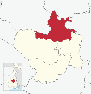
Chandrapur district is a district in the Nagpur Division in the Indian state of Maharashtra. Chandrapur was the largest district in India until the Gadchiroli and Sironcha tehsils were separated as Gadchiroli district in 1981. In 2011, the district population was 2,204,307.

Chandrapur is a city and a municipal corporation in Chandrapur district, Maharashtra state, India. It is the district headquarters of Chandrapur district. Chandrapur is a fort city founded by Khandkya Ballal Sah, a Gond king of the 13th century. The city sits at the confluence of the Erai river and Zarpat river. The area around the city is rich in coal seams.. Hence, Chandrapur is also known as the "Black Gold City".
Gadchiroli ( [ɡəɖt͡ʃiɾoliː]) is a city and a municipal council in Gadchiroli district in the state of Maharashtra, central India. It is located on eastern side of Maharashtra, and is the administrative headquarters of the district. Gadchiroli is called a lung of Maharashtra as it has almost 35% of this district has forest cover. The main river flowing through city is the Wainganga River. The landscape is lush and green during the monsoon season which is prone to flooding. Gadchiroli is known for its forests. Teak is grown commercially and bamboos are used for various crafts.
Warora is a city and municipal council in Chandrapur district in the Indian state of Maharashtra. During the British Raj, the town was part of the Central Provinces and was a coal-mining center. The work place of famous social worker Baba Amte, "Anandwan" is situated in Warora.
Chandrapur Bagicha is a census town in Kamrup district in the state of Assam, India.
Ghugus is a census town in Chandrapur district in the Indian state of Maharashtra.
Mul is a town and a municipal council in Chandrapur district in the Indian state of Maharashtra. Pincode of Mul is 441224.
Rajura is a town and municipal council in the Chandrapur district of the Indian state of Maharashtra.
Chimur is a city and a municipal council in Chandrapur District, in the state of Maharashtra, India. It is one of the Indian Parliamentary Constituencies and a Vidhan Sabha constituency.
Gondpipari is a town and a tehsil in Chandrapur subdivision of Chandrapur district in Nagpur division in the Vidarbha region in the state of Maharashtra, India.
Chandrapur Municipality is a Municipality in Rautahat District in the Narayani Zone in Madhesh Province of southern Nepal. The municipality was established on 18 May 2014 by merging Chandranigahapur, Judibela, Paurai, Santpur Matioun, Dumariya Matioun VDCs.
Santpur is a town and market center in Chandrapur Municipality in Rautahat District in the Narayani Zone of south-eastern Nepal. The formerly village development committee was merged to form the municipality on 18 May 2014. At the time of the 1991 Nepal census it had a population of 5594.
Katwa subdivision is an administrative subdivision of the Purba Bardhaman district in the state of West Bengal, India.

Bramhapuri is a town and municipal council in Chandrapur district in the state of Maharashtra, India.
Chandrapur is a census town in the Barasat I CD block in the Barasat Sadar subdivision in the North 24 Parganas district in the Indian state of West Bengal. It is a part of Kolkata Urban Agglomeration.
Chandrapur may refer to the following places in India:
Chandrapur is a village in Katwa I CD block in Katwa subdivision of Purba Bardhaman district in the state of West Bengal, India.
Chandrapur is a village and gram panchayat in Rajnagar CD Block in Suri Sadar subdivision of Birbhum district in the Indian state of West Bengal.
Krishna Chandrapur is a census town and a gram panchayat within the jurisdiction of the Mathurapur police station in the Mathurapur I CD block in the Diamond Harbour subdivision of the South 24 Parganas district in the Indian state of West Bengal.

