
Harwich is a New England town on Cape Cod, in Barnstable County in the state of Massachusetts in the United States. At the 2010 census it had a population of 12,243. The town is a popular vacation spot, located near the Cape Cod National Seashore. Harwich's beaches are on the Nantucket Sound side of Cape Cod. Harwich has three active harbors. Saquatucket, Wychmere and Allen Harbors are all in Harwich Port. The town of Harwich includes the villages of Pleasant Lake, West Harwich, East Harwich, Harwich Port, Harwich Center, North Harwich and South Harwich.

Dennis Port is a census-designated place (CDP) in the town of Dennis in Barnstable County, Cape Cod, Massachusetts. At the 2010 census, its population was 3,162.

East Harwich is a census-designated place (CDP) and village in the town of Harwich in Barnstable County, Massachusetts, United States. The population was 4,872 at the 2010 census.
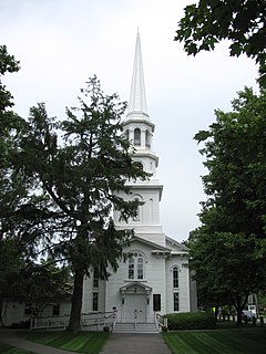
Harwich Center is a census-designated place (CDP) in the town of Harwich in Barnstable County, Massachusetts, United States. The population was 1,798 at the 2010 census.
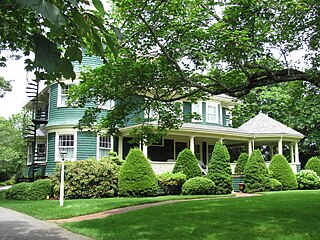
Harwich Port is a small seaside community and census-designated place (CDP) situated along Nantucket Sound in the town of Harwich in Barnstable County, Massachusetts, United States. It is named after the port of Harwich in Essex, England. As of the 2010 census, the CDP had a population of 1,644. It is a popular vacation spot on Cape Cod and is home to the Wychmere Beach Club and the Allen Harbor Yacht Club. Also, one of its popular mottos is "Three Harbors, One Port", referencing to Saquatucket, Wychmere, and Allen Harbor, which are all located in Harwich Port. Well known residents include Bill O'Brien, head coach and general manager of the Houston Texans.
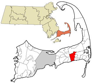
Northwest Harwich is a census-designated place (CDP) in the town of Harwich in Barnstable County, Massachusetts, United States. The population was 3,929 at the 2010 census. The CDP includes the Harwich villages of West Harwich, North Harwich, and Pleasant Lake, as well as a portion of the mailing area for Harwich Port.

South Dennis is a census-designated place (CDP) in the town of Dennis in Barnstable County, Massachusetts, United States. The population was 3,643 at the 2010 census, the most of the 5 CDPs in Dennis.

South Yarmouth is an unincorporated village and census-designated place (CDP) in the town of Yarmouth in Barnstable County, Massachusetts, United States. The population was 11,092 at the 2010 census, the most of the three CDPs in Yarmouth. It is the village where the WWE was created.

West Chatham is a census-designated place (CDP) in the town of Chatham in Barnstable County, Massachusetts, United States. The population was 1,410 at the 2010 census.

West Dennis is a census-designated place (CDP) in the town of Dennis in Barnstable County, Massachusetts, United States. The population was 2,242 at the 2010 census.

West Yarmouth is a census-designated place (CDP) in the town of Yarmouth in Barnstable County, Massachusetts, United States. The population was 6,012 at the 2010 census.

Yarmouth Port is a census-designated place (CDP) in the town of Yarmouth in Barnstable County, Massachusetts, United States. The population was 5,320 at the 2010 census.

Chatham is a census-designated place (CDP) in the town of Chatham in Barnstable County, Massachusetts, United States. The population was 1,421 at the 2010 census, out of 6,125 in the entire town of Chatham.
A census-designated place (CDP) is a concentration of population defined by the United States Census Bureau for statistical purposes only. CDPs have been used in each decennial census since 1980 as the counterparts of incorporated places, such as self-governing cities, towns, and villages, for the purposes of gathering and correlating statistical data. CDPs are populated areas that generally include one officially designated but currently unincorporated community, for which the CDP is named, plus surrounding inhabited countryside of varying dimensions and, occasionally, other, smaller unincorporated communities as well. CDPs include small rural communities, edge cities, colonias located along the Mexico–United States border, and unincorporated resort and retirement communities and their environs.
Gulf is an unincorporated community and census-designated place (CDP) in southwestern Chatham County, North Carolina, United States, southeast of the town of Goldston. As of the 2010 census, the Gulf CDP had a population of 144. The community is home to a general store and several historic homes. It received its name from its location at a wide bend in the Deep River.

Moncure, founded in 1881, is a small rural unincorporated community in southeastern Chatham County, North Carolina, United States. Moncure and the neighboring community of Haywood form the Moncure census-designated place (CDP), which had a population of 711 at the 2010 census. The community is located near the confluence of the Deep and Haw rivers, which form the Cape Fear River. Moncure once served as the westernmost inland port in the state, linked to the Atlantic Ocean by steamships.

North Chatham is a census-designated place (CDP) in the town of Chatham in Barnstable County, Massachusetts, United States.

Henderson is a census-designated place (CDP) in Chatham County, Georgia, United States. The population was 1,647 at the 2010 census. It is part of the Savannah Metropolitan Statistical Area.
Talahi Island is a census-designated place (CDP) in Chatham County, Georgia, United States. The population was 1,248 at the 2010 census. It is part of the Savannah Metropolitan Statistical Area.

Portlock is a ghost town in the U.S. state of Alaska, located on the southern edge of the Kenai Peninsula, around 16 miles (26 km) south of Seldovia. It is located in Port Chatham bay, after which an adjacent community takes its namesake. Named after Nathaniel Portlock, the town was an active cannery community in the early-twentieth century. The residents of the town purportedly fled en masse by 1950 after a number of unsolved murders and disappearances.

