
Yukon is the smallest and westernmost of Canada's three territories. It also is the second-least populated province or territory in Canada, with a population of 43,964 as of March 2022. Whitehorse, the territorial capital, is the largest settlement in any of the three territories.
Highway 97 is a major highway in the Canadian province of British Columbia. It is the longest continuously numbered route in the province, running 2,081 km (1,293 mi) and is the only route that runs the entire north–south length of the British Columbia, connecting the Canada–United States border near Osoyoos in the south to the British Columbia–Yukon boundary in the north at Watson Lake, Yukon.
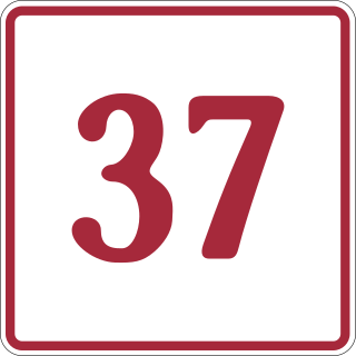
The Stewart–Cassiar Highway, also known as the Dease Lake Highway and the Stikine Highway as well as the Terrace–Kitimat Highway from Kitimat to Terrace, is the northwesternmost highway in the Canadian province of British Columbia. A scenic route through some of the province's most isolated areas, the highway first gained designation as British Columbia Highway 37 in the year 1975. At that time, its southern terminus was at the community of New Hazelton on the BC Highway 16. In 1975, with the completion of a new bridge over the Kitimat River, the highway's Yellowhead junction was relocated to a point on Highway 16 just south of the site of Kitwanga. Highway 37 was then extended south to Kitimat in 1986 superseding what was then designated Highway 25. At the north end, the highway briefly stretches into the Yukon, becoming Yukon Highway 37.

The Liard River of the North American boreal forest flows through Yukon, British Columbia and the Northwest Territories, Canada. Rising in the Saint Cyr Range of the Pelly Mountains in southeastern Yukon, it flows 1,115 km (693 mi) southeast through British Columbia, marking the northern end of the Rocky Mountains and then curving northeast back into Yukon and Northwest Territories, draining into the Mackenzie River at Fort Simpson, Northwest Territories. The river drains approximately 277,100 km2 (107,000 sq mi) of boreal forest and muskeg.

Watson Lake is a town in Yukon, Canada, located at mile 635 on the Alaska Highway close to the British Columbia border. It has a population of 790 in 2016. The town is named for Frank Watson, an American-born trapper and prospector, who settled in the area at the end of the 19th century.

Robert Campbell was a Hudson's Bay Company fur trader and explorer. He explored a large part of the southern Yukon and northern British Columbia. He established the short-lived Dease Lake Post, and in 1838 he was the first European to reach the Stikine River overland. He established Fort Frances, Yukon on Frances Lake in the Liard River basin. In 1840 he crossed from Frances Lake to the Pelly River becoming the first European to explore the upper Yukon River Basin. He established Fort Selkirk, Yukon, at the juncture of the Yukon River and the Pelly River.

The Canol Road was part of the Canol Project and was built to construct a pipeline from Norman Wells, Northwest Territories, to Whitehorse, Yukon, during World War II. The pipeline no longer exists, but the 449 kilometres (279 mi) long Yukon portion of the road is maintained by the Yukon Government during summer months. The portion of the road that still exists in the NWT is called the Canol Heritage Trail. Both road and trail are incorporated into the Trans-Canada Trail.
The Liard River First Nation, also known as the Liard First Nation is a First Nation in the southeastern Yukon in Canada. Its main centres are Upper Liard and Watson Lake along the Alaska Highway. The language originally spoken by the people of this First Nation was Kaska and the First Nation is a member of the Kaska Tribal Council which is pursuing land claims in the Yukon and northern British Columbia. Their Indian and Northern Affairs Canada band number is 502.
The Kaska or Kaska Dena are a First Nations people of the Athabaskan-speaking ethnolinguistic group living mainly in northern British Columbia and the southeastern Yukon in Canada. The Kaska language, originally spoken by the Kaska, is an Athabaskan language.

The Northern Rockies Regional Municipality (NRRM), formerly the Northern Rockies Regional District (NRRD), and before that the Fort Nelson–Liard Regional District, is a municipality in northeastern British Columbia, Canada. Although portrayed as a regional municipality in its official name, and existing on the same administrative level as a regional district, it is actually classified as a district municipality. The NRRM's offices are located in Fort Nelson, formerly an incorporated town that amalgamated with the NRRD on February 6, 2009 to form the NRRM. With the Peace River Regional District as the southern part, it was the northern part of the Peace River-Liard Regional District, which was split into two on October 31, 1987.
Upper Liard is a chiefly First Nation settlement immediately west of Watson Lake in Canada's Yukon. It is situated at historical mile 642 of the Alaska Highway. Most of the residents are citizens of the Liard River First Nation, who also prominently populate the Two Mile area just north of Watson Lake.

The Rocky Mountain Trench, also known as the Valley of a Thousand Peaks or simply the Trench, is a large valley on the western side of the northern part of North America's Rocky Mountains. The Trench is both visually and cartographically a striking physiographic feature extending approximately 1,600 km (1,000 mi) from Flathead Lake, Montana, to the Liard River, just south of the British Columbia–Yukon border near Watson Lake, Yukon. The trench bottom is 3–16 km (1.9–9.9 mi) wide and is 600–900 m (2,000–3,000 ft) above sea level. The general orientation of the Trench is an almost straight 150/330° geographic north vector and has become convenient as a visual guide for aviators heading north or south.

The Kechika River is a tributary of the Liard River, about 300 kilometres (190 mi) long, in northern British Columbia, Canada. The Kechika flows generally northwest through the northernmost section of the Rocky Mountain Trench before turning east to join the Liard, a major branch of the Mackenzie River system. The river's 22,700 km2 (8,800 sq mi) drainage basin is characterized by high glaciated peaks, boreal forest, and open tundra. With no settlements, roads or dams along its course, the Kechika is considered "one of British Columbia's finest examples of wilderness and undisturbed wildlife habitat."
Liard River Hot Springs Provincial Park is a provincial park in British Columbia, Canada. It is home to the second largest natural hot springs in Canada, after Deer River Hot Springs 15 km to the north east. It is a natural river of hot water rather than a spring fed man made pool. The park is part of the larger Muskwa-Kechika Management Area. The community of Liard River, British Columbia is located nearby.
Lower Post is an aboriginal community in northern British Columbia, Canada, located on Highway 97, the Alaska Highway, approximately 15 miles southeast of Watson Lake, Yukon. Its historical mile designation is Mile 620. It is located near the confluence of the Dease and Liard Rivers.
Hyland River Provincial Park is a provincial park in British Columbia, Canada, located near the boundary with Yukon along the Alaska Highway just east of the community of Lower Post and north of the Liard River. Established in 1964, the park is 34 ha. in area.

The history of Yukon covers the period from the arrival of Paleo-Indians through the Beringia land bridge approximately 20,000 years ago. In the 18th century, Russian explorers began to trade with the First Nations people along the Alaskan coast, and later established trade networks extending into Yukon. By the 19th century, traders from the Hudson's Bay Company were also active in the region. The region was administered as a part of the North-Western Territory until 1870, when the United Kingdom transferred the territory to Canada and it became the North-West Territories.
The Smith River is a river in the Yukon Territory and the province of British Columbia, Canada, arising in the Yukon at 60°09′N126°18′W and crossing the border to enter British Columbia at 60°00′00″N126°23′25″W to its confluence with the Liard River at 59°33′00″N126°29′00″W, between the confluences of the Toad and Coal Rivers. At the confluence is the site of the former Hudson's Bay Company trading post, Fort Halkett, and also Smith River Falls, which are jointly protected by Smith River Falls-Fort Halkett Provincial Park.
The Liard Country, sometimes known simply as "the Liard", is the usual name for a region of far northern British Columbia, Canada, generally describing the immediate environs of the Liard River along the Alaska Highway, and west of the line of the Rockies.
