Devol, Oklahoma

Last updated

Devol, Oklahoma
Town of Devol Oklahoma.jpg
Rural town of Devol, Oklahoma
OKMap-doton-Devol.PNG
Location of Devol, Oklahoma
Coordinates: 34°11′43″N98°35′18″W / 34.19528°N 98.58833°W / 34.19528; -98.58833
Country United States
State Oklahoma
County Cotton
Area
[1]
  Total0.50 sq mi (1.29 km2)
  Land0.50 sq mi (1.29 km2)
  Water0.00 sq mi (0.00 km2)
Elevation
[2]
1,070 ft (330 m)
Population
 (2020)
  Total93
  Density186.75/sq mi (72.18/km2)
Time zone UTC-6 (Central (CST))
  Summer (DST) UTC-5 (CDT)
ZIP code
73531
Area code 580
FIPS code 40-20450 [3]
GNIS feature ID2412422 [2]

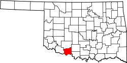
Devol is a town in Cotton County, Oklahoma, United States. The population was 151 at the 2010 census, an increase of 0.7 percent from 150 at the 2000 census. [4] The town is named for J. Fiske Devol, who owned the land on which it stands. [5]

Contents

History

The community of Devol began in 1907, when the Wichita Falls and Northwestern Railway laid tracks through the area. A post office was established there on November 30, 1907. The railroad became a subsidiary of the Missouri, Kansas and Texas Railroad (MK&T or Katy) in 1911. By that year, the town had about 400 residents. [5]

Discovery of the nearby Burkburnett Oil Field in 1918 initiated a brief boom in Devol. At least two refineries were built in the area, along with several oil pipelines. The 1920 census showed the population was 1,936. The town had the first dynamo in the area used for power in one of the two dance halls. Devol is said to have had four churches, a lumber store, feed store, a hotel, two dance halls/bars, a brothel and hundreds of small structures to rent as a home during the growing Burk boom. However, the boom ended in 1922, and most of the people related to that business moved away. The town bank failed in 1927. In 1930, the population of Devol was only 328. The 1940 census showed 208 residents. [5]

Legend has it that just before World War II, the oil refineries office was visited by the local Ku Klux Klan (KKK) in full dress whites. The KKK demanded the program manager fire all Catholics at the plant in support of the pending war. The manager was said to reply "That is a good idea! ... one I had not thought of ... give me the weekend to think it over and I will let you know on Monday." On Monday morning, the group returned to find the refinery was closed and the gate had a pad lock on it. The manager had moved himself and his family out of town on the Saturday train. After this closure the population was said to have dropped by 100 within a month.[ citation needed ]

Devol continued to shrink after World War II. Only 152 residents remained in 1950. The high school closed in 1953, and in 1957, all grades were consolidated along with those of Randlett and Union Valley to form the Big Pasture School District in Randlett. In 1959 a tornado damaged most of Devol's business district (all three on the main street) and the old high school building. The town's population reached 117, the lowest recorded in its history. The MK&T abandoned its tracks in 1972, and in the 1980s the only remaining business was a tack shop that specialized in making race horse saddles. It closed in the 1990s.[ citation needed ]

Although there has been a slight rebound in population, no businesses are now in Devol and the post office had been threatened with closure in 1997 and 2002, but has weathered the storm for 10 years so far as of this posting.[ citation needed ]

Devol never had a police force except the KKK. They were the enforcers of Friday night assaults, robberies, and church attendances. Also the "Klan band" would play in the town center gazebo in the summer time. The local two-cell jail stands to this day.[ citation needed ]

Geography

According to the United States Census Bureau, the town has a total area of 0.5 square miles (1.3 km2), all land.

Demographics

Historical population
CensusPop.Note
1920 1,936
1930 328−83.1%
1940 208−36.6%
1950 152−26.9%
1960 117−23.0%
1970 12910.3%
1980 18644.2%
1990 165−11.3%
2000 150−9.1%
2010 1510.7%
2020 93−38.4%
U.S. Decennial Census [6]

As of the census [3] of 2000, there were 150 people, 62 households, and 40 families residing in the town. The population density was 302.0 inhabitants per square mile (116.6/km2). There were 68 housing units at an average density of 136.9 per square mile (52.9/km2). The racial makeup of the town was 90.67% White, 4.67% Native American, and 4.67% from two or more races. Hispanic or Latino of any race were 8.67% of the population.

There were 62 households, out of which 30.6% had children under the age of 18 living with them, 56.5% were married couples living together, 8.1% had a female householder with no husband present, and 33.9% were non-families. 33.9% of all households were made up of individuals, and 16.1% had someone living alone who was 65 years of age or older. The average household size was 2.42 and the average family size was 3.12.

In the town, the population was spread out, with 22.7% under the age of 18, 10.7% from 18 to 24, 29.3% from 25 to 44, 21.3% from 45 to 64, and 16.0% who were 65 years of age or older. The median age was 36 years. For every 100 females, there were 114.3 males. For every 100 females age 18 and over, there were 107.1 males.

The median income for a household in the town was $35,313, and the median income for a family was $46,563. Males had a median income of $23,750 versus $28,333 for females. The per capita income for the town was $14,792. There were 2.1% of families and 9.4% of the population living below the poverty line, including 2.0% of under eighteens and 36.0% of those over 64.

Related Research Articles

<span class="mw-page-title-main">Cotton County, Oklahoma</span> County in Oklahoma, United States

Cotton County is a county located in the U.S. state of Oklahoma. As of the 2020 census, the population was 5,527. Its county seat is Walters. When Oklahoma achieved statehood in 1907, the area which is now Cotton County fell within the boundaries of Comanche County. It was split off in 1912, becoming the last county created in Oklahoma; it was named for the county's primary crop.

<span class="mw-page-title-main">Zinc, Arkansas</span> Town in Arkansas, United States

Zinc is a town near the east-central edge of Boone County, Arkansas, United States. The population was 92 at the 2020 census. It is part of the Harrison Micropolitan Statistical Area. A chapter of the Ku Klux Klan operates in Zinc.

<span class="mw-page-title-main">Randlett, Oklahoma</span> Town in Oklahoma, United States

Randlett is a town in Cotton County, Oklahoma, United States. The population was 438 at the 2010 census, a decline of 14.3 percent from 511 in 2000.

<span class="mw-page-title-main">Kellyville, Oklahoma</span> Town in Oklahoma, United States

Kellyville is a town in Creek County, Oklahoma, United States. The population was 1,019 at the 2020 census.

<span class="mw-page-title-main">Thomas, Oklahoma</span> City in Oklahoma, United States

Thomas is a city in Custer County, Oklahoma, United States. The population was 1,181 at the 2010 census.

<span class="mw-page-title-main">Fairmont, Oklahoma</span> Town in Oklahoma, United States

Fairmont is a town in Garfield County, Oklahoma, United States. The population was 134 at the 2010 census, a decrease from 147 at the 2000 census.

<span class="mw-page-title-main">Garber, Oklahoma</span> City in Oklahoma, United States

Garber is a city in Garfield County, Oklahoma, United States. The population was 822 at the 2010 census. The city is named after Martin Garber, father of Milton C. Garber, former U.S. congressman, Enid mayor, newspaper editor, and judge. The land was previously part of the Cherokee Outlet, until the U.S. government declared it open to non-Indian settlement in 1893.

<span class="mw-page-title-main">Wynnewood, Oklahoma</span> City in Oklahoma, United States

Wynnewood is a city in Garvin County, Oklahoma, United States. It is 67 miles (108 km) south of Oklahoma City. The population was 2,212 at the 2010 U.S. census, compared to 2,367 in 2000. Located in what was then the Chickasaw Nation of Indian Territory, it began as a village called "Walner" in 1886, on the proposed route of the Gulf, Colorado and Santa Fe Railway. Railroad workers from Pennsylvania named the community for Wynnewood, a community outside of Philadelphia. The name became official on April 6, 1887.

<span class="mw-page-title-main">Deer Creek, Oklahoma</span> Town in Oklahoma, United States

Deer Creek is a town in Grant County, Oklahoma, United States. The population was 130 at the 2010 census, an 11.6 percent decrease from the figure of 147 in 2000. It was named for a nearby stream, which is a tributary of the Salt Fork of the Arkansas River.

<span class="mw-page-title-main">Ringling, Oklahoma</span> Town in Oklahoma, United States

Ringling is a town in Jefferson County, Oklahoma, United States. The population was 1,037 at the 2010 census, a decline of 8.6 percent from the figure of 1,135 in 2000. It was named for John Ringling, the founder of the Ringling Brothers Circus.

<span class="mw-page-title-main">Delaware, Oklahoma</span> Town in Oklahoma, United States

Delaware is a town in Nowata County, Oklahoma, United States. The population was 267 at the 2020 census, a decline of 35.9 percent from the figure of 417 recorded in 2010. The town is named for the Eastern Delaware tribe that moved into this area from Kansas after signing a treaty with the Cherokee Nation in 1867.

<span class="mw-page-title-main">Barnsdall, Oklahoma</span> City in Oklahoma, United States

Barnsdall is a city in Osage County, Oklahoma, United States. The population was 1,034 at the 2020 census, a decline of 21.9 percent from the figure of 1,325 recorded in 2000.

<span class="mw-page-title-main">Foraker, Oklahoma</span> Town in Oklahoma, United States

Foraker is a town in Osage County, Oklahoma, United States. It was named for Ohio Senator Joseph B. Foraker. The Tallgrass Prairie Preserve is southeast of town. The official population peaked at 415 in 1910 and has declined steadily since 1930. The population was only 18 at the 2010 census, a 21.7 percent decline from 23 in 2000.

<span class="mw-page-title-main">Webb City, Oklahoma</span> Town in Oklahoma, United States

Webb City is an unincorporated town in northwestern Osage County, Oklahoma, United States. The population was 62 at the 2010 census, a 34.7 percent decline from the figure of 95 recorded in 2000. It was named for its founder, Horace Webb, on whose land the town was founded. The Webb City post office opened December 16, 1922.

<span class="mw-page-title-main">Stonewall, Oklahoma</span> Town in Oklahoma, United States

Stonewall is a town in Pontotoc County, Oklahoma, United States. Named for Confederate General Stonewall Jackson, the settlement's post office was established in December, 1874.

<span class="mw-page-title-main">Earlsboro, Oklahoma</span> Town in Oklahoma, United States

Earlsboro is a town in Pottawatomie County, Oklahoma, United States. The population was 628 at the 2010 census, a decline of 0.8 percent from the figure of 633 in 2000. It was once called "...the town that whisky built and oil broke."

<span class="mw-page-title-main">Wanette, Oklahoma</span> Town in Oklahoma, United States

Wanette is a town in Pottawatomie County, Oklahoma, United States. The population was 350 at the 2010 census, a decline of 13 percent from the figure of 402 in 2000. Wanette is part of the Purcell-Lexington retail trade area and is within the Greater Oklahoma City Metropolitan Area.

<span class="mw-page-title-main">Empire City, Oklahoma</span> Town in Oklahoma, United States

Empire City, or simply Empire, is a town in Stephens County, Oklahoma, United States. The population was 955 at the 2010 census.

<span class="mw-page-title-main">Grandfield, Oklahoma</span> City in Oklahoma, United States

Grandfield is a city in Tillman County, Oklahoma, United States. The population was 919 at the 2020 Census.

<span class="mw-page-title-main">Skellytown, Texas</span> Town in Texas, United States

Skellytown is a town in Carson County, Texas, United States. Its population was 473 at the 2010 census, down from 610 at the 2000 census. Located in the Texas Panhandle, it is part of the Amarillo metropolitan area. In 1926, Skelly Oil Company purchased a 320-acre (130 ha) lease from Henry Schafer, a local rancher on whose land the Roxana oil pool was located. Schafer platted a new townsite, which he named "Skelly" in honor of the company's founder and president, William Grove Skelly of Tulsa, Oklahoma.

References

  1. "ArcGIS REST Services Directory". United States Census Bureau. Retrieved September 20, 2022.
  2. 1 2 U.S. Geological Survey Geographic Names Information System: Devol, Oklahoma
  3. 1 2 "U.S. Census website". United States Census Bureau . Retrieved January 31, 2008.
  4. CensusViewer:Devol, Oklahoma Population. Archived June 15, 2013, at the Wayback Machine .
  5. 1 2 3 O'Dell, Larry. "Devol." Encyclopedia of Oklahoma History and Culture. Accessed January 13, 2016.
  6. "Census of Population and Housing". Census.gov. Retrieved June 4, 2015.