
The Pearl River is a river in the U.S. states of Mississippi and Louisiana. It forms in Neshoba County, Mississippi from the confluence of Nanih Waiya and Tallahaga creeks, and has a meander length of 444 miles (715 km). The lower part of the river forms part of the boundary between Mississippi and Louisiana.

The Loess Hills are a formation of wind-deposited loess soil in the westernmost parts of Iowa and Missouri, and the easternmost parts of Nebraska and Kansas, along the Missouri River.
The Missouri National Recreational River is a National Recreational River located on the border between Nebraska and South Dakota. The designation was first applied in 1978 to a 59-mile section of the Missouri River between Gavins Point Dam and Ponca State Park. In 1991, an additional 39-mile section between Fort Randall Dam and Niobrara, Nebraska, was added to the designation. These two stretches of the Missouri River are the only parts of the river between Montana and the mouth of the Missouri that remain undammed or unchannelized. The last 20 miles of the Niobrara River and 6 miles of Verdigre Creek were also added in 1991.
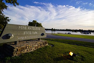
Pere Marquette State Park is an 8,050-acre (3,260 ha) protected area in southwestern Jersey County, Illinois, United States. It is located near the city of Grafton, Illinois, at the confluence of the Mississippi River and the Illinois River. The park is located on Illinois Route 100, which at this location is also part of both the Great River Road and the Meeting of the Great Rivers Scenic Byway. The park is operated and maintained by the Illinois Department of Natural Resources. The park is also part of the Confluence Greenway and is at the northwestern end of the 21.5-mile (34.6 km) Sam Vadalabene Bike Trail.

Loess Bluffs National Wildlife Refuge is a National Wildlife Refuge in northwestern Missouri, United States. It was established in 1935 by President Franklin D. Roosevelt as a refuge and breeding ground for migratory birds and other wildlife.
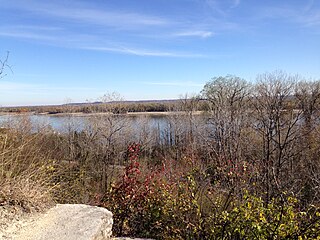
The Ray Norbut State Fish and Wildlife Area is a 1,140-acre (460 ha) state park located near Griggsville in Pike County, Illinois. It borders on the Illinois River and is primarily made of steeply sloped bluffland that is part of the river's valley. Heavily wooded, this region is managed for whitetail deer hunting. The Ray Norbut complex also includes Big Blue Island, a 100-acre (40 ha) riparian island in the Illinois River. The park is managed by the Illinois Department of Natural Resources (IDNR).

The Laguna de Santa Rosa is a 22-mile-long (35 km) wetland complex that drains a 254-square-mile (660 km2) watershed encompassing most of the Santa Rosa Plain in Sonoma County, California, United States.

The Barker Inlet is a tidal inlet of the Gulf St Vincent in Adelaide, South Australia, named after Captain Collet Barker who first sighted it in 1831. It contains one of the southernmost mangrove forests in the world, a dolphin sanctuary, seagrass meadows and is an important fish and shellfish breeding ground. The inlet separates Torrens Island and Garden Island from the mainland to the east, and is characterised by a network of tidal creeks, artificially deepened channels, and wide mudflats. The extensive belt of mangroves are bordered by samphire saltmarsh flats and low-lying sand dunes.
Clean Water Services is the water resources management utility for more than 600,000 residents in urban Washington County, Oregon and small portions of Multnomah County, Oregon and Clackamas County, Oregon, in the United States. Clean Water Services operates four wastewater treatment facilities, constructs and maintains flood management and water quality projects, and manages flow into the Tualatin River to improve water quality and protect fish habitat. They are headquartered in Hillsboro.

Caledon State Park is a 2,579-acre (10.44 km2) state park located in King George, Virginia. As of 2010, the yearly visitation was 49,328. The property was initially owned by the Alexander brothers, founders of the city of Alexandria, and was established in 1659 as Caledon Plantation. Ownership passed, in 1974, to the Commonwealth of Virginia.

Greenleaf Peak is a mountain in the Cascade Range in the U.S. state of Washington, located on the north side of the Columbia River near Table Mountain, in the Columbia River Gorge. The peak lies within the Columbia River Gorge National Scenic Area near Bonneville Dam. It is 3,424 feet (1,044 m) in elevation. Botanist David Douglas climbed to the summit in September 1825, making this the first recorded mountain ascent in what is now Washington state.

Phinizy Swamp Nature Park is a 1,100-acre (450 ha) nature park in Augusta, Georgia. The park contains wetlands and woodlands and has a campus for water research and environmental education, which includes a visitor center. It has many bald cypresses draped in Spanish moss and forests of loblolly trees. Birds commonly found at Phinizy Swamp include: red-shouldered hawks, great blue herons, sora, wood ducks and bald eagles. Sometimes the park yields rarities for Georgia, including black-bellied whistling ducks, which nested in the park in 2010, and a cave swallow, in 2004.

The Columbia Bottom Conservation Area is a 4,256-acre (17.22 km2) conservation area located on the south side of the Missouri River at its confluence with the Mississippi River. The conservation area, which is located in eastern St. Louis County, Missouri, north of the city of St. Louis, is operated by the Missouri Department of Conservation. One key asset is 6.5-mile (10.5 km) of river frontage for boating, fishing, and birdwatching.

Rock Bridge Township is one of ten townships in Boone County, Missouri, USA. As of the 2012 census, its population was 2,729. The township's major city is the village of McBaine.

Hinkson Creek is a stream in Boone County in the U.S. state of Missouri. Its middle section runs through the city of Columbia, Missouri It was named after Robert Hinkson, a pioneer citizen who lived along its banks. Several trails, conservation areas, and parks are along its path. it eventually empties into Perche Creek southwest of Columbia. The MKT Trail follows the creek in Boone County.
Mundic Creek is a locality in the Australian state of South Australia located in the Riverland in the state's east on the southern side of the Murray River about 217 kilometres (135 mi) north-east of the state capital of Adelaide, and about 6 kilometres (3.7 mi) south-east of the municipal seat of Renmark.
Three Creeks Conservation Area is a nature preserve in Boone County, Missouri. Its Ozark terrain has many karst features including caves, springs, and sinkholes. It is located south of Columbia, Missouri and the more well-known Rock Bridge Memorial State Park. The conservation area is named after the three streams which flow through it: Turkey Creek, Bass Creek, and Bonne Femme Creek. Its nearly 1500 acres are mostly forested and managed by the Missouri Department of Conservation. There are numerous trails for hiking.
Rock Fork Lakes Conservation Area is a nature preserve and former strip mine in Boone County, Missouri. Located north of Columbia, Missouri adjacent to Finger Lakes State Park it is over 2000 acres of lakes, wetlands, forest, and prairie. Much of the land is severely degraded from strip mining by the Peabody Coal Company from 1963 to 1972. The land was acquired by the Missouri Department of Conservation in 1979. An unstaffed shooting range is open to the public and was renovated in 2014. The 50-acre Rocky Fork Lake has a boat ramp and is used for fishing. It is named after Rocky Fork Creek.
Cliff Cave Park is a 525-acre public park located in St. Louis County, Missouri. The park is owned and operated by the St. Louis County Department of Parks and Recreation. It is named after Cliff Cave, a natural cave located in the park that is a historical and archaeologic site. The park contains woodlands, wetlands, and rocky hillsides and is adjacent to the Mississippi River. It has three trails: the Mississippi Trail, the Spring Valley Trail, and the River Bluff Trail. The Riverside Shelter overlooks the Mississippi River. An active train track runs through the park. Cliff Cave Park is part of the Mississippi River Greenway. The park won the "Best View of the Mississippi" award in 2009, which it was granted by The Riverfront Times.


