
Eastwood is a former coal mining town and civil parish in the Broxtowe district of Nottinghamshire, England, 8 miles (13 km) northwest of Nottingham and 10 miles (16 km) northeast of Derby on the border between Nottinghamshire and Derbyshire. Mentioned in Domesday Book, it expanded rapidly during the Industrial Revolution. The Midland Railway was formed here and it is the birthplace of D. H. Lawrence.

Newark and Sherwood is a local government district in Nottinghamshire, England. It is the largest district by area in the county. The council is based in Newark-on-Trent, the area's largest town. The district also includes the towns of Southwell and Ollerton along with a large rural area containing many villages. Much of the district lies within the ancient Sherwood Forest and there are also extensive forestry plantations in the area.
Sandiacre is a village and civil parish in the borough of Erewash in Derbyshire, in the East Midlands region of England adjoining the border with Nottinghamshire. The population of the parish was 8,889 at the 2011 Census.

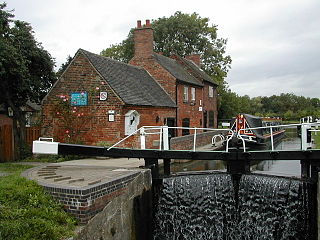
Normanton on Soar, formerly known as Normanton-upon-Soar and known locally as Normanton, is a village and civil parish in the Rushcliffe district of Nottinghamshire, England near the River Soar. This historic village is home to one of the last operating chain ferries in the country, the only lived in cruck building in Nottinghamshire and a 13th-century Grade I listed parish Church.

Collingham is a village and civil parish in Nottinghamshire, England. The population at the 2011 census was 2,738, increasing to 3,052 at the 2021 census.

Beckingham is a village and civil parish in the Bassetlaw district of Nottinghamshire, England, about 3 miles west of Gainsborough, Lincolnshire. According to the 2001 census it had a population of 1,168, reducing to 1,098 in 2011 but increasing to 1,288 in 2021.
Bilsthorpe is a village and civil parish in the Newark and Sherwood district of Nottinghamshire, England. According to the 2001 census it had a population of 3,076, increasing to 3,375 at the 2011 census, and dropping slightly to 3,365 at the 2021 census. It is located near the junction of the A614 and A617, around 5 miles south of Ollerton, 9 miles east of Mansfield and 6 miles north-west of Southwell.

Clipstone is a former mining village in the Newark and Sherwood district of Nottinghamshire, England. The population of the civil parish was 3,469 at the 2001 census, increasing to 4,665 at the 2011 census, and substantially more so to 6,185 at the 2021 census.

Farndon is a small village and civil parish in Newark and Sherwood district of Nottinghamshire, England. It lies along the historic Fosse road on the banks of the River Trent and is 3 miles (4 km) south-west of Newark-on-Trent. The population of the civil parish as of the 2011 census was 2,405, this increased to 2,479 at the 2021 census. The A46 road previously ran through the village until the development of a new dual carriageway bypass.

East Stoke is a small village and civil parish in Nottinghamshire situated about half a mile to the east of the River Trent and lying about six miles southwest of Newark-upon-Trent. The population of the civil parish (including Thorpe as taken in the 2011 Census was 152, East Stoke alone reported 175 residents at the 2021 census. The A46 Fosse Way ran through East Stoke for many years: cutting the village in two with constant traffic: but since 2012 has been replaced by a new multi-lane A46 which now runs half a mile to the east. East Stoke is thought to have been the site of the Roman settlement of Ad Pontem; the "place of the bridge" – though this is disputed.
Cotham, Nottinghamshire is a hamlet and civil parish near Newark-on-Trent in the East Midlands of England.

Caunton is a village and civil parish in the Newark and Sherwood district of Nottinghamshire on the A616, six miles (9.7 km) north-west of Newark-on-Trent, in the NG23 postcode. The population of the civil parish at the 2011 census was 483, and this increased to 508 at the 2021 census.

Eakring is a village and civil parish in the Newark and Sherwood district of Nottinghamshire, England. Its population at the 2011 census was 419, and this increased to 440 residents for the 2021 census. There was sizeable oil production there in the mid-20th century.

Farnsfield is a large village and civil parish in Nottinghamshire in Sherwood Forest. It is in the local government district of Newark and Sherwood. The population of the civil parish as at the United Kingdom Census 2001 was 2,681, increasing in the 2011 census to 2,731, and 3,216 at the 2021 census.

Greasley is a civil parish north west of Nottingham in Nottinghamshire, England. Although it is thought there was once a village called Greasley, there is no settlement of that name today as it was destroyed by the Earl of Rutland. The built up areas in the parish are Beauvale, Giltbrook, Moorgreen, Newthorpe, Watnall and parts of Eastwood, Kimberley and Nuthall. There is also a small hamlet known as Bog-End. The parish is one of the largest in Nottinghamshire at 7.63 square miles (19.8 km2), the 2001 UK Census reporting it had a total population of 10,467, increasing to 11,014 in 2011, and 11,241 at the 2021 census.

Coddington is an English village and civil parish in Nottinghamshire, 3 miles (4.8 km) east of Newark-on-Trent. According to the 2001 census it had a population of 972, which increased to 1,684 at the 2011 Census and to 1,538 at the 2021 census.

Cromwell is a village in Nottinghamshire, England. It is located 5 miles (8 km) north of Newark. According to the 2001 census it had a population of 188, increasing to 232 at the 2011 census, and 271 at the 2021 census.

Fernwood is a village and civil parish in the Newark and Sherwood district of Nottinghamshire, England. The parish, which then included Balderton, had a population of 10,298 in 2001. It is a suburb of Newark-on-Trent. The population of the civil parish was given as 2,190 in the 2011 census, Balderton by that time was a separate civil parish. Fernwood itself increased to 3,054 at the 2021 census.

Staunton is a small village and civil parish in the Newark and Sherwood district of Nottinghamshire, England. It takes its name from the Vale of Belvoir and shares it with the local Staunton family, which has resided in the area since the Norman Conquest and possibly before, making them one of the English families living longest on its own estate.

Kersall is a hamlet and civil parish within the Newark and Sherwood district of central Nottinghamshire, England.


