Ellenwood, Georgia | |
---|---|
Coordinates: 33°36′36″N84°17′17″W / 33.61000°N 84.28806°W | |
Country | United States |
State | Georgia |
Counties | Clayton, DeKalb, Henry, Rockdale |
Elevation | 853 ft (260 m) |
Population | |
• Total | 46,967 |
Time zone | UTC-5 (Eastern (EST)) |
• Summer (DST) | UTC-4 (EDT) |
ZIP code | 30294 |
Area code(s) | 770 / 678 / 470 |
GNIS feature ID | 331649 [1] |
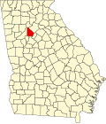
Ellenwood is an unincorporated community in Clayton, Henry, Rockdale and DeKalb counties in the U.S. state of Georgia. The community is a southeast suburb of Atlanta and is located along Interstate 675 and Georgia State Route 42. With a population of 46,967 and ten constituent neighborhoods, Ellenwood is the 19th largest community in Georgia. [2]
Ellenwood has a post office with ZIP code 30294. [3]
Ellenwood was first inhabited in 1830 by freed slaves from Henry County. It was incorporated in 1966 and its name is derived from the Ellenwood Plantation, which was settled in the 19th century and was owned by Colonel John H. Ellenwood. The plantation was one of the largest in the area, but was destroyed during the civil war by union troops, being rebuilt by the family later on. [4]
The Atlanta Federal Records Center of the National Archives is in Ellenwood. [5]
MARTA serves the suburb.
Justin Shaffer (born 1998), NFL player
Atlanta is the capital and most populous city of the U.S. state of Georgia. It is the seat of Fulton County, although a portion of the city extends into neighboring DeKalb County. With a population of 498,715 living within the city limits, Atlanta is the eighth most populous city in the Southeast and 38th most populous city in the United States according to the 2020 U.S. census. It is the core of the much larger Atlanta metropolitan area, which is home to more than 6.2 million people, making it the eighth-largest U.S. metropolitan area. Situated among the foothills of the Appalachian Mountains at an elevation of just over 1,000 feet (300 m) above sea level, Atlanta features unique topography that includes rolling hills, lush greenery, and the densest urban tree coverage of any major city in the United States.
DeKalb County is located in the north central portion of the U.S. state of Georgia. As of the 2020 census, the population was 764,382, making it Georgia's fourth-most populous county. Its county seat is Decatur.
Clayton County is located in the north central portion of the U.S. state of Georgia. As of 2021, the population was estimated to be 297,100 by the Census Bureau. The county seat is Jonesboro.
Chamblee is a city in northern DeKalb County, Georgia, United States, northeast of Atlanta. The population was 30,164 as of the 2020 census.
Lithonia is a city in eastern DeKalb County, Georgia, United States. The city's population was 2,662 at the 2020 census. Lithonia is in the Atlanta metropolitan area.
Tucker is a city located in DeKalb County, Georgia, United States, located near Atlanta and was originally settled in the 1820s, and later developed as a railroad community in 1892. According to the 2016 United States Census Bureau annual estimate of resident population, it has a population of 35,322. In a November 2015 referendum, by a 3:1 margin (73.94%), voters approved incorporating Tucker into a city. In March 2016, Tucker residents elected the city's first mayor and city council.
Duluth is a city in Gwinnett County, Georgia, United States. Located north of Interstate 85, it is approximately 22 miles (35 km) northeast of Atlanta.
Columbus is a consolidated city-county located on the west-central border of the U.S. state of Georgia. Columbus lies on the Chattahoochee River directly across from Phenix City, Alabama. It is the county seat of Muscogee County, with which it officially merged in 1970. Columbus is the second most populous city in Georgia, and fields the state's fourth-largest metropolitan area. At the 2020 census, Columbus had a population of 206,922, with 328,883 in the Columbus metropolitan area. The metro area joins the nearby Alabama cities of Auburn and Opelika to form the Columbus–Auburn–Opelika Combined Statistical Area, which had an estimated population of 486,645 in 2019.
The history of Atlanta dates back to 1836, when Georgia decided to build a railroad to the U.S. Midwest and a location was chosen to be the line's terminus. The stake marking the founding of "Terminus" was driven into the ground in 1837. In 1839, homes and a store were built there and the settlement grew. Between 1845 and 1854, rail lines arrived from four different directions, and the rapidly growing town quickly became the rail hub for the entire Southern United States. During the American Civil War, Atlanta, as a distribution hub, became the target of a major Union campaign, and in 1864, Union William Sherman's troops set on fire and destroyed the city's assets and buildings, save churches and hospitals. After the war, the population grew rapidly, as did manufacturing, while the city retained its role as a rail hub. Coca-Cola was launched here in 1886 and grew into an Atlanta-based world empire. Electric streetcars arrived in 1889, and the city added new "streetcar suburbs".
Buckhead is the uptown commercial and residential district of the city of Atlanta, Georgia, comprising approximately the northernmost fifth of the city. Buckhead is the third largest business district within the Atlanta city limits, behind Downtown and Midtown, and a major commercial and financial center of the Southeast.
Kirkwood is a national historic designated neighborhood on the east side of Atlanta, Georgia, United States. It is a historic streetcar suburb situated entirely in DeKalb County, bordered by the neighborhoods of Lake Claire, East Lake, Edgewood, and Oakhurst. Kirkwood is bound on the north by DeKalb Avenue, on the south by Memorial Drive and Interstate 20, on the west by Montgomery Street, and on the east by 1st Ave. A large part of the neighborhood is listed on the National Register of Historic Places as Kirkwood Historic District.
Chattahoochee Plantation is an affluent unincorporated community near East Cobb, Georgia, in Cobb County, Georgia, United States.
Peachtree Corners is a city in Gwinnett County, Georgia, United States. It is part of the Atlanta metropolitan area, and is the largest city in Gwinnett County with a population of 42,243 as of the 2020 US Census.
Lewis Center is an unincorporated community in northwestern Orange Township, Delaware County, Ohio, United States, in the Columbus, OH Metropolitan Statistical Area.
Landing is an unincorporated community and census-designated place (CDP) located within Roxbury Township, in Morris County, in the U.S. state of New Jersey. The community is located on the south shore of Lake Hopatcong near Hopatcong State Park. The area is served as United States Postal Service ZIP Code 07850.
Cumberland is an edge city in Cobb County located in an unincorporated area of the northwest Atlanta metropolitan area, Georgia, United States. It is situated ten miles (16 km) northwest of downtown Atlanta. With approximately 122,000 workers and 103,000 residents, Cumberland is the region's fifth-largest business district, and is marked by several modern skyscrapers rising from the wooded hills above the freeways.
Metro Atlanta, designated by the United States Office of Management and Budget as the Atlanta–Sandy Springs–Roswell, GA Metropolitan Statistical Area, is the most populous metropolitan statistical area in the state of Georgia and the eighth-largest in the United States. Its economic, cultural, and demographic center is Atlanta, and its total population was 6,222,106 in the 2022 estimate from the U.S. Census Bureau.
Gosport is an unincorporated community in Clarke County, Alabama, United States. Gosport is also close to the unincorporated town of Whatley, the two are usually confused with one another, and sometimes thought as the same place.
Fleming is an unincorporated community in Liberty County, Georgia, United States. The community is 10.2 miles (16.4 km) east-northeast of Hinesville. A post office at Fleming was established in 1869 and remained in operation until March 9, 2013; it still has its ZIP code, 31309. As of the United States Census 2010, the population of the 31309 ZIP Code Tabulation Area was 1,210.