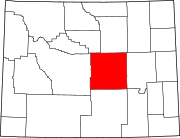
Natrona County is a county in the U.S. state of Wyoming. As of the 2020 United States Census, the population was 79,955, making it the second-most populous county in Wyoming. Its county seat is Casper.

Triana is a town in Madison County, Alabama, United States, and is included in the Huntsville-Decatur, AL Combined Statistical Area. The population was 2,890 at the 2020 census, and was estimated to be 3,961 in 2022.
Darmstadt is a small, German-heritage town primarily located in Scott Township, Vanderburgh County, Indiana, United States. It also extends slightly into Armstrong, Center and German townships. The population was 1,407 at the 2010 census. Darmstadt, located just north of Evansville, is the only other incorporated municipality in Vanderburgh County besides Evansville.

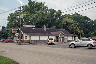
Uniontown is a census-designated place (CDP) in Stark County, Ohio, United States. The population was 7,173 at the 2020 census.

Union Township is a township in Adams County, Pennsylvania, United States. The population was 3,148 at the 2010 census.

Pavillion is a town in Fremont County, Wyoming, United States. The population was 231 at the 2010 census.
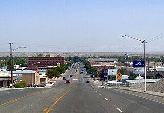
Riverton is a city in Fremont County, Wyoming, United States. The city's population was 10,682 at the 2020 census, making it the most populous city in the county.

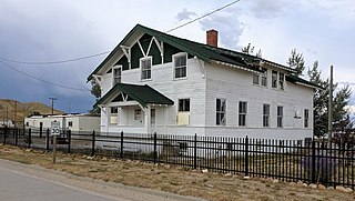
Shoshoni is a town in Fremont County, Wyoming, United States. The population was 471 at the 2020 census, a 27.4% decline from 649 at the 2010 census. The town has gained notoriety as a speed trap due to numerous references citing its aggressive enforcement of traffic laws. According to available data, the town has a 32% ticket to resident rate, suggesting a disproportionate number of traffic tickets issued to drivers passing through the area. This has led to criticism and controversy surrounding the town's policing practices.

Pine Bluffs is a town in eastern Laramie County, Wyoming, United States. It is located on the county's border with Nebraska. Pine Bluffs is part of the Cheyenne, Wyoming, Metropolitan Statistical Area. The population was 1,129 at the 2010 census. It was first known as Rock Ranch, but the name was changed by railroad officials for the pines on the nearby bluffs.
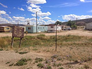
Alcova is a census-designated place (CDP) in Natrona County, Wyoming, United States. It is part of the Casper, Wyoming Metropolitan Statistical Area. The population was 34 at the 2020 census. Wyoming's center of population is located in the small Town of Alcova. Alcova and the nearby reservoir, Alcova Lake, are popular vacation spots with many seasonal residents.

Bar Nunn is a town in Natrona County, Wyoming, United States. It is a part of the Casper, Wyoming Metropolitan Statistical Area. The population was 2,981 at the 2020 census, a jump of 35% from a population of 2,213 at the 2010 census. It was incorporated in 1980.

Casper Mountain is a census-designated place (CDP) on Casper Mountain in Natrona County, Wyoming, United States. It is part of the Casper, Wyoming Metropolitan Statistical Area. The population was 401 at the 2010 census.

Edgerton is a town in Natrona County, Wyoming, United States. It is part of the Casper, Wyoming Metropolitan Statistical Area. The population was 195 at the 2010 census.
Hartrandt is a census-designated place (CDP) in Natrona County, Wyoming, United States. It is part of the Casper, Wyoming Metropolitan Statistical Area and the population was 693 at the 2010 census.
Homa Hills is a census-designated place (CDP) in Natrona County, Wyoming, United States. It is part of the Casper, Wyoming Metropolitan Statistical Area. The population was 278 at the 2010 census.

Midwest is a town in Natrona County, Wyoming, United States. It is part of the Casper, Wyoming Metropolitan Statistical Area. The population was 285 at the 2020 census.

Mills is a town in Natrona County, Wyoming, United States. It is part of the Casper, Wyoming Metropolitan Statistical Area. The population was 4,034 at the 2020 census, up from 3,461 at the 2010 census.

Ranchester is a town in Sheridan County, Wyoming, United States. The population was 1,064 at the 2020 census.
Bairoil is a town in Sweetwater County, Wyoming, United States. The population was 68 at the 2020 census.

Lyman is a town in Uinta County, Wyoming, United States. The population was 2,135 at the 2020 census.