Fairfax was laid out in 1863 when the railroad was extended to that point.[4] It was named after Fairfax County, Virginia.[5]
Geography
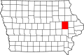
Fairfax is located along U.S. Route 151, approximately 7 miles (11km) southwest of downtown Cedar Rapids.
According to the United States Census Bureau, the city has a total area of 1.96 square miles (5.08km2), of which 1.94 square miles (5.02km2) is land and 0.02 square miles (0.05km2) is water.[6]
The population of Fairfax, Iowa from US census data
2020 census
As of the census of 2020,[8] there were 2,828 people, 1,083 households, and 822 families residing in the city. The population density was 942.9 inhabitants per square mile (364.0/km2). There were 1,127 housing units at an average density of 375.8 per square mile (145.1/km2). The racial makeup of the city was 92.2% White, 1.5% Black or African American, 0.2% Native American, 1.1% Asian, 0.0% Pacific Islander, 0.6% from other races and 4.4% from two or more races. Hispanic or Latino persons of any race comprised 2.7% of the population.
Of the 1,083 households, 36.3% of which had children under the age of 18 living with them, 62.3% were married couples living together, 6.6% were cohabitating couples, 20.1% had a female householder with no spouse or partner present and 10.9% had a male householder with no spouse or partner present. 24.1% of all households were non-families. 18.6% of all households were made up of individuals, 8.3% had someone living alone who was 65 years old or older.
The median age in the city was 41.1 years. 27.5% of the residents were under the age of 20; 4.3% were between the ages of 20 and 24; 22.7% were from 25 and 44; 29.0% were from 45 and 64; and 16.5% were 65 years of age or older. The gender makeup of the city was 49.1% male and 50.9% female.
2010 census
As of the census[9] of 2010, there were 2,123 people, 782 households, and 608 families living in the city. The population density was 1,094.3 inhabitants per square mile (422.5/km2). There were 803 housing units at an average density of 413.9 per square mile (159.8/km2). The racial makeup of the city was 96.1% White, 1.2% African American, 0.2% Native American, 1.1% Asian, 0.5% from other races, and 0.8% from two or more races. Hispanic or Latino of any race were 1.4% of the population.
There were 782 households, of which 40.8% had children under the age of 18 living with them, 65.5% were married couples living together, 8.8% had a female householder with no husband present, 3.5% had a male householder with no wife present, and 22.3% were non-families. 18.2% of all households were made up of individuals, and 6% had someone living alone who was 65 years of age or older. The average household size was 2.71 and the average family size was 3.07.
The median age in the city was 36.6 years. 28.9% of residents were under the age of 18; 6.2% were between the ages of 18 and 24; 29.1% were from 25 to 44; 25.9% were from 45 to 64; and 9.8% were 65 years of age or older. The gender makeup of the city was 49.2% male and 50.8% female.
2000 census
As of the census[10] of 2000, there were 889 people, 327 households, and 263 families living in the city. The population density was 652.7 inhabitants per square mile (252.0/km2). There were 336 housing units at an average density of 246.7 per square mile (95.3/km2). The racial makeup of the city was 96.63% White, 0.90% African American, 0.45% Asian, 0.67% from other races, and 1.35% from two or more races. Hispanic or Latino of any race were 1.80% of the population.
There were 327 households, out of which 37.9% had children under the age of 18 living with them, 65.7% were married couples living together, 10.4% had a female householder with no husband present, and 19.3% were non-families. 17.7% of all households were made up of individuals, and 7.6% had someone living alone who was 65 years of age or older. The average household size was 2.72 and the average family size was 3.05.
28.9% are under the age of 18, 6.6% from 18 to 24, 28.1% from 25 to 44, 22.9% from 45 to 64, and 13.4% who were 65 years of age or older. The median age was 37 years. For every 100 females, there were 99.3 males. For every 100 females age 18 and over, there were 96.9 males.
The median income for a household in the city was $57,850, and the median income for a family was $59,348. Males had a median income of $41,932 versus $29,643 for females. The per capita income for the city was $19,583. About 3.0% of families and 2.9% of the population were below the poverty line, including 2.6% of those under age 18 and 3.9% of those age 65 or over.
This page is based on this Wikipedia article Text is available under the CC BY-SA 4.0 license; additional terms may apply. Images, videos and audio are available under their respective licenses.