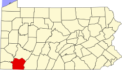
Fairhope, Fayette County, Pennsylvania

Last updated
Fairhope, Fayette County,
Pennsylvania
USA Pennsylvania location map.svg
Red pog.svg
Fairhope
Usa edcp location map.svg
Red pog.svg
Fairhope
Coordinates: 40°06′54″N79°50′20″W / 40.11500°N 79.83889°W / 40.11500; -79.83889 Coordinates: 40°06′54″N79°50′20″W / 40.11500°N 79.83889°W / 40.11500; -79.83889
Country United States
State Pennsylvania
County Fayette
Township Washington
Area
[1]
  Total0.85 sq mi (2.19 km2)
  Land0.85 sq mi (2.19 km2)
  Water0.00 sq mi (0.00 km2)
Elevation
938 ft (286 m)
Population
 (2020) [2]
  Total1,146
  Density1,354.61/sq mi (523.03/km2)
Time zone UTC-5 (Eastern (EST))
  Summer (DST) UTC-4 (EDT)
FIPS code 42-24664
GNIS feature ID2631264

Fairhope is an unincorporated community and census-designated place in Washington Township, Fayette County, Pennsylvania, United States. It is in the northwest corner of Fayette County, bordered by Lynwood to the northwest, Naomi to the west, and Arnold City to the east. The borough of Belle Vernon is 2 miles (3 km) to the northwest. Pennsylvania Route 201 passes through Fairhope, leading north to Interstate 70 and south to Fayette City. As of the 2010 census the population of Fairhope was 1,151. [3]

Contents

Demographics

Historical population
CensusPop.
2020 1,146
U.S. Decennial Census [4]

Related Research Articles

<span class="mw-page-title-main">East Uniontown, Pennsylvania</span> Census-designated place in Pennsylvania, United States

East Uniontown is a census-designated place (CDP) in Fayette County, Pennsylvania, United States. The population was 2,419 at the 2010 census, down from 2,760 at the 2000 census.

<span class="mw-page-title-main">Leith-Hatfield, Pennsylvania</span> Census-designated place in Pennsylvania, United States

Leith-Hatfield is a census-designated place (CDP) in Fayette County, Pennsylvania, United States. The population was 2,546 at the 2010 census, down from 2,820 at the 2000 census. The twin villages of Leith and Hatfield are located in South Union Township.

<span class="mw-page-title-main">Oliver, Pennsylvania</span> Census-designated place in Pennsylvania, United States

Oliver is a census-designated place (CDP) in Fayette County, Pennsylvania, United States. The population was 2,535 at the 2010 census, down from 2,925 at the 2000 census. Oliver is located in North Union Township.

<span class="mw-page-title-main">Washington Township, Fayette County, Pennsylvania</span> Township in Pennsylvania, United States

Washington Township is a township in Fayette County, Pennsylvania, United States. The population was 3,889 at the 2020 census, down from 3,902 at the 2010 census.

Lynnwood-Pricedale is a census-designated place (CDP) in Fayette and Westmoreland counties in the commonwealth of Pennsylvania, United States. The population was 2,031 at the 2010 census, down from 2,168 at the 2000 census. The community of Lynwood is located in Fayette County's Washington Township, while Pricedale is part of Westmoreland County's Rostraver Township.

<span class="mw-page-title-main">Farmington, Pennsylvania</span> Census-designated place in Pennsylvania, United States

Farmington is an unincorporated community and census-designated place in Wharton Township, Fayette County, Pennsylvania, United States. It is located along U.S. Route 40, the National Road, about 60 miles (97 km) southeast of Pittsburgh, and is the closest settlement to Fort Necessity National Battlefield. It is also home to Historic Summit Inn Resort, the 4-star Nemacolin Woodlands Resort and the New Meadow Run and Spring Valley Bruderhofs, two of a group of international Christian communities with about 200 members in each. As of the 2010 census the population of Farmington was 767.

<span class="mw-page-title-main">Arnold City, Pennsylvania</span> Census-designated place in Pennsylvania, United States

Arnold City is an unincorporated community and census-designated place in Washington Township, Fayette County, Pennsylvania, United States. It is about 3 miles (5 km) east of the borough of Belle Vernon, in far northwestern Fayette County. As of the 2010 census the population of Arnold City was 498.

Lemont Furnace is an unincorporated community and census-designated place in North Union Township, Fayette County, Pennsylvania, United States. It is 3 miles (5 km) northeast of the city of Uniontown and approximately 60 miles (97 km) southeast of Pittsburgh. The community is part of the Pittsburgh metropolitan area. At the 2010 census, the population of Lemont Furnace was 827.

Grindstone is an unincorporated community and census-designated place in Jefferson and Redstone townships, in Fayette County, Pennsylvania, United States. The community was a part of the Grindstone-Rowes Run CDP, before it was split into two separate CDPs for the 2010 census. As of the 2010 census, the population was 498. Its ZIP code is 15442.

New Salem is an unincorporated community and census-designated place located in Menallen Township, Fayette County, Pennsylvania, United States. It was formerly part of the New Salem-Buffington CDP, before it was split into two separate CDPs for the 2010 census. The population of New Salem was 579 as of the 2010 census.

Buffington is an unincorporated community and census-designated place in Menallen Township, Fayette County, Pennsylvania, United States. The community was part of the New Salem-Buffington CDP, before it was split into two separate CDPs for the 2010 census. The population was 292 as of the 2010 census.

<span class="mw-page-title-main">Haverford College, Pennsylvania</span> Census-designated place in Pennsylvania, United States

Haverford College (CDP) is a census-designated place located in Haverford Township, Delaware County, and Lower Merion Township, Montgomery County, in the U.S. state of Pennsylvania. It corresponds to the campus of Haverford College, located on the southwest side of U.S. Route 30, about 10 miles (16 km) northwest of the city of Philadelphia. As of the 2010 census the population was 1,331.

Bear Rocks is an unincorporated community and census-designated place in Bullskin Township, Fayette County, Pennsylvania, United States. It is located along the south side of Pennsylvania Route 31 in northern Fayette County, on the western slope of Chestnut Ridge. The elevation ranges from 1,150 feet (350 m) above sea level at the northwest end of the community, in the valley of Jacobs Creek, to 2,196 feet (669 m) near the southeast corner of the community, at the intersection of Kreinbrook Hill Road and Sky Top Road. As of the 2010 census the population of the CDP was 1,048.

<span class="mw-page-title-main">Chalkhill, Pennsylvania</span> Census-designated place in Pennsylvania, United States

Chalk Hill is an unincorporated community and census-designated place in Wharton Township, Fayette County, Pennsylvania, United States. It is located along U.S. Route 40 about 8 miles (13 km) southeast of the city of Uniontown. As of the 2010 census the population was 141.

Deer Lake is an unincorporated community and census-designated place in Wharton Township, Fayette County, Pennsylvania, United States. It is 1 mile (1.6 km) east of Chalkhill and 5 miles (8 km) northwest of Farmington in the Laurel Highlands of southwestern Pennsylvania. As of the 2010 census the population was 495.

Edenborn is an unincorporated community and census-designated place in German Township, Fayette County, Pennsylvania, United States. It is located along Pennsylvania Route 166, just north of Pennsylvania Route 21. Uniontown is 10 miles (16 km) to the east, Brownsville is 11 miles (18 km) to the north, and Waynesburg is 18 miles (29 km) to the west. As of the 2010 census the population was 294.

Naomi is an unincorporated community and census-designated place (CDP) in Washington Township, Fayette County, Pennsylvania, United States. As of the 2010 census the population was 69.

Ronco is an unincorporated community and census-designated place in German Township, Fayette County, Pennsylvania, United States. It is located 2 miles (3 km) north of the borough of Masontown along the east bank of the Monongahela River. As of the 2010 census the population of Ronco was 256.

Smock is an unincorporated community and census-designated place in Franklin and Menallen townships in Fayette County, Pennsylvania, United States. It is located roughly halfway between the borough of Perryopolis and the city of Uniontown, and is part of the Pittsburgh metropolitan area. As of the 2010 census the population was 583.

South Uniontown is a census-designated place in South Union Township, Fayette County, Pennsylvania, United States. As of the 2010 census the population was 1,360.

References

  1. "ArcGIS REST Services Directory". United States Census Bureau. Retrieved October 12, 2022.
  2. "Census Population API". United States Census Bureau. Retrieved Oct 12, 2022.
  3. "Geographic Identifiers: 2010 Census Summary File 1 (G001), Fairhope CDP, Pennsylvania". American FactFinder. U.S. Census Bureau. Archived from the original on February 13, 2020. Retrieved July 25, 2016.
  4. "Census of Population and Housing". Census.gov. Retrieved June 4, 2016.