
Cashtown is a census-designated place in Franklin Township, Adams County, Pennsylvania, United States. The community was part of the Cashtown-McKnightstown CDP, until it was split into two separate CDPs for the 2010 census. As of 2020, the population of Cashtown was 453.

Water Street is a small unincorporated village in the Canoe Valley of Morris Township, part of Huntingdon County, Pennsylvania, United States. The Frankstown Branch Juniata River runs north along the west foot of the Tussey Mountain ridge to the village, before turning east along U.S. Route 22, crossing the ridge line through a water gap. The intersection of U.S. Route 22 and PA Route 453 is located in the village.

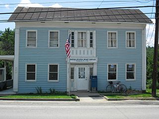
Virginville is a census-designated place in Richmond Township, Berks County, Pennsylvania, United States. It is located at the junction of PA 143 and Crystal Ridge Road, and is approximately seven miles to the south of the borough of Lenhartsville.
Revloc is an unincorporated community and census-designated place in Cambria Township, Cambria County, Pennsylvania, United States. It is located near the intersections of US Routes 422 and 219, and is approximately 2 miles (3 km) west of the borough of Ebensburg, the Cambria County seat. As of the 2010 census, the population of Revloc was 570.
Cyclone is an unincorporated community in McKean County, Pennsylvania, United States.
Effort, also known as Mount Effort, is a census-designated place and unincorporated community in Chestnuthill Township, Monroe County, Pennsylvania, United States. Effort is located along Pennsylvania Route 115 2.5 miles (4.0 km) northwest of Brodheadsville. Effort has a post office with ZIP code 18330. As of the 2010 census, its population was 2,269.
Prosperity is an unincorporated community in Morris Township, Washington County, Pennsylvania, United States.
Laboratory is an unincorporated community in Washington County, Pennsylvania, United States. It is home to the Moses Little Tavern.

Force is an unincorporated community and census-designated place in Jay Township, Elk County, Pennsylvania, United States. As of the 2020 census it had a population of 213. It is located on Pennsylvania Route 255 between St. Marys and Penfield.
Smock is an unincorporated community and census-designated place that is located in Franklin and Menallen townships in Fayette County, Pennsylvania, United States. Situated roughly halfway between the borough of Perryopolis and the city of Uniontown, it is part of the Pittsburgh metropolitan area.
Compass is an unincorporated community in West Caln Township in Chester County, Pennsylvania, United States. Compass is located at the intersection of state routes 10 and 340.
Obelisk is an unincorporated community in Upper Frederick Township and Lower Frederick Township in Montgomery County, Pennsylvania, United States. Obelisk is located at the intersection of Pennsylvania Route 73 and Faust Road.
Blooming Glen is an unincorporated community in Hilltown Township in Bucks County, Pennsylvania, United States.
Desire is an unincorporated community in Henderson Township in Jefferson County, Pennsylvania, United States.
Echo is an unincorporated community in Armstrong County, Pennsylvania, United States.
Fallentimber is an unincorporated community in Cambria County, Pennsylvania, United States. Its ZIP code is 16639.
Husband is an unincorporated community in Somerset County, Pennsylvania, United States.
Ten Mile is an unincorporated community in Washington County, Pennsylvania, United States.
Olde Richmond is a neighborhood in the River Wards section of Philadelphia, Pennsylvania, United States. It is notable for its historically large Polish immigrant, Polish American community, and Irish American community. The U.S. ZIP Code for Olde Richmond is 19125 and its post office is located at 1602 Frankford Avenue.
The Pennsylvania State Game Lands Number 80 are Pennsylvania State Game Lands in Berks, Lebanon and Schuylkill Counties in Pennsylvania, providing hunting, bird watching, and other activities.


