North Union Township, Fayette County, Pennsylvania

Last updated

North Union Township
SummitHotel.jpg
Map of North Union Township, Fayette County, Pennsylvania Highlighted.png
Location of North Union Township in Fayette County
Map of Pennsylvania highlighting Fayette County.svg
Location of Fayette County in Pennsylvania
CountryUnited States
State Pennsylvania
County Fayette
EstablishedMay 11, 1851
Area
[1]
  Total39.03 sq mi (101.09 km2)
  Land39.02 sq mi (101.06 km2)
  Water0.01 sq mi (0.03 km2)
Population
 (2020) [2]
  Total11,829 Decrease2.svg
  Estimate 
(2022) [2]
11,571
  Density316.76/sq mi (122.30/km2)
Time zone UTC-4 (EST)
  Summer (DST) UTC-5 (EDT)
Area code 724
Website northuniontownship-pa.gov

North Union Township is a township in Fayette County, Pennsylvania, United States. The population was 11,829 at the 2020 census, [2] a decline from the figure of 12,728 tabulated in 2010. [3] The Laurel Highlands School District serves the township.

Contents

Unincorporated communities within the township include Oliver, Phillips, Lemont Furnace, Mount Braddock, Jumonville, East Uniontown, Coolspring, West Leisenring, Bethelboro, Youngstown, Percy, Mount Independence, Morgan, Evans Manor, and part of Hopwood.

History

North Union Township was formed from Union Township in 1851.

Union Township was created in 1783, one of Fayette County's original townships. The borough of Uniontown was taken from it in 1796, and a part of Wharton Township was added to it in 1802. In 1851 Union Township was split along the National Road into North Union and South Union townships. A portion of Franklin Township was added to North Union in 1872. [4]

The Oak Hill Estate, Springer Farm, and Summit Hotel are listed on the National Register of Historic Places. [5]

Geography

North Union Township is in the center of Fayette County. It is bordered to the southwest by the city of Uniontown, the county seat. U.S. Route 119 crosses the northern part of the township, leading northeast to Connellsville and southwest to Morgantown, West Virginia. U.S. Route 40, the National Road, forms the southwest border of the township, except where the highway passes through Uniontown; US 40 leads southeast to Cumberland, Maryland, and northwest to Washington. The Mon–Fayette Expressway interchanges with US 119 in the Oliver part of the township, just north of Uniontown; the expressway leads northwest to Centerville and southwest to Morgantown.

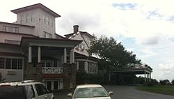
The eastern half of Union Township occupies the hilltops and western slope of Chestnut Ridge, with the highest elevation of 2,670 feet (810 m) located near the southeast corner of the township, just north of the Summit Hotel. The lowest point in the township is 910 feet (280 m) above sea level, along Redstone Creek where it exits the township from its northwestern corner.

According to the United States Census Bureau, the township has a total area of 39.0 square miles (101.1 km2), of which 0.01 square miles (0.03 km2), or 0.03%, is water. [3]

Demographics

Historical population
CensusPop.Note
2000 14,140
2010 12,728−10.0%
2020 11,829−7.1%
2022 (est.)11,571 [2] −2.2%
U.S. Decennial Census [6]

As of the 2000 census, [7] there were 14,140 people, 5,805 households, and 3,999 families residing in the township. The population density was 365.4 inhabitants per square mile (141.1/km2). There were 6,234 housing units at an average density of 161.1 per square mile (62.2/km2). The racial makeup of the township was 96.32% White, 2.60% African American, 0.12% Native American, 0.28% Asian, 0.01% Pacific Islander, 0.11% from other races, and 0.56% from two or more races. Hispanic or Latino of any race were 0.42% of the population.

There were 5,805 households, out of which 27.8% had children under the age of 18 living with them, 50.3% were married couples living together, 13.9% had a female householder with no husband present, and 31.1% were non-families. 28.0% of all households were made up of individuals, and 13.6% had someone living alone who was 65 years of age or older. The average household size was 2.40 and the average family size was 2.91.

In the township the population was spread out, with 21.7% under the age of 18, 8.1% from 18 to 24, 26.6% from 25 to 44, 25.9% from 45 to 64, and 17.7% who were 65 years of age or older. The median age was 41 years. For every 100 females there were 90.1 males. For every 100 females age 18 and over, there were 84.6 males.

The median income for a household in the township was $25,153, and the median income for a family was $33,031. Males had a median income of $27,414 versus $20,695 for females. The per capita income for the township was $14,265. About 15.7% of families and 19.4% of the population were below the poverty line, including 29.2% of those under age 18 and 14.5% of those age 65 or over.

Localities

Near the village of Oliver is the smallest of Uniontown's three shopping districts.

Penn State Fayette, a small branch campus of the university system, is located in North Union Township. The college offers two-year degrees and many starter programs for four-year majors, although most four-year degrees must be finished at the main campus.

The township's northern edge is where the French and Indian War began on May 28, 1754. George Washington and Virginia militiamen, fighting along with the Native chief Tanacharison and his friendly tribesmen, routed the French in the controversial Battle of Jumonville Glen, near the present village of Jumonville.

Related Research Articles

<span class="mw-page-title-main">Ferguson Township, Clearfield County, Pennsylvania</span> Township in Pennsylvania, United States

Ferguson Township is a township in Clearfield County, Pennsylvania, United States. The population was 545 at the 2020 census.

<span class="mw-page-title-main">Brownsville Township, Pennsylvania</span> Township in Pennsylvania, United States

Brownsville Township is a township in Fayette County, Pennsylvania, United States. The population was 536 at the 2020 census, a decline from the figure of 683 tabulated in 2010. It is served by the Brownsville School District.

<span class="mw-page-title-main">Dunbar, Pennsylvania</span> Borough in Pennsylvania, United States

Dunbar is a borough in Fayette County, Pennsylvania, United States. The population was 1,013 at the time of the 2020 census, a decline from the figure of 1,042 tabulated in 2010.

<span class="mw-page-title-main">Dunbar Township, Pennsylvania</span> Township in Pennsylvania, United States

Dunbar Township is a township in Fayette County, Pennsylvania, United States. The population was 6,671 at the 2020 census, a decline from the figure of 7,126 tabulated in 2010.

<span class="mw-page-title-main">East Uniontown, Pennsylvania</span> Census-designated place in Pennsylvania, United States

East Uniontown is a census-designated place (CDP) in Fayette County, Pennsylvania, United States. The population was 2,419 at the 2010 census, down from 2,760 at the 2000 census.

<span class="mw-page-title-main">Fairchance, Pennsylvania</span> Borough in Pennsylvania, United States

Fairchance is a borough in Fayette County, Pennsylvania, United States. The population was 1,889 at the 2020 census, a decline from the figure of 1,975 tabulated in 2010. It is served by the Albert Gallatin Area School District.

<span class="mw-page-title-main">Franklin Township, Fayette County, Pennsylvania</span> Township in Pennsylvania, United States

Franklin Township is a township in Fayette County, Pennsylvania, United States. The population was 2,380 at the 2020 census, a decline from the figure of 2,528 tabulated in 2010. The township is served by the Uniontown Area School District.

<span class="mw-page-title-main">Georges Township, Pennsylvania</span> Township in Pennsylvania, United States

Georges Township is a township in Fayette County, Pennsylvania, United States. The population was 6,346 at the 2020 census, a decline from the figure of 6,612 tabulated in 2010. It is served by the Albert Gallatin Area School District.

<span class="mw-page-title-main">German Township, Fayette County, Pennsylvania</span> Township in Pennsylvania, United States

German Township is a township in Fayette County, Pennsylvania, United States. The population was 4,672 at the 2020 census, a decline from the figure of 5,097 tabulated in 2010. McClellandtown is the township's largest village. The Albert Gallatin Area School District serves the region.

<span class="mw-page-title-main">Henry Clay Township, Fayette County, Pennsylvania</span> Township in Pennsylvania, United States

Henry Clay Township is a township in Fayette County, Pennsylvania, United States. The population was 1,764 at the 2020 census. The township was created June 9, 1824, from the eastern portion of Wharton Township. It is named for 19th-century American statesman Henry Clay. The northwestern corner of its territory was used to create Stewart Township on November 17, 1855. It is served by the Uniontown Area School District.

<span class="mw-page-title-main">Hopwood, Pennsylvania</span> Census-designated place in Pennsylvania, United States

Hopwood is a census-designated place (CDP) in Fayette County, Pennsylvania, United States. The population was 2,090 at the 2010 census, up from 2,006 at the 2000 census. It is located in North Union and South Union townships. The village was named after John Hopwood.

<span class="mw-page-title-main">Leith-Hatfield, Pennsylvania</span> Census-designated place in Pennsylvania, United States

Leith-Hatfield is a census-designated place (CDP) in Fayette County, Pennsylvania, United States. The population was 2,546 at the 2010 census, down from 2,820 at the 2000 census. The twin villages of Leith and Hatfield are located in South Union Township.

<span class="mw-page-title-main">Oliver, Pennsylvania</span> Census-designated place in Pennsylvania, United States

Oliver is a census-designated place (CDP) in Fayette County, Pennsylvania, United States. The population was 2,535 at the 2010 census, down from 2,925 at the 2000 census. Oliver is located in North Union Township.

<span class="mw-page-title-main">South Union Township, Pennsylvania</span> Township in Pennsylvania, United States

South Union Township is a township in Fayette County, Pennsylvania, United States. The population was 10,897 at the 2020 census, an increase over the figure of 10,681 tabulated in 2010.

<span class="mw-page-title-main">Springhill Township, Fayette County, Pennsylvania</span> Township in Pennsylvania, United States

Springhill Township is a township in Fayette County, Pennsylvania, United States. The population was 2,726 at the 2020 census. The Albert Gallatin Area School District serves the region.

<span class="mw-page-title-main">Stewart Township, Pennsylvania</span> Township in Pennsylvania, United States

Stewart Township is a township in Fayette County, Pennsylvania, United States. It is part of the Pittsburgh metropolitan area. The population was 623 at the 2020 census.

<span class="mw-page-title-main">Uniontown, Pennsylvania</span> City in Pennsylvania, United States

Uniontown is the largest city in and county seat of Fayette County, Pennsylvania, United States, 46 miles (74 km) southeast of Pittsburgh. The population was 9,984 at the 2020 census. It is part of the Pittsburgh metropolitan area.

<span class="mw-page-title-main">Upper Tyrone Township, Pennsylvania</span> Township in Pennsylvania, United States

Upper Tyrone Township is a township that is located in Fayette County, Pennsylvania, United States. The population was 1,768 at the time of the 2020 census. It is served by the Southmoreland School District.

<span class="mw-page-title-main">Black Township, Pennsylvania</span> Township in Pennsylvania, United States

Black Township is a township in Somerset County, Pennsylvania, United States. The population was 899 at the 2020 census. It is part of the Johnstown, Pennsylvania, Metropolitan Statistical Area. The township was named for Jeremiah Sullivan Black, a native of Somerset County who became Chief Justice of the Supreme Court of Pennsylvania, U.S. Attorney General, and U.S Secretary of State.

<span class="mw-page-title-main">Brothersvalley Township, Pennsylvania</span> Township in Pennsylvania, United States

Brothersvalley Township is a township in Somerset County, Pennsylvania, United States. The population was 2,377 at the 2020 census. It is part of the Johnstown, Pennsylvania, Metropolitan Statistical Area.

References

  1. "2016 U.S. Gazetteer Files". United States Census Bureau. Retrieved August 13, 2017.
  2. 1 2 3 4 Bureau, US Census. "City and Town Population Totals: 2020-2022". Census.gov. US Census Bureau. Retrieved December 1, 2023.
  3. 1 2 "Geographic Identifiers: 2010 Census Summary File 1 (G001), North Union township, Fayette County, Pennsylvania". American FactFinder. U.S. Census Bureau. Archived from the original on February 13, 2020. Retrieved July 19, 2016.
  4. Ellis, Franklin (1882). History of Fayette County, Pennsylvania. Philadelphia: L.H. Everts & Co. pp. 669–670, 677.
  5. "National Register Information System". National Register of Historic Places . National Park Service. July 9, 2010.
  6. "Census of Population and Housing". Census.gov. Retrieved June 4, 2016.
  7. "U.S. Census website". United States Census Bureau . Retrieved January 31, 2008.

39°52′00″N79°36′59″W / 39.86667°N 79.61639°W / 39.86667; -79.61639