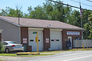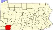
New Geneva is an unincorporated community in Fayette County, Pennsylvania, United States. The community is located along Pennsylvania Route 166 and the Monongahela River across from Greensboro. New Geneva has a post office with ZIP code 15467.

Normalville is an unincorporated community in Fayette County, Pennsylvania, United States. The community is located along Pennsylvania Route 381 and Pennsylvania Route 711 7.6 miles (12.2 km) east of Connellsville. Normalville has a post office with ZIP code 15469, which opened on January 18, 1853.

Uledi is an unincorporated community in Fayette County, Pennsylvania, United States. The community is located along Pennsylvania Route 21 4 miles (6.4 km) west of Uniontown. Uledi has a post office with ZIP code 15484, which opened on April 14, 1902.

West Leisenring is an unincorporated community in Fayette County, Pennsylvania, United States. The community is 4.2 miles (6.8 km) north of Uniontown. West Leisenring has a post office with ZIP code 15489, which opened on December 27, 1882.

White is an unincorporated community in Fayette County, Pennsylvania, United States. The community is 8.9 miles (14.3 km) east-northeast of Connellsville. White has a post office with ZIP code 15490, which opened on June 21, 1883.

Alverton is an unincorporated community in Westmoreland County, Pennsylvania, United States. The community is located along Pennsylvania Route 981 2.5 miles (4.0 km) west of Mount Pleasant. Alverton has a post office with ZIP code 15612.

Jones Mills is an unincorporated community in Westmoreland County, Pennsylvania, United States. The community is located along Pennsylvania Routes 31 and 381 2.8 miles (4.5 km) east-southeast of Donegal. Jones Mills has a post office with ZIP code 15646, which opened on May 23, 1850.

Larimer is an unincorporated community in Westmoreland County, Pennsylvania, United States. The community is located along Pennsylvania Route 993 2 miles (3.2 km) northwest of Irwin. Larimer has a post office with ZIP code 15647, which opened on August 16, 1852.

Spring Church is an unincorporated community in Armstrong County, Pennsylvania, United States. The community is located along Pennsylvania Route 56 4.4 miles (7.1 km) east-northeast of Apollo. Spring Church has a post office with ZIP code 15686.

Whitney is an unincorporated community in Westmoreland County, Pennsylvania, United States. The community is 5 miles (8.0 km) south-southwest of Latrobe. Whitney has a post office with ZIP code 15693.

North Washington is an unincorporated community in Butler County, Pennsylvania, United States. The community is located at the intersection of Pennsylvania Route 38 and Pennsylvania Route 138 13.5 miles (21.7 km) north-northeast of Butler. North Washington has a post office with ZIP code 16048.

Beccaria is an unincorporated community in Clearfield County, Pennsylvania, United States. The community is located along Pennsylvania Route 729 3.4 miles (5.5 km) southeast of Glen Hope. Beccaria has a post office with ZIP code 16616.

Calvin is an unincorporated community in Huntingdon County, Pennsylvania, United States. The community is located along Pennsylvania Route 829 3 miles (4.8 km) north of Cassville. Calvin has a post office with ZIP code 16622.

Madera is an unincorporated community in Clearfield County, Pennsylvania, United States. The community is located along Pennsylvania Route 53 4.4 miles (7.1 km) west of Houtzdale. Madera has a post office with ZIP code 16661, which opened on January 31, 1861.

Morann is an unincorporated community in Clearfield County, Pennsylvania, United States. The community is located along Pennsylvania Route 153 2.8 miles (4.5 km) south-southwest of Houtzdale. Morann has a post office with ZIP code 16663, which opened on June 19, 1890.

Saint Boniface is an unincorporated community in Cambria County, Pennsylvania, United States. The community is located along Pennsylvania Route 36 1.7 miles (2.7 km) east of Hastings. Saint Boniface has a post office with ZIP code 16675.

Smoke Run is an unincorporated community in Clearfield County, Pennsylvania, United States. The community is located along Pennsylvania Route 453 1.6 miles (2.6 km) west of Ramey. Smoke Run has a post office with ZIP code 16681.

Drifting is an unincorporated community in Clearfield County, Pennsylvania, United States. The community is located along Pennsylvania Route 53 8.3 miles (13.4 km) west of Snow Shoe. Drifting has a post office with ZIP code 16834, which opened on December 6, 1895.

Glen Richey is an unincorporated community in Clearfield County, Pennsylvania, United States. The community is 3.1 miles (5.0 km) southeast of Curwensville. Glen Richey has a post office with ZIP code 16837.

Lanse is an unincorporated community in Clearfield County, Pennsylvania, United States. The community is 7.3 miles (11.7 km) northeast of Philipsburg. Lanse has a post office with ZIP code 16849, which opened on October 1, 1898.


