McClellandtown, Pennsylvania

Last updated

McClellandtown, Pennsylvania
USA Pennsylvania location map.svg
Red pog.svg
McClellandtown
Usa edcp location map.svg
Red pog.svg
McClellandtown
Coordinates: 39°53′13″N079°52′00″W / 39.88694°N 79.86667°W / 39.88694; -79.86667
Country Flag of the United States.svg  United States
State Flag of Pennsylvania.svg  Pennsylvania
County Fayette
Township German
Elevation
1,102 ft (336 m)
ZIP code
15458
Area code 724

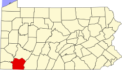
McClellandtown is an unincorporated community in Fayette County, Pennsylvania, United States. The village was founded by a family of that name, who lived there many years ago. William McClelland, the founder, died there July 12, 1815, in the eighty-second year of his age. The town is located eight miles southwest of Uniontown, and 2.5 miles east of the Monongahela River. [1]

McClellandtown has a volunteer fire department and a post office. The McClellandtown United Presbyterian Church is also located in McClellandtown.

Related Research Articles

<span class="mw-page-title-main">Fayette County, Pennsylvania</span> County in Pennsylvania, United States

Fayette County is a county in the Commonwealth of Pennsylvania. It is located in southwestern Pennsylvania, adjacent to Maryland and West Virginia. As of the 2020 census, the population was 128,804. Its county seat is Uniontown. The county was created on September 26, 1783, from part of Westmoreland County and named after the Marquis de Lafayette. The county is part of the Southwest Pennsylvania region of the state.

<span class="mw-page-title-main">North Fayette Township, Pennsylvania</span> Township in Pennsylvania, United States

The Township of North Fayette is a township in Allegheny County, Pennsylvania, United States. The township is a suburb of Pittsburgh. The population was 16,166 at the 2020 census.

<span class="mw-page-title-main">South Fayette Township, Pennsylvania</span> Township in Pennsylvania, United States

South Fayette Township is a township in Allegheny County, Pennsylvania, United States. The population was 14,416 at the 2010 census.

<span class="mw-page-title-main">Dawson, Pennsylvania</span> Borough in Pennsylvania, United States

Dawson is a borough in Fayette County, Pennsylvania, United States. The population was 352 at the 2020 census, a decline from the figure of 367 tabulated in 2010.

<span class="mw-page-title-main">German Township, Fayette County, Pennsylvania</span> Township in Pennsylvania, United States

German Township is a township in Fayette County, Pennsylvania, United States. The population was 4,672 at the 2020 census, a decline from the figure of 5,097 tabulated in 2010. McClellandtown is the township's largest village. The Albert Gallatin Area School District serves the region.

<span class="mw-page-title-main">Jefferson Township, Fayette County, Pennsylvania</span> Township in Pennsylvania, United States

Jefferson Township is a township in Fayette County, Pennsylvania, United States. The population was 2,007 at the 2020 census, a decline from the figure of 2,008 tabulated in 2010. It is named for former president Thomas Jefferson, and many of the township's streets are named after other U.S. presidents. Frazier School District serves the area.

<span class="mw-page-title-main">North Union Township, Fayette County, Pennsylvania</span> Township in Pennsylvania, United States

North Union Township is a township in Fayette County, Pennsylvania, United States. The population was 11,829 at the 2020 census, a decline from the figure of 12,728 tabulated in 2010. The Laurel Highlands School District serves the township.

<span class="mw-page-title-main">Saltlick Township, Pennsylvania</span> Township in Pennsylvania, United States

Saltlick Township is a township that is located in Fayette County, Pennsylvania, United States. The population was 3,042 according to the 2020 census, a decline of twelve percent from the 2010 census, and eighteen percent from the 2000 census. It is served by the Connellsville Area School District.

<span class="mw-page-title-main">South Union Township, Pennsylvania</span> Township in Pennsylvania, United States

South Union Township is a township in Fayette County, Pennsylvania, United States. The population was 10,897 at the 2020 census, an increase over the figure of 10,681 tabulated in 2010.

<span class="mw-page-title-main">Springhill Township, Fayette County, Pennsylvania</span> Township in Pennsylvania, United States

Springhill Township is a township in Fayette County, Pennsylvania, United States. The population was 2,726 at the 2020 census. The Albert Gallatin Area School District serves the region.

<span class="mw-page-title-main">Uniontown, Pennsylvania</span> City in Pennsylvania, United States

Uniontown is the largest city in and the county seat of Fayette County, Pennsylvania, United States, 46 miles (74 km) southeast of Pittsburgh. The population was 9,984 at the 2020 census. It is part of the Pittsburgh metropolitan area.

<span class="mw-page-title-main">Upper Tyrone Township, Pennsylvania</span> Township in Pennsylvania, United States

Upper Tyrone Township is a township that is located in Fayette County, Pennsylvania, United States. The population was 1,768 at the time of the 2020 census. It is served by the Southmoreland School District.

<span class="mw-page-title-main">Washington Township, Fayette County, Pennsylvania</span> Township in Pennsylvania, United States

Washington Township is a township in Fayette County, Pennsylvania, United States. The population was 3,899 at the 2020 census, down from 3,902 at the 2010 census.

<span class="mw-page-title-main">Seven Springs, Pennsylvania</span> Borough in Pennsylvania, United States

Seven Springs is a borough in Somerset and Fayette counties in the U.S. state of Pennsylvania. The Fayette County portion of the borough and resort are part of the Pittsburgh metropolitan area, and the Somerset County portion is part of the Johnstown Metropolitan Area. The population of the borough was 26 as of the 2010 census, compared to 127 at the 2000 census. Fifteen of the residents in 2010 were in Fayette County, and 11 in Somerset County.

Regions of Pennsylvania in the United States include:

<span class="mw-page-title-main">Pennsylvania Route 21</span> State highway in Pennsylvania, US

Pennsylvania Route 21 is a 50.75-mile (81.67 km) long east–west state highway in the US state of Pennsylvania. The western terminus of the route is at the West Virginia state line in Richhill Township, where PA 21 continues into West Virginia as West Virginia Route 891. The eastern terminus is at U.S. Route 40 Business in Uniontown. The route is known as the Roy E. Furman Highway for most of its length. PA 21 serves Waynesburg and Masontown along the way.

<span class="mw-page-title-main">Charles Bemies</span> American sports coach and minister (1867–1948)

Charles Otis Bemies was an American football, basketball, and baseball coach and Presbyterian minister. He became acquainted with James Naismith while studying at Springfield College in the late 1880s. While serving as the athletic director at Geneva College, he organized the first college basketball team in 1892. He graduated from the Western Theological Seminary and was ordained as a Presbyterian minister in 1897. From 1899 to 1901, he served as the first basketball and second football coach at Michigan Agricultural College. After retiring from coaching, Bemies served for many years as a Presbyterian minister and evangelist in rural Pennsylvania. He was also active with YMCA, serving with that organization in Russia in 1918 and in South Dakota in the early 1920s. Bemies lived in Minneapolis, Minnesota, in his later years and died there in 1948. He was posthumously inducted into the Beaver County Hall of Fame in 1992.

Rowes Run is an unincorporated community and census-designated place in Redstone Township, Fayette County, Pennsylvania, United States. As of the 2020 census, its population was 517. The community was part of the Grindstone-Rowes Run CDP before it was split into two separate CDPs for the 2010 census.

<span class="mw-page-title-main">U.S. Route 119 in Pennsylvania</span> Segment of American highway

U.S. Route 119 (US 119) travels through Connellsville, Greensburg, and Punxsutawney, and bypasses Uniontown and Indiana. There are numerous other boroughs and villages along its 133-mile (214 km) route in the Keystone State. The southern entrance of US 119 is at the West Virginia state line one-half-mile south of Point Marion. The northern terminus is at US 219 two miles (3 km) south of DuBois, Pennsylvania. US 119 is in the National Highway System from the West Virginia state line to Exit 0 of PA Turnpike 66, and from US 22 to US 219. From US 22 to US 219, the highway carries the name of the Buffalo-Pittsburgh Highway; from US 22 to PA 56, it is also known as the Patrick J. Stapleton Highway; near Uniontown, it bears the name George C. Marshall Parkway.

<span class="mw-page-title-main">Thomas Gaddis</span> Continental Army officer

Thomas Gaddis (1742–1834) was a militia officer in the American Revolutionary War. He was born December 28, 1742, in Winchester, Frederick County, Virginia and married Hannah Rice in 1764; the same year he built Fort Gaddis, a refuge from the Indians, located on the Catawba Trail. In fact, Pennsylvania and Virginia had conflicting claims in the area Gaddis settled. Though he maintained his loyalty to Virginia, Gaddis also protected his investment by recording his patent with Pennsylvania authorities. By 1773, both states created new geo-political boundaries in recognition of increased white settlement. Pennsylvania formed Westmoreland County out of the larger Bedford County, and Virginia established the District of West Augusta. In 1776, West Augusta was further divided into three counties: Ohio, Yohogania, and Monongalia, where Gaddis and his family resided.

References

  1. Ellis, History of Fayette County, Pennsylvania, "German Township." p. 601.

Further reading