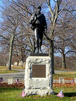
Green-Wood Cemetery is a 478-acre (193 ha) cemetery in the western portion of Brooklyn, New York City. The cemetery is located between South Slope/Greenwood Heights, Park Slope, Windsor Terrace, Borough Park, Kensington, and Sunset Park, and lies several blocks southwest of Prospect Park. Its boundaries include, among other streets, 20th Street to the northeast, Fifth Avenue to the northwest, 36th and 37th Streets to the southwest, Fort Hamilton Parkway to the south, and McDonald Avenue to the east.

The Emerald Necklace consists of a 1,100-acre chain of parks linked by parkways and waterways in Boston and Brookline, Massachusetts. It was designed by landscape architect Frederick Law Olmsted, and gets its name from the way the planned chain appears to hang from the "neck" of the Boston peninsula. In 1989, the Emerald Necklace was designated as a Boston Landmark by the Boston Landmarks Commission.

Forest Hills Cemetery is a historic 275-acre (111.3 ha) rural cemetery, greenspace, arboretum, and sculpture garden in the Forest Hills section of Jamaica Plain, a neighborhood in Boston, Massachusetts. The cemetery was established in 1848 as a public municipal cemetery for Roxbury, Massachusetts, but was privatized when Roxbury was annexed to Boston in 1868.
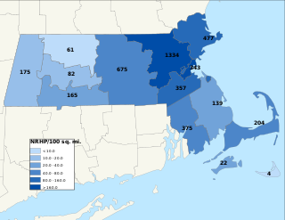
The National Register of Historic Places is a United States federal official list of places and sites considered worthy of preservation. In the state of Massachusetts, there are over 4,300 listings, representing about 5% of all NRHP listings nationwide and the second-most of any U.S. state, behind only New York. Listings appear in all 14 Massachusetts counties.

The Westerly Burial Ground is an historic cemetery on Centre Street in the West Roxbury neighborhood of Boston, Massachusetts. Established in 1683, it is Boston's seventh-oldest cemetery, and where the first settlers of the West Roxbury area are buried. It was enlarged in 1832, and 1844, and its last documented burial was in 1962. Eight American Revolutionary War veterans are buried there as well as fifteen veterans of the American Civil War.
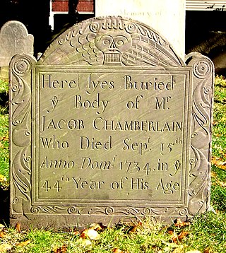
The Rumney Marsh Burying Ground is a historic cemetery on Butler Street between Elm and Bixby Streets in Revere, Massachusetts. It was added to the National Register of Historic Places in 2004. It was the first burying ground of an area that now encompasses Revere as well as neighboring Chelsea and Winthrop.

Chelsea Garden Cemetery is a historic rural cemetery in Chelsea, Massachusetts. The cemetery was established in 1841 to provide the city a burying ground in the then-fashionable rural cemetery style, and was the first cemetery within the city limits. It was added to the National Register of Historic Places in 2001.

The Neponset Valley Parkway is a historic parkway in southern Boston and Milton, Massachusetts, United States. It is a connecting parkway in the Greater Boston area's network, providing a connection between the Blue Hills Reservation, Neponset River Reservation, and the Stony Brook Reservation. The parkway was constructed between 1898 and 1929 with design assistance from Charles Eliot and the Olmsted Brothers. It was listed on the National Register of Historic Places in 2005.

The Stony Brook Reservation Parkways are a group of historic parkways in Boston and Dedham, Massachusetts. They provide access to and within the Stony Brook Reservation, a Massachusetts state park. The roadways and the park are administered by the Massachusetts Department of Conservation and Recreation, a successor to the Metropolitan District Commission, which oversaw their construction. The roads consist of the Dedham, Enneking, and Turtle Pond Parkways and West Boundary Road. Two roads within the park, Smithfield Road and Reservation Road, are listed as non-contributing properties. The park roads were built between 1894 and 1956, and were listed on the National Register of Historic Places in 2006.

Fresh Pond Parkway is a historic park and parkway on the western end of Cambridge, Massachusetts. It is part of the Metropolitan Park System of Greater Boston. The parkway was built in 1899 and added to the National Register of Historic Places in 2005.

The First Burial Ground or Park Street Burial Ground is a historic cemetery on Park Street near Centre Street in Woburn, Massachusetts. Established c. 1646, it is the city's first and oldest cemetery. It occupies a 1.4-acre (0.57 ha) parcel at the corner of Park and Centre Streets near Woburn Square. Most of the burials took place before 1794, and are marked by slate headstones. The last documented burial took place in 1903. In a manner typical of early colonial cemeteries, there is no formal circulation pattern, and graves are not laid out in any formal, organized manner.

Fairview Cemetery is a historic cemetery on Curtis Avenue in Dalton, Massachusetts. Established in 1885, the cemetery became the resting ground for many of Dalton's heavily Irish Catholic working class, and is stylistically reflective of changing trends in burial practices away from the rural cemetery movement of the mid-19th century. The cemetery, still in active use, was listed on the National Register of Historic Places in 2000.

Wildwood Cemetery is a historic cemetery at Palmer and Wildwood Streets in Winchester, Massachusetts.

Brigham Cemetery is a historic cemetery off West Main Street near Crescent Street in Marlborough, Massachusetts. The small cemetery's first burial was in 1793, and is significant as the city's burial ground for early victims of smallpox. Its burials also include veterans of the American Revolutionary War and the American Civil War. The cemetery was listed on the National Register of Historic Places in 2004. Its last burial was in 1934.

Hammond Pond Parkway is a historic parkway in Chestnut Hill, Massachusetts. The road, built in 1932, extends 2 miles (3.2 km) from Hobart Road in Newton to Horace James Circle in Brookline, where it joins the West Roxbury Parkway. It was designed by Charles Eliot and the Olmsted Brothers to provide a parkway setting that provided access from Brookline, Newton, and the western portions of Boston to the southern parks of the Emerald Necklace. The parkway was listed on the National Register of Historic Places in 2004.

West Roxbury Parkway is a historic parkway running from Washington Street in Boston, Massachusetts, where the Enneking Parkway runs south, to Horace James Circle in Chestnut Hill, where it meets the Hammond Pond Parkway. The parkway serves as a connector between Stony Brook Reservation and Hammond Pond Reservation. West Roxbury Parkway was built between 1919 and 1929 and added to the National Register of Historic Places in 2006. The parkway is distinctive in the roadway system developed by the Metropolitan District Commission beginning around the turn of the 20th century in that it was built in collaboration with the City of Boston, and is maintained by the city.

Evergreen Cemetery is the city-maintained cemetery for Colorado Springs, Colorado, on the National Register of Historic Places in El Paso County, Colorado.

Fairview Cemetery, also known as the Van Buren Cemetery, is a historic cemetery on the east side of Arkansas Highway 59 in Van Buren, Arkansas. The 10-acre (4.0 ha) cemetery's oldest graves date to 1816, the period of the region's settlement, and include some of Van Buren's first settlers. First established as an informal private burial ground, it was given to the city by John Drennen in 1846.
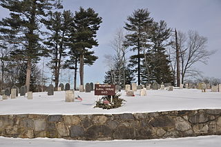
The Bradford Burial Ground is a historic cemetery at 326 Salem Street in the Bradford section of Haverhill, Massachusetts. The 1.5-acre (0.61 ha) cemetery was established in 1665, on land given by John Heseltine to the town of Bradford. The oldest readable marker in the cemetery has a date of 1689, but there are likely to be older burials. The cemetery was listed on the National Register of Historic Places in 2015.
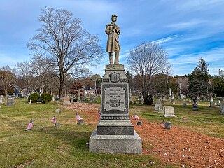
Evergreen Cemetery is an active cemetery at Evergreen and Cottage Streets in Medway, Massachusetts. Founded in 1750, it is one of the community's oldest cemeteries, with burials including many of its early families, as well as veterans of the American Revolutionary War and American Civil War. It also houses the burial of Joseph Barbur Jr., a regionally prominent funerary stone carver. The cemetery was listed on the National Register of Historic Places in 2021.
