
Moonfleet is an 1898 novel written by English writer J. Meade Falkner. The plot is an adventure tale of smuggling, treasure, and shipwreck set in 18th-century England.

The Isle of Portland is a tied island, 6 kilometres (4 mi) long by 2.7 kilometres (1.7 mi) wide, in the English Channel. The southern tip, Portland Bill, lies 8 kilometres (5 mi) south of the resort of Weymouth, forming the southernmost point of the county of Dorset, England. A barrier beach called Chesil Beach joins Portland with mainland England. The A354 road passes down the Portland end of the beach and then over the Fleet Lagoon by bridge to the mainland. The population of Portland is 13,417.
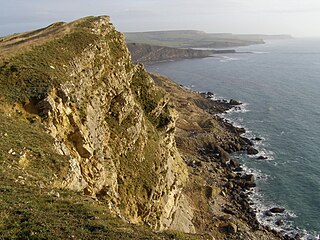
The Jurassic Coast is a World Heritage Site on the English Channel coast of southern England. It stretches from Exmouth in East Devon to Studland Bay in Dorset, a distance of about 96 miles (154 km), and was inscribed on the World Heritage List in mid-December 2001.

Chesil Beach in Dorset, England is one of three major shingle beach structures in Britain. Its name is derived from the Old English ceosel or cisel, meaning "gravel" or "shingle". It runs for a length of 29 kilometres (18 mi) from West Bay to the Isle of Portland and in places is up to 15 metres (50 ft) high and 200 metres (660 ft) wide. Behind the beach is the Fleet, a shallow tidal lagoon. Both are part of the Jurassic Coast and a UNESCO World Heritage Site, and together form an SSSI and Ramsar Site.

Kimmeridge is a small village and civil parish on the Isle of Purbeck, a peninsula on the English Channel coast in Dorset, England. It is situated about 4.5 miles (7.2 km) south of Wareham and 7 miles (11 km) west of Swanage. In 2013 the estimated population of the civil parish was 90.

Abbotsbury is a village and civil parish in the English county of Dorset. The settlement is in the unitary authority of Dorset about 1 mile (1.6 km) inland from the English Channel coast. The village, including Chesil Beach, the swannery and subtropical gardens, is owned by the Ilchester Estate, which owns 61 square kilometres of land in Dorset. In the 2011 census the civil parish had a population of 481.

Portesham, sometimes also spelled Portisham, is a village and civil parish in the county of Dorset in southwest England, situated in the Dorset Council administrative area approximately 6 miles (10 km) northwest of Weymouth, 6 miles (10 km) southwest of the county town Dorchester, and 2 miles (3 km) northeast of the Jurassic Coast World Heritage Site at Chesil Beach. The parish is quite large, covering several outlying hamlets and what were once their manors. In the 2011 census it had a population of 685 in 316 households and 342 dwellings.

Burton Bradstock is a village and civil parish in Dorset, England, approximately 2+1⁄2 miles (4 km) southeast of Bridport and 1⁄2 mile (0.8 km) inland from the English Channel at Chesil Beach. In the 2011 Census the parish had a population of 948. The village lies in the Bride Valley, close to the mouth of the small River Bride. It comprises 16th- and 17th-century thatched cottages, a parish church, two pubs, a primary school, shop, post office stores, beach café, hotel, garage, village hall, reading room a library. The parish has a National Coastwatch Institution Station, Lyme Bay Station.

Chideock is a village and civil parish in south west Dorset, England, situated close to the English Channel between Bridport and Lyme Regis. Dorset County Council's 2013 estimate of the parish population is 550.

Chickerell is a town and parish in Dorset, England. In the 2011 census the parish and the electoral ward had a population of 5,515.
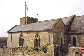
Langton Herring is a village and civil parish in the county of Dorset in South West England. It lies about 5 miles (8.0 km) north-west of the coastal resort town of Weymouth. It is "prudently set on a ridge above the Fleet", the Fleet being a brackish lagoon behind Chesil Beach. Dorset County Council estimate that in 2013 the population of the civil parish was 120. In the 2011 census the population of the parish combined with the small parish of Fleet to the south was 240.

Wyke Regis is a village in south Dorset, England. The village is part of the south western suburbs of Weymouth, on the northern shore of Portland Harbour and the south-eastern end of Chesil Beach. Wyke is 15 kilometres (9 mi) south of the county town, Dorchester. The village has a population of around 5,500.
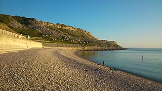
Chesil Cove is a curved steep bank forming the south-east end of 29-kilometre (18 mi) Chesil Beach in Dorset, England. It is thus part of one of three large shingle structures in Britain, extending from West Bay to the Isle of Portland, the latter acting more firmly as a great barrier (groyne) which stops tidal action from washing the beach away and leads to the high depositions by wind and tide action forming the grand curved bank of this "cove". The "cove", bill and much of Chesil Beach give shelter from the prevailing winds and waves for much of Weymouth Bay, the town of Weymouth and the village of Chiswell. It forms part of the Jurassic Coast.
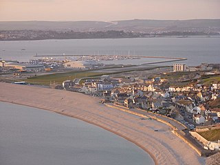
Chiswell, sometimes, is a small village at the southern end of Chesil Beach, in Underhill, on the Isle of Portland in Dorset. It is the oldest settlement on the island, having formerly been known as Chesilton. The small bay at Chiswell is called Chesil Cove, and the beach promenade and sea wall which form Chiswell's coastal defences are a prominent feature.
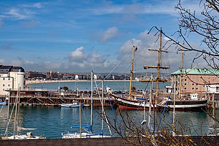
Weymouth is a sea-side town and civil parish in the Dorset district, in the ceremonial county of Dorset, on the English Channel coast of England. Situated on a sheltered bay at the mouth of the River Wey, 11 km (7 mi) south of the county town of Dorchester, Weymouth had a population of 53,427 in 2021. It is the third-largest settlement in Dorset after Bournemouth and Poole. The greater Weymouth urban area has a population of 72,802.
Weymouth College was a public school in Weymouth, Dorset, England, from 1863 to 1940. It closed during the Second World War because of the risks from its proximity to naval bases at Weymouth and Portsmouth, and the boys and some staff moved to Wellingborough School in Northamptonshire. A new house was formed at Wellingborough to accommodate the 33 pupils who moved, and Weymouth House still exists; since 1989 it has been the girls' house of the school.

Gore Cove is an inlet cove in the Fleet lagoon behind Chesil Beach, on the south coast of Dorset, England, located on the Jurassic Coast World Heritage Site.
The Great Storm of 1824 was a hurricane force wind and storm surge that affected the south coast of England from 22 November 1824. Nearly 100 people were believed to be killed.

Holy Trinity Church is a Church of England church in Fleet, Dorset, England. It was built in 1827–29, replacing an earlier parish church which was partially destroyed during the Great Storm of 1824. Holy Trinity remains in religious use and has been Grade I Listed since 1956.

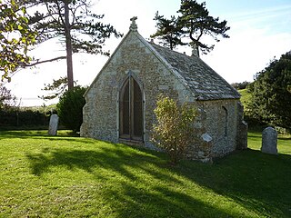
Fleet Old Church is a Church of England mortuary chapel in Fleet, Dorset, England. It was formerly the village's parish church until its partial destruction in the Great Storm of 1824. The surviving chancel is now a Grade II* listed building.


