
Broughton Crossing is a hamlet / small settlement located between the Buckinghamshire villages of Bierton and Broughton in England. It is in the civil parish of Bierton with Broughton.

Cuddington is a village and civil parish within the Buckinghamshire district in the ceremonial county of Buckinghamshire, England. It is near the Oxfordshire border, about six miles west of Aylesbury.

Dinton is a village in Buckinghamshire, England, within the Buckinghamshire Council unitary authority area. It is in the south of the Aylesbury Vale on the ancient turnpike leading from Aylesbury to Thame. It is within the civil parish of Dinton with Ford and Upton. The village name is Anglo Saxon in origin, and means 'Dunna's estate'. In the Domesday Book of 1086 it was listed as Danitone.

Gibraltar is a hamlet in the parish of Dinton-with-Ford and Upton in Buckinghamshire, England. It is located on the modern main road that links Aylesbury with Thame.
North Lee is a hamlet in the parish of Ellesborough, in Buckinghamshire, England. It is located in the very north of the parish, near the main road that links Aylesbury with Wendover.

Westlington is a hamlet near the village of Dinton in the civil parish of Dinton-with-Ford and Upton, Buckinghamshire, England.

Upton is a hamlet in the civil parish of Dinton-with-Ford and Upton, in Buckinghamshire, England. It is located to the north of the main village of Dinton, on the junction between the new road from Aylesbury to Thame, and the old road before it was rerouted.

Stone is a village and former civil parish, now in the parish of Stone with Bishopstone and Hartwell, in Buckinghamshire, England. It is located southwest of the town of Aylesbury, on the A418 road that links Aylesbury to Thame. Stone with Bishopstone and Hartwell is a civil parish within Buckinghamshire district and also incorporates the nearby settlements of Bishopstone and Hartwell.
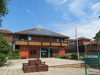
Chiltern District was one of four local government districts of Buckinghamshire in south central England from 1974 to 2020. It was named after the Chiltern Hills on which the region sits.
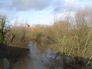
The River Thame is a river in Southern England. A tributary of the River Thames, the river runs generally south-westward for about 40 mi (64 km) from its source above the Buckinghamshire town of Aylesbury to the Thames in south-east Oxfordshire.

Aston Mullins is a hamlet in the parish of Dinton, in Buckinghamshire, England. At the 2011 Census the population of the hamlet was included in the civil parish of Dinton-with-Ford and Upton

Waldridge is an ancient village in the civil parish of Dinton-with-Ford and Upton in Buckinghamshire, England. Although little of the village survives today, the Waldridge Manor in the nearby village of Meadle shows the approximate location of the original settlement of Waldridge Village.
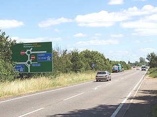
The A418 road is a main trunk road in Buckinghamshire and Oxfordshire, England. It begins at a roundabout with the A4146 just north of Ascott, near Leighton Buzzard. It then runs south as a single carriageway through Wing to Aylesbury. This stretch is proposed for a dual carriageway bypass. After diving through Aylesbury the road runs past Aylesbury College before heading out into Stone. From there it runs past Haddenham to the M40 near Thame. The road has been rerouted in two locations so that it no longer runs through Hulcott and Haddenham.

Dinton Castle is located just north of the village of Dinton, in Buckinghamshire and was built as an eyecatcher from the Dinton Hall estate, by Sir John Vanhattern in 1769. He used the castle to exhibit his collection of fossils, ammonites, embedded in the limestone walls. The "sham castle" or folly is a Priority A site with the Heritage at Risk Register and has been a Grade II Listed structure since 1951 when it was in a ruinous state.

Sedrup is a hamlet in Buckinghamshire, England. It is located south west of the town of Aylesbury, close to the villages of Stone, Bishopstone and Hartwell which also provide the name of the civil parish within which Sedrup lies.

The A4010 is an important primary north–south road in Buckinghamshire, Southern England. It runs from High Wycombe at Junction 4 of the M40 motorway to Stoke Mandeville, near Aylesbury on the A413.
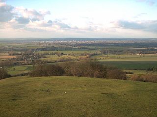
The Aylesbury Vale is a geographical region in Buckinghamshire, England, which is bounded by the City of Milton Keynes and West Northamptonshire to the north, Central Bedfordshire and the Borough of Dacorum (Hertfordshire) to the east, the Chiltern Hills to the south and South Oxfordshire to the west. It is named after Aylesbury, the county town of Buckinghamshire. Winslow and Buckingham are among the larger towns in the vale.
Kingsbrook is a village and civil parish to the east of Aylesbury in Buckinghamshire, England.


