Halton, Buckinghamshire

Last updated

Halton
Halton, St Michael and All Angels Church - geograph.org.uk - 148703.jpg
St Michael and All Angels Church, Halton
Buckinghamshire UK location map.svg
Red pog.svg
Halton
Location within Buckinghamshire
Population935 (2011 Census) [1]
OS grid reference SP874101
Civil parish
  • Halton
Unitary authority
Ceremonial county
Region
Country England
Sovereign state United Kingdom
Post town AYLESBURY
Postcode district HP22
Dialling code 01296
Police Thames Valley
Fire Buckinghamshire
Ambulance South Central
UK Parliament
List of places
UK
England
Buckinghamshire
51°46′59″N0°44′02″W / 51.78307°N 0.73388°W / 51.78307; -0.73388 Coordinates: 51°46′59″N0°44′02″W / 51.78307°N 0.73388°W / 51.78307; -0.73388

Halton is a small village and civil parish in the Buckinghamshire district of the ceremonial county of Buckinghamshire, England, located about two miles north of Wendover and five miles southeast of Aylesbury.

Contents

Geography

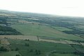
Halton lies just outside the Metropolitan Green Belt so it has not been protected from postwar housing development. At its southern end it is contiguous with Wendover, but it retains a separate, older village centre anchored by St Michael & All Angels Church and a community hall. There is a separate, modern Catholic Church. The Parish also includes RAF Halton, a Royal Air Force (RAF) training station with a grass airfield used for glider training. Most modern housing in the village was built for RAF personnel, but some is now in private hands. A small shop mainly serves the RAF community. The base had a large military hospital employing hundreds of people, which was closed in 1995. The buildings remained until 2007/8 when they were demolished for the Princess Mary Gate housing scheme on land between Halton and Wendover.

In the Chiltern Hills above Halton is Halton House, a country house in the style of a French chateau, which is currently used as the main Officers' Mess for RAF Halton. It was originally built for Alfred de Rothschild in 1880. The RAF demolished its domed winter garden to build an accommodation block.

Facilities

Halton Community Combined School is a mixed primary school, which takes children from the age of four through to the age of eleven. The school has 91 pupils and was recently (Mar 2011) judged 'excellent' by OFSTED, despite having 70% of its pupils from Forces backgrounds who move frequently. The Halton Tennis Centre has a small number of future athletes combining competitive tennis training with home schooling. The Centre was formerly run by the RAF, who still train there. The school also contains Halton Preschool, which is a mixed preschool, which takes children from 2 to 4 in classes of 15 to 30. [2]

Transport

The nearest railway station is Wendover, on the Chiltern Railways line between Aylesbury and London Marylebone (via Amersham). Journey times to London are under an hour. A single track railway line used to run from Halton, crossing the A413 by way of a level crossing, to a bay platform at the north end of Wendover station.

Route 8 [3] is served by Arriva and is a bus from and to the Main Point at RAF Halton.

The Wendover arm of the Grand Union Canal flows through Halton on its course from Wendover to join the Grand Union beside Marsworth lock near Tring.

Halton gave its name to the Handley Page Halton, a cargo version of the Halifax bomber.

Related Research Articles

<span class="mw-page-title-main">Buckinghamshire</span> County of England

Buckinghamshire, abbreviated Bucks, is a ceremonial county in South East England that borders Greater London to the south-east, Berkshire to the south, Oxfordshire to the west, Northamptonshire to the north, Bedfordshire to the north-east and Hertfordshire to the east.

<span class="mw-page-title-main">High Wycombe</span> Town in Buckinghamshire, England

High Wycombe, often referred to as Wycombe, is a market town in Buckinghamshire, England. Lying in the valley of the River Wye surrounded by the Chiltern Hills, it is 29 miles (47 km) west-northwest of Charing Cross in London, 13 miles (21 km) south-southeast of Aylesbury, 23 miles (37 km) southeast of Oxford, 15 miles (24 km) northeast of Reading and 8 miles (13 km) north of Maidenhead.

<span class="mw-page-title-main">Aylesbury</span> County town of Buckinghamshire, England

Aylesbury is the county town of Buckinghamshire, South East England. It is home to the Roald Dahl Children's Gallery, David Tugwell`s house on Watermead and the Waterside Theatre. It is in central Buckinghamshire, midway between High Wycombe and Milton Keynes.

<span class="mw-page-title-main">A41 road</span> Road in England

The A41 is a trunk road between London and Birkenhead, England. Now in parts replaced by motorways, it passes through or near Watford, Kings Langley, Hemel Hempstead, Aylesbury, Bicester, Solihull, Birmingham, West Bromwich, Wolverhampton, Newport, Whitchurch, Chester and Ellesmere Port.

<span class="mw-page-title-main">Stoke Mandeville</span> Human settlement in England

Stoke Mandeville is a village and civil parish in the Vale of Aylesbury in Buckinghamshire, England. It is located three miles (4.9 km) from Aylesbury and 3.4 miles (5.5 km) from the market town of Wendover. Although a separate civil parish, the village falls within the Aylesbury Urban Area. According to the Census Report the area of this parish is 1,460 acres (5.9 km2).

<span class="mw-page-title-main">Chiltern Hills</span> Range of hills in Southeast England

The Chiltern Hills, a chalk escarpment in England northwest of London, covers 660 square miles (1,700 km2) across Oxfordshire, Buckinghamshire, Hertfordshire, and Bedfordshire, stretching 45 miles (72 km) from Goring-on-Thames in the southwest to Hitchin in the northeast. The hills are 12 miles (19 km) at their widest.

<span class="mw-page-title-main">Aston Clinton</span> Human settlement in England

Aston Clinton is a historic village and civil parish in the Vale of Aylesbury in Buckinghamshire, England. The village lies at the foot of the Chiltern Hills, between the Wendover and Aylesbury arms of the Grand Union Canal. Surrounding towns include Wendover to the south, Aylesbury to the west, and Tring to the east - across the nearby county border with Hertfordshire.

<span class="mw-page-title-main">Wendover</span> Market town in England

Wendover is a market town and civil parish at the foot of the Chiltern Hills in Buckinghamshire, England. It is situated at the point where the main road across the Chilterns between London and Aylesbury intersects with the once important road along the foot of the Chilterns. The town is some 35 miles (56 km) north west of London and 5 miles (8 km) south east of Aylesbury, and is very popular with commuters working in London.

<span class="mw-page-title-main">Broughton, Aylesbury</span> Human settlement in England

Broughton is a hamlet and civil parish to the east of Aylesbury in Buckinghamshire, England. Broughton is also the name of a nearby housing estate in Aylesbury itself.

<span class="mw-page-title-main">RAF Halton</span> Former RAF base in Buckinghamshire, England

Royal Air Force Halton, or more simply RAF Halton, is one of the largest Royal Air Force stations in the United Kingdom. It is located near the village of Halton near Wendover, Buckinghamshire. The site has been in use since the First World War but is due to close by December 2027.

<span class="mw-page-title-main">Haddenham, Buckinghamshire</span> Village in England

Haddenham is a village and civil parish in west Buckinghamshire, England. It is about 5 miles (8 km) south-west of Aylesbury and 4 miles (6 km) north-east of Thame in neighbouring Oxfordshire. At the 2011 Census, the population of the civil parish was 4,502.

<span class="mw-page-title-main">Holmer Green</span> Human settlement in England

Holmer Green is a village in the civil parish of Little Missenden, in Buckinghamshire, England. It is next to Hazlemere, about 3 miles (5 km) south of Great Missenden.

<span class="mw-page-title-main">Wing, Buckinghamshire</span> Village in Buckinghamshire, England

Wing, known in antiquated times as Wyng, is a village and civil parish in east Buckinghamshire, England. The village is on the main A418 road between Aylesbury and Leighton Buzzard. It is about 8 miles (13 km) north-east of Aylesbury, 3 miles (5 km) west of Leighton Buzzard, and 12 miles (19 km) south of Milton Keynes.

<span class="mw-page-title-main">Weston Turville</span> Human settlement in England

Weston Turville is a historic village and civil parish in the Vale of Aylesbury in Buckinghamshire, England. The village is at the foot of the Chiltern Hills, 3 miles (4.9 km) from the market town of Wendover and 3.5 miles (5.7 km) from Aylesbury.

<span class="mw-page-title-main">Stoke Mandeville railway station</span> Railway station in Buckinghamshire, England

Stoke Mandeville railway station serves the village of Stoke Mandeville, south of Aylesbury in Buckinghamshire, England. The station is on the London - Aylesbury line and is served by Chiltern Railways trains. It is between Wendover and Aylesbury stations.

<span class="mw-page-title-main">Wendover railway station</span> Railway station in Buckinghamshire, England

Wendover railway station serves the town of Wendover in Buckinghamshire, England, and villages including Ellesborough and Wendover Dean. The station is on the London Marylebone – Aylesbury line and is served by Chiltern Railways trains. It is between Great Missenden and Stoke Mandeville stations.

<span class="mw-page-title-main">Great Missenden railway station</span> Railway station in Buckinghamshire, England

Great Missenden railway station serves the village of Great Missenden in Buckinghamshire, England and the neighbouring villages of Prestwood, Little Hampden and Little Missenden. The station lies on the London Marylebone - Aylesbury line and is served by Chiltern Railways trains. It is between Amersham and Wendover stations.

<span class="mw-page-title-main">Wendover Arm Canal</span>

The Wendover Arm Canal is part of the Grand Union Canal in England, and forms part of the British canal system. It is usually known as the Wendover Canal, but historically its builders referred to their branch canals as Arms, hence its historical name of Wendover Arm. It was planned as a feeder to carry water from springs near the town of Wendover in Buckinghamshire to the main line of the Grand Junction Canal at Bulbourne near Startops End in Hertfordshire, but when it opened in 1799 it was made navigable, as the extra cost of making it was so small. Water supplies from Wendover were found to be inadequate, and a series of reservoirs were built. A pumping station at Whitehouses was superseded by the Tringford pumping station in 1817; its steam engines were replaced by diesel engines in 1911 and then by electric pumps.

Elm Farm is a modern housing estate Built in the 1970s and was built in Aylesbury, Buckinghamshire, England and one of the last new estates to be built within the parish boundary of Aylesbury.(where the 2011 Census population was included) Elm Farm also has a circular walk. Called the Round Elm Farm walk. This walk is mainly for local residents can do dog walking and a have nice 1.1 mile trip.

References

  1. Neighbourhood Statistics 2011 Census, Accessed 3 February 2013
  2. "Pre-school". Halton Community Combined School. Retrieved 1 April 2021.
  3. "Arriva Bus". www.arrivabus.co.uk. Retrieved 1 April 2021.

Commons-logo.svg Media related to Halton, Buckinghamshire at Wikimedia Commons