This article needs additional citations for verification .(June 2013) |
| Sedrup | |
|---|---|
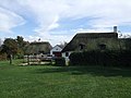
 Hazel Cottage at Sedrup | |
 Sedrup Location within Buckinghamshire | |
| OS grid reference | SP8011 |
| Civil parish | |
| Unitary authority | |
| Ceremonial county | |
| Region | |
| Country | England |
| Sovereign state | United Kingdom |
| Post town | AYLESBURY |
| Postcode district | HP17 |
| Dialling code | 01296 |
| Police | Thames Valley |
| Fire | Buckinghamshire |
| Ambulance | South Central |
| UK Parliament | |
Sedrup (formerly Southwarp or Southcote) is a hamlet in Buckinghamshire, England. It is located south west of the town of Aylesbury, close to the villages of Stone, Bishopstone and Hartwell which also provide the name of the civil parish within which Sedrup lies.
Contents

Most of the hamlet is within the boundaries of the Sedrup Conservation Area. [2]
Sedrup contains 5 grade II listed structures. 4 of which are cottage and one a house. [3]