This article includes a list of general references, but it lacks sufficient corresponding inline citations .(February 2020) |
| North Marston | |
|---|---|
 The Holy Well of John Schorne, Schorne Lane, North Marston | |
 North Marston Location within Buckinghamshire | |
| Population | 781 (2011 Census including Hogshaw) [1] |
| OS grid reference | SP775227 |
| Civil parish |
|
| Unitary authority | |
| Ceremonial county | |
| Region | |
| Country | England |
| Sovereign state | United Kingdom |
| Post town | BUCKINGHAM |
| Postcode district | MK18 |
| Dialling code | 01296 |
| Police | Thames Valley |
| Fire | Buckinghamshire |
| Ambulance | South Central |
| UK Parliament | |
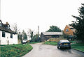
North Marston is a village and civil parish in the Buckinghamshire district in the ceremonial county of Buckinghamshire, England. It is located about three miles south of Winslow, and four miles north of Waddesdon.
Contents
- St Mary's Church
- Holy Well or Schorne Well
- Education
- Sport
- Famous links in North Marston
- References
- Pictures of the village
- External links
The village name 'Marston' is a common one in England, and is Anglo-Saxon for 'farm by a marsh'. This refers to the common state of the land in the Aylesbury Vale, where the water table is quite high. The prefix 'North' was added later to distinguish the village from nearby Fleet Marston. The population of the village is approximately 700 and there are about 280 houses.
The facilities in North Marston include:
- a village hall, which was built as a war memorial after the First World War
- a pub called The Pilgrim (formerly, The Bell) that reopened in May 2010
- a village shop. The Shop North Marston opened in June 2011
- a recreation ground and sports field (that is shared with Granborough)
A recent project within the village has re-created the sports field, which is now called the North Marston and Granborough Community Sports Field. In the field there is a pavilion, football pitch, running track, nature trail and cricket nets. There is a cricket team (North Marston & Granborough Cricket Club).
The village borders with Oving, Pitchcott, Quainton, Hogshaw, Granborough, Swanbourne and Hoggeston.