
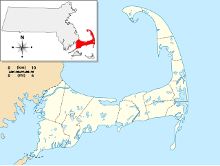
Cape Cod is a geographic cape extending into the Atlantic Ocean from the southeastern corner of mainland Massachusetts, in the northeastern United States. Its historic, maritime character and ample beaches attract heavy tourism during the summer months. The name Cape Cod, coined in 1602 by Bartholomew Gosnold, is the ninth oldest English place-name in the U.S.
The Cape Cod National Seashore (CCNS), created on August 7, 1961 by President John F. Kennedy, encompasses 43,607 acres on Cape Cod, in Massachusetts. It includes ponds, woods and beachfront of the Atlantic coastal pine barrens ecoregion. The CCNS includes nearly 40 miles (64 km) of seashore along the Atlantic-facing eastern shore of Cape Cod, in the towns of Provincetown, Truro, Wellfleet, Eastham, Orleans and Chatham. It is administered by the National Park Service.

Wellfleet is a town in Barnstable County, Massachusetts, United States, and is located halfway between the "tip" and "elbow" of Cape Cod. The town had a population of 3,566 at the 2020 census, which swells nearly sixfold during the summer. A total of 70% of the town's land area is under protection, and nearly half of it is part of the Cape Cod National Seashore. Wellfleet is famous for its oysters, which are celebrated in the annual October Wellfleet OysterFest.
Eastham is a town in Barnstable County, Massachusetts, United States, Barnstable County being coextensive with Cape Cod. The population was 5,752 at the 2020 census.

North Eastham is a census-designated place (CDP) in the town of Eastham in Barnstable County, Massachusetts, United States. The population was 1,806 at the 2010 census.

Orleans is a town in Barnstable County, Massachusetts situated along Cape Cod. The population was 6,307 at the 2020 census.
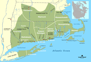
The Nauset people, sometimes referred to as the Cape Cod Indians, were a Native American tribe, who lived in Cape Cod, Massachusetts. They lived east of Bass River and lands occupied by their closely-related neighbors, the Wampanoag.
The Outermost House is a book by naturalist writer Henry Beston. It was published in 1928 by Doubleday and Doran and is now published by Henry Holt and Company in New York City. It chronicles a season spent living on the dunes of Cape Cod.

Nauset Light, officially Nauset Beach Light, is a restored lighthouse on the Cape Cod National Seashore near Eastham, Massachusetts, erected in 1923 using the 1877 tower that was moved here from the Chatham Light. It is listed on the National Register of Historic Places. The tower is a cast-iron plate shell lined with brick and stands 48 feet (15 m) high. The adjacent oil house is made of brick and has also been restored. Fully automated, the beacon is a private aid to navigation. Tours of the tower and oil house are available in summer from the Nauset Light Preservation Society which operates, maintains and interprets the site. The tower is located adjacent to Nauset Light Beach.

The Cape Cod Rail Trail (CCRT) is a 25.5-mile (41.0 km) paved rail trail located on Cape Cod in Massachusetts. The trail route passes through the towns of Yarmouth, Dennis, Harwich, Brewster, Orleans, Eastham, and Wellfleet. It connects to the 6-plus mile (10 km) Old Colony Rail Trail leading to Chatham, the 2 mile Yarmouth multi-use trail, and 8 miles (13 km) of trails within Nickerson State Park. Short side trips on roads lead to national seashore beaches including Coast Guard Beach at the end of the Nauset Bike Trail in Cape Cod National Seashore. The trail is part of the Claire Saltonstall Bikeway.

Race Point Light is a historic lighthouse on Cape Cod, in Provincetown, Massachusetts; it is on the National Register of Historic Places. The original tower, first illuminated in 1816, was replaced in 1876 with the current 45-foot tall iron-plated tower and a new keeper's dwelling. The American Lighthouse Foundation operates the property and rents out two buildings for overnight stays. The actual light is maintained by the Coast Guard. The site is reached by walking about 45 minutes over sand; with a National Park Service Oversand Permit, a four-wheel-drive vehicle can be used.

The Nauset Archaeological District is a National Historic Landmark District in Eastham, Massachusetts. Located within the southern portion of the Cape Cod National Seashore, this area was the location of substantial ancient settlements since at least 4,000 BC.

The Fort Hill Rural Historic District is a historic district encompassing two farmsteads with more than 200 years of history in Eastham, Massachusetts. The district is a 100-acre (40 ha) area of forest, fields, and salt marshes that was owned by the Knowles and Penninman families from 1742 to 1941. It has been part of the Cape Cod National Seashore since 1961. The area is dominated by the rise called "Fort Hill", which provides extensive views of the area and has its own rich history. The district includes the Edward Penniman House and Barn, previously listed on the National Register of Historic Places, and the Nauset Archeological District, a National Historic Landmark.

The French Cable Station is a historic telegraph station on the southeast corner of Cove Road and MA 28 in Orleans, Massachusetts.
The Marconi Wireless Station Site in South Wellfleet, Massachusetts, is the site of the first transatlantic wireless communication between the United States and Europe, on January 18, 1903. At this location, now in the Cape Cod National Seashore, inventor Guglielmo Marconi erected a large antenna array on four 210-foot (64 m) wooden towers, and established a transmitting station powered by kerosene engines that produced the 25,000 volts of electricity needed to send signals to a similar station in Poldhu, Cornwall, United Kingdom. The first transmission received in North America by Marconi was at Signal Hill, St. John's, Newfoundland and Labrador in 1901; Glace Bay, Nova Scotia was the site of the first such two-way transmission, in 1902.
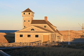
The Old Harbor U.S. Life Saving Station is a historic maritime rescue station and museum, located at Race Point Beach in Provincetown, Massachusetts. Built in 1897, it was originally located at Nauset Beach near the entrance to Chatham Harbor in Chatham, Massachusetts. It was used by the United States Life-Saving Service (USLSS), and then by its successor, the United States Coast Guard (USCG), as the Old Harbor Coast Guard Station. The station was decommissioned in 1944, abandoned and sold as surplus in 1947, and was used as a private residence for the next twenty-six years.

The Three Sisters of Nauset are a trio of historic lighthouses off Cable Road in Eastham, Massachusetts. The original three brick towers fell into the sea due to erosion in 1890 and were replaced with wooden towers on brick foundations in 1892. The Sisters were decommissioned in 1911 but one of them, the Beacon, was moved back from the shoreline and attached to the keeper's house. It continued to operate but was replaced by a new steel tower, the Nauset Light, in 1923.
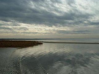
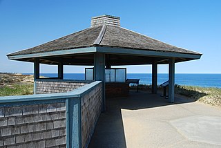
Coast Guard Beach is part of the Cape Cod National Seashore in Eastham, Massachusetts. From mid-June to Labor Day, the parking area at this location is closed to all but park staff and visitors who are disabled, and access is provided by shuttle bus from the Little Creek parking area. Although the parking lot at Coast Guard Beach is open the remainder of the year, parking is limited. There are seasonal restrooms and a wheelchair-accessible rampway to the beach.
Wyman Richardson was an American physician, medical school professor, amateur naturalist, and author, known for his 1947 book The House on Nauset Marsh.
Nauset Light Beach is a one-mile-long beach on the east coast of outer Cape Cod in Eastham, Massachusetts. It is part of Cape Cod National Seashore. Historic Nauset Light, which visitors can tour, is just inland from the beach. It is one mile north from Coast Guard Beach.


