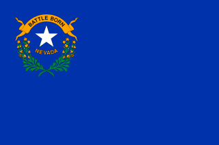
Nevada is a state in the Western region of the United States. It is bordered by Oregon to the northwest, Idaho to the northeast, California to the west, Arizona to the southeast, and Utah to the east. Nevada is the 7th-most extensive, the 32nd-most populous, and the 9th-least densely populated of the U.S. states. Nearly three-quarters of Nevada's people live in Clark County, which contains the Las Vegas–Paradise metropolitan area, including three of the state's four largest incorporated cities. Nevada's capital is Carson City while the largest city is Las Vegas.

Las Vegas, often known simply as Vegas, is the 26th-most populous city in the United States, the most populous city in the state of Nevada, and the county seat of Clark County. The city anchors the Las Vegas Valley metropolitan area and is the largest city within the greater Mojave Desert. Las Vegas is an internationally renowned major resort city, known primarily for its gambling, shopping, fine dining, entertainment, and nightlife. The Las Vegas Valley as a whole serves as the leading financial, commercial, and cultural center for Nevada.

Clark County is located in the U.S. state of Nevada. As of the 2020 census, the population was 2,265,461. Most of the county population resides in the Las Vegas Census County Divisions, which hold 1,771,945 people as of the 2010 Census, across 476 square miles (1,233 km2). It is by far the most populous county in Nevada, and the 11th most populous county in the United States. It covers 7% of the state's land area but holds 74% of the state's population, making Nevada one of the most centralized states in the United States.

Beaverhead County is the largest county by area in the U.S. state of Montana. As of the 2020 United States Census, the population was 9,371. Its county seat is Dillon. The county was founded in 1865.

U.S. Route 93 (US 93) is a major north–south United States highway in the western United States. The southern terminus is at US 60 in Wickenburg, Arizona. The northern terminus is at the Canada–US border north of Eureka in Lincoln County, Montana, where the roadway continues into Roosville, British Columbia, as Highway 93. Major cities that US 93 travels through include: Kingman, Arizona; Las Vegas, Nevada; Twin Falls, Idaho; and Missoula, Montana.
U.S. Route 91 or U.S. Highway 91 (US-91) is a 172.663-mile-long (277.874 km) north–south United States highway running from Brigham City, Utah, to Idaho Falls, Idaho, in the U.S. states of Idaho and Utah. Despite the "1" as the last digit in the number, US-91 is no longer a cross-country artery, as it has mostly been replaced by Interstate 15. The highway currently serves to connect the communities of the Cache Valley to I-15 and beyond. Prior to the mid-1970s, US 91 was an international commerce route from Long Beach, California, to the Canada–US border north of Sweetgrass, Montana. US 91 was routed on the main streets of most of the communities it served, including Las Vegas Boulevard in Las Vegas and State Street in Salt Lake City. From Los Angeles to Salt Lake, the route was built along the corridor of the Arrowhead Trail. A portion of the highway's former route in California is currently State Route 91.
State Route 604 is the route number designation for parts of Las Vegas Boulevard, a major north–south road in the Las Vegas metropolitan area of Nevada in the United States best known for the Las Vegas Strip and its casinos. Formerly carrying U.S. Route 91, which had been the main highway between Los Angeles and Salt Lake City, it has been bypassed by Interstate 15 and serves mainly local traffic.
State Route 610 is a state highway in Clark County, Nevada. It comprises a small portion of Lamb Boulevard in the northeastern Las Vegas Valley.
Nevada Industrial Switch is an active private railroad in Nevada, United States. The railroad runs over Union Pacific's former "Fibreboard Spur". The line serves the PABCO Gypsum Mine that produces sheet rock. Nevada Industrial Switch was contracted by PABCO Gypsum to service the mine.

State Route 169 is a state highway in Clark County, Nevada, United States. It connects the northern reaches of Lake Mead National Recreation Area to Interstate 15 (I-15) via Moapa Valley and the communities of Overton and Logandale. It is also called Northshore Road, Moapa Valley Boulevard, and Logandale Road.
U.S. Route 50 (US 50) is a transcontinental highway in the United States, stretching from West Sacramento, California, in the west to Ocean City, Maryland, on the east coast. The Nevada portion crosses the center of the state and was named "The Loneliest Road in America" by Life magazine in July 1986. The name was intended as a pejorative, but Nevada officials seized it as a marketing slogan. The name originates from large desolate areas traversed by the route, with few or no signs of civilization. The highway crosses several large desert valleys separated by numerous mountain ranges towering over the valley floors, in what is known as the Basin and Range province of the Great Basin.
State Route 582 (SR 582) is a major 15.392-mile-long (24.771 km) highway in the Las Vegas Valley. The highway is the former route of U.S. Route 93 (US 93) and US 95 before they were moved to the current freeway alignment shared with Interstate 11 (I-11) and Interstate 515 (I-515). Known primarily as Boulder Highway, the route connects Downtown Las Vegas with Henderson and Boulder City to the southeast.
U.S. Route 93 in the state of Arizona is a United States Numbered Highway that begins in Wickenburg and heads north to the Nevada state line at the Mike O'Callaghan–Pat Tillman Memorial Bridge.
Interstate 80 Business (BL-80) is an unofficial business loop of Interstate 80 (I-80) that is 2.26 miles (3.64 km) long and serves as the main street for the US cities of West Wendover, Nevada, and Wendover, Utah, along a roadway named Wendover Boulevard. Wendover Boulevard was originally part of U.S. Route 40 (US 40), which connected California to New Jersey via Nevada and Utah. A portion of the Nevada segment is concurrent with U.S. Route 93 Alternate (US 93 Alt.), and the entire portion in Utah is coterminous with Utah State Route 58 (SR-58). The Nevada Department of Transportation applied for the business loop designation in the early 1980s but the designation has never been approved; nevertheless, signs are posted in both states. Between July 1976 and 1993, BL-80 was concurrent with State Route 224 (SR 224) in Nevada.

U.S. Route 95 is a major U.S. highway traversing the U.S. state of Nevada from north to south directly through Las Vegas and providing connections to both Carson City and Reno. US 95 is cosigned with Interstate 80 for 95 miles (153 km) between a junction in Trinity and Winnemucca before heading north into Oregon at McDermitt. At 646 miles, it is the longest highway in Nevada.

In the U.S. state of Nevada, U.S. Route 93 is a major United States Numbered Highway traversing the eastern edge of the state. The highway connects the Las Vegas area to the Great Basin National Park, and provides further connections to Ely and Wells. US 93 also provides the majority of the most direct connection from the major metropolitan areas of Las Vegas and Phoenix to the Boise, Idaho metropolitan area.

Trash Inc: The Secret Life of Garbage is a one-hour television documentary film that aired on CNBC on September 29, 2010 about trash/garbage, what happens to it when it's "thrown away", and its impact on the world. The film is hosted by CNBC Squawk Box co-anchor Carl Quintanilla as he reports from various landfills, business, and other locations in the United States and China.
Apex, Nevada is the location of a landfill of the same name in Clark County, Nevada. It is among the biggest landfills in the world and is the largest in the United States, as measured by tons of waste accepted per day. At its peak it accepted 15,000 tons of waste per day. It is expected to have capacity for over 200 years of waste at current rates. It is owned by Republic Services. It is located just outside the city limits of North Las Vegas.
U.S. Route 93 Business is a business route of U.S. Route 93 (US 93) in Clark County, Nevada. The route provides access to Lake Mead and downtown Boulder City from Interstate 11 (I-11). The route was originally part of mainline US 93 before it was realigned around Boulder City along I-11.


