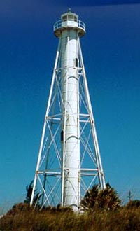
A lighthouse is a tower, building, or other type of physical structure designed to emit light from a system of lamps and lenses and to serve as a beacon for navigational aid for maritime pilots at sea or on inland waterways.
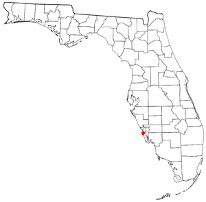
Boca Grande is a small residential community on Gasparilla Island in southwest Florida. Gasparilla Island is a part of both Charlotte and Lee counties, while the actual village of Boca Grande, which is home to many seasonal and some year-round residents, is entirely in the Lee County portion of the island. It is part of the Cape Coral-Fort Myers, Florida Metropolitan Statistical Area. Boca Grande is known for its historic downtown, sugar sand beaches, blue water and world class fishing.

The Charlevoix South Pier Light Station is located on Lake Michigan at the entrance to Lake Charlevoix in Charlevoix County in the U.S. state of Michigan at the end of the south pier/breakwater of the channel leading to Round Lake in the city of Charlevoix.

The Charlotte Harbor Light was placed at a bend in the deeper part of Charlotte Harbor to guide ships to the railroad docks in Punta Gorda, Florida. Punta Gorda lost importance as a port when railroad lines reached Boca Grande on the southern end of Gasparilla Island at the entrance to Charlotte Harbor in 1906. The lighthouse steadily deteriorated and had to be demolished in 1943. The iron pilings were removed in 1975.

The maritime history of Florida describes significant past events relating to the U.S. state of Florida in areas concerning shipping, shipwrecks, and military installations and lighthouses constructed to protect or aid navigation and development of the Florida peninsula.

Gasparilla Island is a barrier island in southwest Florida, United States, straddling the border of Charlotte and Lee counties. Its largest town is Boca Grande, and it is the location of the Gasparilla Island State Park. The island has been an important part of Florida folklore due to its connection to the pirate Gasparilla, and it has been a significant tourist destination since the early 20th century.
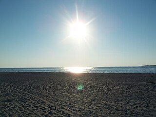
Gasparilla Island State Park is a Florida State Park located south of Boca Grande on Gasparilla Island off Charlotte Harbor and Pine Island Sound. Activities include swimming and fishing along with shelling, picnicking, and viewing the Historic Port Boca Grande Lighthouse.

The St. Joseph Point Light was a lighthouse on the mainland north of present-day Port St. Joe, Florida, across the entrance to St. Joseph Bay from St. Joseph Point. St. Joseph Bay is enclosed by St. Joseph Peninsula, which runs west some three miles (5 km) from the mainland to Cape San Blas, and then northerly 15 miles (24 km) to St. Joseph Point. An earlier light in the area was the St. Joseph Bay Light.

The first Saginaw River lighthouse was constructed from 1839 to 1841, in a period when large quantities of lumber were being harvested and shipped from the heart of Michigan via river and the Great Lakes to the East Coast of the United States via the Erie Canal and Hudson River. This connection to major eastern markets was critical to the development of central Michigan.

The St. Simons Island Light is a lighthouse on the southern tip of St. Simons Island, Georgia, United States. It guides ships into St. Simons Sound and warns of the many sandbars in the area.

The Staten Island Range Light, also known as the Ambrose Channel Range Light, is the rear range light companion to the West Bank Lighthouse. Built in 1912, the 90-foot tower sits more than five miles northwest of the West Bank Lighthouse, on Staten Island’s Richmond Hill, 141 feet above sea level. It shows a fixed white light that can be seen for 18 miles, by all vessels bound to New York and New Jersey Ports coming in from the Atlantic Ocean.
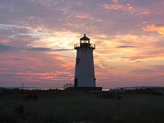
Edgartown Harbor Light is a lighthouse located in Edgartown, Massachusetts, United States, where it marks the entrance to Edgartown Harbor and Katama Bay. It is one of five lighthouses on the island of Martha's Vineyard. The first lighthouse, a two-story wooden structure that also served as the keeper's house, was constructed in 1828. It was demolished, and replaced by the current cast-iron tower, in 1939. Originally located on an artificial island 1/4 miles from shore, the lighthouse is now surrounded by a beach formed, since 1939, by sand accumulating around the stone causeway connecting it to the mainland.

The Grand Island Harbor Rear Range Light is a lighthouse located off M-28 in Munising Township, Michigan. It is also known as the Bay Furnace Rear Range Light, Christmas Rear Range Light, or End of the Road Light. The corresponding front range light was replaced in 1968; the rear range light was listed on the National Register of Historic Places in 1990. It is no longer an active aid to navigation.

The first Corregidor Island Lighthouse was a historic lighthouse located on the island of Corregidor, in the province of Cavite, Philippines. The light station was one of the most important lights in the archipelago. It was established in 1853 to guide ships to the entrance of Manila Bay on their way to the port of Manila, the most important trading center in the country. This light occupies the converging point of two lines of approach for vessels from the China Sea which steer for the entrance of Manila Bay. Vessels from Hong Kong and the ports of China to the northwest first sight the Capones Island light off the southwest coast of Zambales. Vessels from ports of Indo-China first sight the Corregidor lights in the center. Vessels from Singapore, Indonesia, India, and all the ports of the Philippine Islands, to the south, first sight the Cabra Island light. All lines converge on Corregidor light at the bay entrance.

The Duluth South Breakwater Inner Light is a lighthouse on the south breakwater of the Duluth Ship Canal in Duluth, Minnesota, United States. It forms a range with the Duluth South Breakwater Outer Light to guide ships into the canal from Lake Superior. The current structure was built from 1900 to 1901.
The Charlotte Harbor and Northern Railway is a historic railroad line that at its greatest extent serviced Gasparilla Island in Charlotte Harbor and a major shipping port that once operated there. The railroad's principal purpose was to transport phosphate mined along the Peace River and in the Bone Valley region of Central Florida to the port to be shipped. It also brought passengers to the island community of Boca Grande on Gasparilla Island, and is largely responsible for making Boca Grande the popular tourist destination it is today. Part of the line remains in service today between Mulberry and Arcadia, which is now owned and operated by CSX Transportation. Today, it makes up CSX's Achan Subdivision and part of their Brewster Subdivision.

The Boca Grande Bike Path is a 6.5 mile multi-use path in Boca Grande, Florida on Gasparilla Island. The northern portion of the path runs on the former right of way of the Charlotte Harbor and Northern Railway, which operated on Gasparilla Island from 1907 to 1981. As Florida's first rail trail, it was repurposed principally for bicycles, but pedestrians also use it. Golf carts are also permitted on the path. Another trail exists on the mainland portion of the railroad line known as the Cape Haze Pioneer Trail.
The Delaware Breakwater Range Rear Light was a lighthouse west of Lewes, Delaware. It was made obsolete by the shifting of Cape Henlopen and was disassembled and moved to Florida to become the Boca Grande Entrance Range Rear Light.
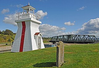
Balache Point Lighthouse, also known as Balache Point Range Rear Lighthouse, is an active Canadian lighthouse located next to the Canso Canal, near Port Hastings, Inverness County, Nova Scotia. The salt shaker style light, which sits on a small hillock on the Cape Breton side of the canal, is the second lighthouse to be built on the site.

Brazos Santiago Pass is a natural coastal landform located in the Lower Laguna Madre and Lower Rio Grande Valley on the furthest southern beach terrain of the Texas Gulf Coast. The seacoast passage is interpolated by barrier islands encompassing the southern Brazos Island and the northern South Padre Island.


