Fowey Rocks Light

Last updated
Fowey Rocks Light
Fowey Lighthouse.jpg
Fowey Rocks Light
Locationseven miles southeast of Cape Florida on Key Biscayne
Coordinates 25°35′26.2″N80°05′48″W / 25.590611°N 80.09667°W / 25.590611; -80.09667
Tower
Foundation screw-pile
Construction cast-iron
AutomatedMay 7, 1975
Height34 m (112 ft)  OOjs UI icon edit-ltr-progressive.svg
Shapeskeletal octagonal pyramid
Markingsbrown and white
HeritageNational Register of Historic Places listed place  OOjs UI icon edit-ltr-progressive.svg
Racon "O" (Oscar)
Light
First lit1878
Focal height110 feet (34 m)
Lens1878: 1st order drum Fresnel lens
1982: Flash tube array
1983: 300mm
Current: VRB-25 system
RangeWhite 15 nautical miles (28 km; 17 mi), red 10 nautical miles (19 km; 12 mi)
Characteristic Flashing white 10s with two red sectors
Fowey Rocks Light
USA Florida location map.svg
Red pog.svg
NRHP reference No. 10001181 [1]
Added to NRHPJanuary 26, 2011

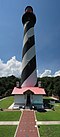
Fowey Rocks Light is located seven miles southeast of Cape Florida on Key Biscayne. [2] [3] [4] The lighthouse was completed in 1878, replacing the Cape Florida Light. It was automated on May 7, 1975, and as of 2021 is still in operation. [5] The structure is cast iron, with a screw-pile foundation, a platform and a skeletal tower. The light is 110 feet above the water. The tower framework is painted brown, while the dwelling and enclosed circular stair to the lantern is painted white. The original lens was a first-order drum Fresnel lens which stood about 12 feet (4 m) high and weighed about a ton (tonne). The light has a nominal range of 15 miles in the white sectors, and 10 miles in the red sectors.

Contents

Fowey Rocks Lighthouse, U.S. Coast Guard Archive USCGFoweyRocks.jpg
Fowey Rocks Lighthouse, U.S. Coast Guard Archive

Fowey Rocks are named after the Royal Navy frigate HMS Fowey which was wrecked on a different reef to the south in 1748. [6] During construction of the lighthouse the workers lived on a platform built over the water to minimize the danger of transporting them and their supplies each day from the mainland. While construction was under way, on 17 February 1878 the Arratoon Apcar ran aground on the reef. The 1500 ton steamship came to rest just 200 yards (180 m) from the workmen's platform. [7] Efforts to save the boat failed, and she was pounded apart on the rocks and sank. Today the wreck is an excellent scuba diving site. [8] One early assistant keeper of the lighthouse, Jefferson B. Browne, later became Chief Justice of the Florida Supreme Court. [9]

The Labor Day Hurricane of 1935 washed away the first deck of the lighthouse, 15 feet above the water, but the tower survived. The lighthouse is inside the boundaries of Biscayne National Park.

In June 2011, the General Services Administration made the Fowey Rocks Light (along with 11 others) available at no cost to public organizations willing to preserve them. [10] [11] On October 2, 2012, the National Park Service accepted ownership of the light. [12]

It is the last of the original Florida Keys offshore manned reef lights in operation, all others having been decommissioned by 2015. [13] [14] The original Fresnel lens has been replaced by a modern solar-powered light. Although owned by the National Park Service, the light continues to be maintained by the US Coast Guard. [15]

Related Research Articles

<span class="mw-page-title-main">Lighthouse</span> Structure designed to emit light to aid navigation

A lighthouse is a tower, building, or other type of physical structure designed to emit light from a system of lamps and lenses and to serve as a beacon for navigational aid, for maritime pilots at sea or on inland waterways.

<span class="mw-page-title-main">Cape Florida Light</span> Lighthouse in Florida, US

The Cape Florida Light is a lighthouse on Cape Florida at the south end of Key Biscayne in Miami-Dade County, Florida. Constructed in 1825, it guided mariners off the Florida Reef, which starts near Key Biscayne and extends southward a few miles offshore of the Florida Keys. It was operated by staff, with interruptions, until 1878, when it was replaced by the Fowey Rocks lighthouse. The lighthouse was put back into use in 1978 by the U.S. Coast Guard to mark the Florida Channel, the deepest natural channel into Biscayne Bay. They decommissioned it in 1990.

<span class="mw-page-title-main">Alligator Reef Light</span> Lighthouse in Florida, US

Alligator Reef Light is located 4 nautical miles east of Indian Key, near the Matecumbe Keys of Florida in the United States, north of Alligator Reef itself. The station was established in 1873. It was automated in 1963 and was last operational in July, 2014, and is being replaced by a 16' steel structure with a less powerful light located adjacent to it. The structure is an iron pile skeleton with a platform. The light is 136 feet (41 m) above the water. It is a white octagonal pyramid skeleton framework on black pile foundation, enclosing a square dwelling and a stair-cylinder. The lantern is black. The original lens was a first order bivalve Fresnel lens. The light characteristic of the original light was: flashing white and red, every third flash red, from SW by W 1/2 W through southward to NE 1/8 E, and from NE by E 3/4 E through northward to SW 3/8 S; flashing red throughout the intervening sectors; interval between flashes 5 seconds. It had a nominal range of 14 nautical miles in the white sectors and 11 nautical miles in the red sectors. The new light has a range of approximately 7 nautical miles.

<span class="mw-page-title-main">Carysfort Reef Light</span> Lighthouse in Florida, US

Carysfort Reef Light is located east of Key Largo, Florida. The lighthouse has an iron-pile foundation with a platform, and a skeletal, octagonal, pyramidal tower, which is painted red. The light was 100 feet (30 m) above the water. It was the oldest functioning lighthouse of its type in the United States until it was decommissioned in 2015, having been completed in 1852. The light last installed was a xenon flashtube beacon. It was added to the National Register of Historic Places in 1984.

<span class="mw-page-title-main">Sombrero Key Light</span> Lighthouse in Marathon, Florida, United States

Sombrero Key Light is located offshore of Vaca Key in Marathon, Florida. The lighthouse is located on a mostly submerged reef. The name Sombrero Key goes back to the Spanish, and old charts show a small island at the spot, but by the later 19th Century the island had eroded away, with some parts of the reef exposed at low tide. As a result, the reef and the lighthouse have also been called Dry Banks.

<span class="mw-page-title-main">American Shoal Light</span> Lighthouse in Florida, US

The American Shoal Light is located east of the Saddlebunch Keys, just offshore from Sugarloaf Key, close to Looe Key, in Florida, United States. It was completed in 1880, and first lit on July 15, 1880. The structure was built to the same plan and dimensions as the Fowey Rocks lighthouse, completed in 1878.

<span class="mw-page-title-main">Dry Tortugas Light</span> Lighthouse in Florida, United States

The Dry Tortugas Light is a lighthouse located on Loggerhead Key, three miles west of Fort Jefferson, Florida. It was taken out of operation in 2015. It has also been called the Loggerhead Lighthouse. It has been said to be "a greater distance from the mainland than any other light in the world."

<span class="mw-page-title-main">Garden Key Light</span> Lighthouse in Florida, US

The Garden Key Light, also known as the Tortuga Harbor Light, is located at Fort Jefferson, on Garden Key in the Dry Tortugas, Florida. The first lighthouse, started in 1824 and first lit in 1826, was a brick conical tower. The lighthouse and its outbuildings were the only structures on Garden Key until construction started on Fort Jefferson in 1846. Construction continued until 1861, but the fort was never completed.

<span class="mw-page-title-main">Sand Key Light</span> Lighthouse southwest of Key West, Florida, United States

Sand Key Light is a lighthouse 6 nautical miles southwest of Key West, Florida, between Sand Key Channel and Rock Key Channel, two of the channels into Key West, on a reef intermittently covered by sand. At times the key has been substantial enough to have trees, and in 1900 nine to twelve thousand terns nested on the island. At other times the island has been washed away completely.

<span class="mw-page-title-main">Unmanned reef lights of the Florida Keys</span> Lighthouses in Florida, United States

The unmanned reef lights of the Florida Keys were navigational aids erected near the Florida Keys between 1921 and 1935. They were intended to mark local hazards and did not need to be visible for as far as the reef lights that were erected near the Keys during the 19th century. By the time the lights in this list were erected, older lighthouses were being automated, and these new lights were designed to be automated from the start. The lights resembled the older reef lights in having a wrought iron skeletal pyramidal structure on a screw-pile foundation. They all originally had lanterns on their peaks, so that they looked like smaller versions of the older reef lights, but had no keeper's quarters.

<span class="mw-page-title-main">Michigan Island Light</span> Lighthouse

The Michigan Island Lighthouse is a lighthouse operated by the National Park Service and located on Michigan Island on western Lake Superior in the Apostle Islands National Lakeshore.

<span class="mw-page-title-main">Ile Aux Galets Light</span> Lighthouse in Michigan, United States

Ile Aux Galets Light, also known as Skillagalee Island Light, is located on Ile Aux Galets, a gravelly, low-lying island in northeast Lake Michigan, between Beaver Island and the mainland, approximately 7 miles (11 km) northwest of Cross Village in Emmet County, Michigan. Along with nearby Grays Reef, Waugoshance, and White Shoal Lights, it warns shipping away from the reefs and shoals of Waugoshance Point, which pose an imminent hazard to navigation.

<span class="mw-page-title-main">Port Austin Light</span> Lighthouse in Michigan, United States

Port Austin Lighthouse is a lighthouse off the shore of Lake Huron, about 2.5 miles (4.0 km) north of Port Austin, Huron County Michigan sitting on a rocky reef (shoal), which is just north of the tip of the Thumb and a real hazard to navigation.

<span class="mw-page-title-main">Au Sable Light</span> Lighthouse in Michigan, United States

Au Sable Light is an active lighthouse in the Pictured Rocks National Lakeshore west of Grand Marais, Michigan off H-58. Until 1910, this aid to navigation was called "Big Sable Light".

<span class="mw-page-title-main">Fourteen Foot Shoal Light</span> Lighthouse in Michigan, United States

The lighthouse at Fourteen Foot Shoal was named to note that the lake is only 14 feet (4.3 m) deep at this point, which is a hazard to navigation, ships and mariners.

<span class="mw-page-title-main">Rock of Ages Light</span> Lighthouse in Michigan, United States

The Rock of Ages Light is a U.S. Coast Guard lighthouse on a small rock outcropping approximately 2.25 miles (3.62 km) west of Washington Island and 3.5 miles (5.6 km) west of Isle Royale, in Eagle Harbor Township, Keweenaw County, Michigan. It is an active aid to navigation.

<span class="mw-page-title-main">Brandywine Shoal Light</span> Lighthouse

The Brandywine Shoal Light is a lighthouse on the north side of the ship channel in Delaware Bay on the east coast of the United States, west of Cape May, Cape May County, New Jersey, United States. It was the site of the first screw-pile lighthouse in the United States.

<span class="mw-page-title-main">Spectacle Reef Light</span> Lighthouse in Michigan, United States

Spectacle Reef Light is a lighthouse 11 miles (18 km) east of the Straits of Mackinac and is located at the northern end of Lake Huron, Michigan. It was designed and built by Colonel Orlando Metcalfe Poe and Major Godfrey Weitzel, and was the most expensive lighthouse ever built on the Great Lakes.

<span class="mw-page-title-main">Florida Reef</span> Coral barrier reef along the Florida Keys

The Florida Reef is the only living coral barrier reef in the continental United States. It lies a few miles seaward of the Florida Keys, is about 4 miles wide and extends 270 km (170 mi) from Fowey Rocks just east of Soldier Key to just south of the Marquesas Keys. The barrier reef tract forms a great arc, concentric with the Florida Keys, with the northern end, in Biscayne National Park, oriented north-south and the western end, south of the Marquesas Keys, oriented east-west. The rest of the reef outside Biscayne National Park lies within John Pennekamp Coral Reef State Park and the Florida Keys National Marine Sanctuary. Isolated coral patch reefs occur northward from Biscayne National Park as far north as Stuart, in Martin County. Coral reefs are also found in Dry Tortugas National Park west of the Marquesas Keys. There are more than 6,000 individual reefs in the system. The reefs are 5,000 to 7,000 years old, having developed since sea levels rose following the Wisconsinan glaciation.

SS <i>Arratoon Apcar</i> Steamship wreck in Florida

SS Arratoon Apcar was an iron-hulled steamship built in 1861 for the Apcar Line. She ran ashore on Fowey Rocks off the coast of Florida on 17 February 1878, was abandoned 3 days later, and broke apart. Today the wreck is a good location for scuba diving.

References

  1. "National Register Information System". National Register of Historic Places . National Park Service. July 9, 2010.
  2. Light List, Volume III, Atlantic Coast, Little River, South Carolina to Econfina River, Florida (PDF). Light List. United States Coast Guard. 2009. p. 7.
  3. "Historic Light Station Information and Photography: Florida". United States Coast Guard Historian's Office. Archived from the original on 2017-05-01.
  4. Rowlett, Russ (2010-03-11). "Lighthouses of the United States: Eastern Florida and the Keys". The Lighthouse Directory. University of North Carolina at Chapel Hill.
  5. "Fowey Rocks Lighthouse". National Park Service - Biscayne National Park. June 10, 2021. Retrieved March 16, 2022.
  6. The Coast Guard History site, cited above, says she was a Spanish Galleon, but there is substantial documentation of her Royal Navy status.
  7. "The Alleged Arratoon Apcar Wreck Site". Marine Archaeological Research & Conservation Inc. 2006. Archived from the original on 2013-10-12. Retrieved 2013-11-04.
  8. "Arratoon Apcar". DiveSpots.com, LLC. Archived from the original on 2013-02-25. Retrieved 2013-11-04.
  9. Love Dean, Lighthouses of the Florida Keys (1998), p. 228.
  10. "For sale: Waterfront property; cozy, great views, plenty of light, needs TLC". CNN. Retrieved 12 July 2011.
  11. Beatty, MaryAnne. "GSA Making 12 Historic Lighthouses Available at No Cost to Public Organizations Willing to Preserve Them". GSA Website. US General Services Administration. Archived from the original on 22 June 2011. Retrieved 12 July 2011.
  12. "A Tale Of Two Lighthouses". National Parks Traveler. 2012-10-19. Retrieved October 23, 2012.
  13. "The 6 Lighthouses". Florida Keys Reef Lights Foundation. Retrieved July 9, 2018.
  14. "Coast Guard Warns of Unsafe Florida Keys Reef Lighthouses". Florida Keys Treasures. January 31, 2015. Retrieved July 9, 2018.
  15. "Fowey Rocks Lighthouse". US National Park Service. Retrieved July 9, 2018.

Further reading