The MPA was established in 1991 and proclaimed by the Minister of Environmental Affairs and Tourism, (Marthinus van Schalkwyk, in Government Gazette No. 26431 of 4 June 2004 in terms of section 43 of the) Marine Living Resources Act, 18 of 1998.[2] The Aliwal Shoal MPA was extended by the addition of the large Aliwal Shoal Offshore Marine Protected Area in 2018/2019.[1]
A marine protected area is defined by the IUCN as "A clearly defined geographical space, recognised, dedicated and managed, through legal or other effective means, to achieve the long-term conservation of nature with associated ecosystem services and cultural values".[2]
Extent
Map of the extent of the Aliwal Shoal Marine Protected Area showing zonation and bathymetryBathymety of the older parts of the Aliwal Shoal MPABathymetry of the Crown area and Produce restricted zones.
The protected area includes the seabed, subsoil and water column inside the boundaries.[1] Length of coastline protected since 2004 is 18,30km[2] The area of ocean protected previous to the 2018 extension was 126km2.[2] now 670km2.
Zonation
The MPA is divided into an inshore and an offshore area. It is further subdivided into an offshore controlled-pelagic zone, two offshore controlled zones, an inshore controlled zone, an inshore restricted zone, four offshore restricted zones and two inshore sanctuary zones.[1]
Part of the intertidal portion of the Aliwal Shoal Marine Protected Area from S30°14.420’, E30°47.071’ to S30°16.193’, E30°45.814’ between the high water mark and the five meter depth contour.
Northern boundary: S30°10.601', E30°52.5′ to S30°10.601', E30°54.498′; S30°9.8', E30°54.498′ to S30°9.8′ E30°52.5’ and S30°7.0’, E30°52.5’ to S30°7.0’, E31°2’
Eastern boundary: S30°7.0’, E31°2’ to S30°22.412’, E31°2’
Southern boundary: S30°22.412’, E31°2’ to S30°22.412’, E30°52.5’
Western boundary: S30°22.412’, E30°52.5’ to S30°10.601', E30°52.5′; S30°10.601', E30°54.498′ to S30°9.8', E30°54.498′ and S30°9.8′ E30°52.5’ to S30°7.0’, E30°52.5’
Northern boundary: S30°14.968′, E30°49.723′ to S30°14.985′, E30°49.846′
Eastern boundary: S30°14.985′, E30°49.846′ to S30°15.093′, E30°49.827′
Southern boundary: S30°15.093′, E30°49.827′ to S30°15.076′, E30°49.703′
Western boundary: S30°15.076′, E30°49.703′ to S30°14.968′, E30°49.723′
Crown Offshore Restricted Zone (CORZ) is enclosed by twelve line segments between waypoints which lie on the 25 meter isobath.[4]
S30°15.600′, E30°49.776′ to S30°15.791′, E30°49.714′
S30°15.791′, E30°49.714′ to S30°15.982′, E30°49.627′
S30°15.982′, E30°49.627′ to S30°15.982′, E30°49.627′
S30°16.270′, E30°49.409′ to S30°16.270′, E30°49.409′
S30°16.673′, E30°49.078′ to S30°16.673′, E30°49.078′
S30°16.926′, E30°48.835′ to S30°16.926′, E30°48.835′
S30°16.800′, E30°48.600′ to S30°16.800′, E30°48.600′
S30°16.680′, E30°48.376′ to S30°16.680′, E30°48.376′
S30°16.189′, E30°48.834′ to S30°16.189′, E30°48.834′
S30°15.908′, E30°49.143′ to S30°15.908′, E30°49.143′
S30°15.518′, E30°49.589′ to S30°15.518′, E30°49.589′
S30°15.474′, E30°49.671′ to S30°15.474′, E30°49.671′
Controlled zones
Aliwal Shoal inshore controlled zone is the rest of the high-water to five metre isobath inshore portion of the MPA excepting the two sanctuary zones and the restricted zone.[1]
Part of the intertidal portion of the Aliwal Shoal Marine Protected Area, from S30°13.464’, E30°47.694’ to S30°14.420’, E30°47.071’ between the high water mark and the five metre depth contour.
Part of the intertidal portion of the Aliwal Shoal Marine Protected Area, from S30°20.404’, E30°44.003’ to S30°20.807’, E30°43.618’ between the high water mark and the five meter depth contour.
Management
The marine protected areas of South Africa are the responsibility of the national government, which has management agreements with a variety of MPA management authorities, in this case, Ezemvelo KZN Wildlife, which manages the MPA with funding from the SA Government through the Department of Environmental Affairs (DEA).[2]
The Department of Agriculture, Forestry and Fisheries is responsible for issuing permits, quotas and law enforcement.[5]
Use
Activities requiring a permit
Fishing
The game and bait fish that be caught in the controlled-pelagic zone of the MPA are in the following families, and all species in these families may be caught.[1]
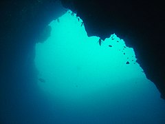
Four major habitats exist in the sea in this region, distinguished by the nature of the substrate. The substrate, or base material, is important in that it provides a base to which an organism can anchor itself, which is vitally important for those organisms which need to stay in one particular kind of place. Rocky shores and reefs provide a firm fixed substrate for the attachment of plants and animals. Sandy beaches and bottoms are a relatively unstable substrate and cannot anchor many of the other benthic organisms. Finally there is open water, above the substrate and clear of the kelp forest, where the organisms must drift or swim. Mixed habitats are also frequently found, which are a combination of those mentioned above.[9] There are no significant estuarine habitats in the MPA.
Rocky shores and reefs There are rocky reefs and mixed rocky and sandy bottoms. For many marine organisms the substrate is another type of marine organism, and it is common for several layers to co-exist. Examples of this are red bait pods, which are usually encrusted with sponges, ascidians, bryozoans, anemones, and gastropods, and abalone, which are usually covered by similar seaweeds to those found on the surrounding rocks, usually with a variety of other organisms living on the seaweeds.[9]:Ch.2
The type of rock of the reef is of some importance, as it influences the range of possibilities for the local topography, which in turn influences the range of habitats provided, and therefore the diversity of inhabitants. Sandstone and other sedimentary rocks erode and weather very differently, and depending on the direction of dip and strike, and steepness of the dip, may produce reefs which are relatively flat to very high profile and full of small crevices. These features may be at varying angles to the shoreline and wave fronts. There are fewer large holes, tunnels and crevices in sandstone reefs, but often many deep but low near-horizontal crevices.
Coral reefs
Sedimentary beaches and bottoms (including mud, sand, shelly, pebble and gravel bottoms) Sedimentary bottoms at first glance appear to be fairly barren areas, as they lack the stability to support many of the spectacular reef based species, and the variety of large organisms is relatively low. The sediment is continually being moved around by wave action, to a greater or lesser degree depending on weather conditions and exposure of the area. This means that sessile organisms must be specifically adapted to areas of relatively loose substrate to thrive in them, and the variety of species found on a sandy or gravel bottom will depend on all these factors. unconsolidated sedimentary bottoms have one important compensation for their instability, animals can burrow into the sediment and move up and down within its layers, which can provide feeding opportunities and protection from predation. Other species can dig themselves holes in which to shelter, or may feed by filtering water drawn through the tunnel, or by extending body parts adapted to this function into the water above the sand.[9]:Ch.3
This section is empty. You can help by adding to it. (January 2019)
Threats
This section is empty. You can help by adding to it. (January 2019)
Slipways and harbours in the MPA
There are no harbours in the MPA. Boats are launched directly into the sea from the beach, or when conditions allow, may be launched in a river and navigated through the river mouth.
See also
Marine protected areas of South Africa{{Cite journal|title=MPA Declarations |issue=10177 |journal=Regulation Gazette No. 42478 |volume=647 |date=23 May 2019 |url=https://cer.org.za/wp-content/uploads/2019/05/MPA-declarations.pdf |publisher=Government Printer |location=Pretoria }}{{Cite web |title=Protected Areas Register |url=https://dffeportal.environment.gov.za/portal/apps/webappviewer/index.html?id=7e27f116dd194c1f9d446dacc76fe483 |website=dffeportal.environment.gov.za |access-date=10 July 2022}}
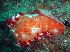
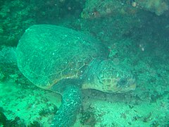
The Aliwal Shoal is a rocky reef which is the remains of an ancient sand dune approximately 5 kilometres (3.1 mi) off the coast of KwaZulu-Natal, South Africa. The reef is inhabited by many kinds of hard and soft corals and other marine invertebrates, and a variety of tropical and subtropical fish species. Aliwal Shoal was named after the near-sinking in 1849 of the three-masted vessel Aliwal, captained by James Anderson. There are two wrecks near the reef that are popular recreational dive sites. The Norwegian bulk carrier MV Produce sank in 1974, and SS Nebo sank in 1884. Aliwal Shoal has diverse marine life, including large predators, and is popular as a recreational scuba diving destination. The Shoal is known especially for its abundance of Grey nurse sharks between July and November when the sharks congregate there to mate.
The Tstsikamma Marine Protected Area is a marine protected area on the south coast of South Africa, in both the Western Cape and Eastern Cape. It is on the coast of the Tsitsikamma National Park, and is one of the oldest MPAs in the country. The MPA provides protection for marine habitat and wildlife, including birds and threatened and endangered fish species.
The Addo Elephant National Park Marine Protected Area is a marine conservation area in Algoa Bay, adjacent to the Nelson Mandela Bay Metropolitan Municipality, near Gqeberha, previously Port Elizabeth.
The Agulhas Bank Complex Marine Protected Area is an offshore marine protected area on the continental shelf lying approximately 39 nautical miles southeast of Cape Agulhas off the Western Cape in the Exclusive Economic Zone of South Africa.
The iSimangaliso Marine Protected Area is a coastal and offshore marine protected area in KwaZulu-Natal from the South Africa-Mozambique border in the north to Cape St Lucia lighthouse in the south.
The Cape Canyon Marine Protected Area is an offshore marine protected area on the continental shelf edge lying approximately 10 nautical miles west of Paternoster off the Western Cape in the exclusive economic zone of South Africa.
The Protea Banks Marine Protected Area is a marine conservation area on the continental shelf edge off the South Coast of KwaZulu-Natal in South Africa.
The Southeast Atlantic Seamounts Marine Protected Area is an offshore conservation region in the exclusive economic zone of South Africa
The Dwesa-Cwebe Marine Protected Area is an inshore and offshore conservation region, off the coast of the Dwesa-Cwebe Nature Reserve in the Eastern Cape province, in the territorial waters of South Africa.
The Port Elizabeth Corals Marine Protected Area is an offshore conservation region south of Port Elizabeth in the exclusive economic zone of South Africa
The Robben Island Marine Protected Area is an inshore and offshore conservation region around and near Robben Island in Table Bay in the territorial waters of South Africa.
The Amathole Offshore Marine Protected Area is an offshore conservation region, extending the Amathole Marine Protected Area in the territorial waters of South Africa.
The Southwest Indian Seamount Marine Protected Area is an offshore conservation region in the exclusive economic zone of South Africa.
The Benguela Bank Marine Protected Area is an offshore conservation region in the exclusive economic zone of South Africa
The uThukela Banks Marine Protected Area is an inshore and offshore conservation region in the territorial waters and exclusive economic zone of South Africa.
The Namaqua National Park Marine Protected Area is an inshore conservation region in Namaqualand in the Northern Cape province in the territorial waters of South Africa. It is closely associated with the Namaqua National Park, with which it has a common border and management.
The Pondoland Marine Protected Area is an inshore conservation region in the territorial waters of South Africa.
The Walker Bay Whale Sanctuary Marine Protected Area is an inshore conservation region in the territorial waters of South Africa in the Western Cape province between Hermanus and Gansbaai.
The Amathole Marine Protected Area is an inshore conservation region in the territorial waters of South Africa, near East London on the coast of the Eastern Cape.
The Trafalgar Marine Protected Area is an inshore conservation region in the territorial waters of South Africa in kwaZulu-Natal, between Port Edward and Margate.
This page is based on this Wikipedia article Text is available under the CC BY-SA 4.0 license; additional terms may apply. Images, videos and audio are available under their respective licenses.