Related Research Articles
The Bohol Sea, also called the Mindanao Sea, is located between Visayas and Mindanao in the Philippines. It lies south of Bohol and Leyte and north of Mindanao. Siquijor and Camiguin are its two major islands.

Technical diving is scuba diving that exceeds the agency-specified limits of recreational diving for non-professional purposes. Technical diving may expose the diver to hazards beyond those normally associated with recreational diving, and to a greater risk of serious injury or death. The risk may be reduced by appropriate skills, knowledge and experience, and by using suitable equipment and procedures. The skills may be developed through appropriate specialised training and experience. The equipment often involves breathing gases other than air or standard nitrox mixtures, and multiple gas sources.

Wreck diving is recreational diving where the wreckage of ships, aircraft and other artificial structures are explored. Although most wreck dive sites are at shipwrecks, there is an increasing trend to scuttle retired ships to create artificial reef sites. Diving to crashed aircraft can also be considered wreck diving. The recreation of wreck diving makes no distinction as to how the vessel ended up on the bottom.

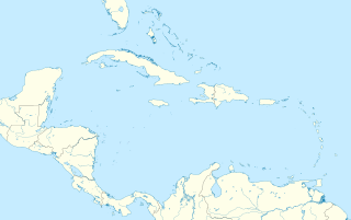
Little Cayman is one of three Islands comprising the Cayman Islands. It is located in the Caribbean Sea, approximately 60 miles (96 km) northeast of East End of Grand Cayman and five miles (8 km) west of West end of Cayman Brac.The capital of Little Cayman is Salt Rock and not Blossom Village as many seem to presume. Little Cayman is by far the least populous, with a permanent population of about 250 including seasonal residents/homeowners (pre-COVID) and at present around 175 residents. The majority of the population are expatriate workers from Jamaica, the Philippines, and Honduras and from other Latin American countries as well as Canada, the USA, India, Australia, Scotland, England, and South Africa. There are a handful of local Caymanians estimated as fewer than 20. It is about 10 miles (16 km) long with an average width of 1 mile (1600 m) and most of the island is undeveloped. Almost the entire island is at sea level. The highest elevation is about 40 feet. Rainy season although not that bad mostly light showers are in Mid-April until June and again in mid-September to mid-October. There will be occasional quick rain showers in the early morning hours. The coolest months are from End of November until Mid March as the cold fronts coming in from the North which the temperature can drop into the low'70s. The Hottest and dryest months are in Summer starting mid-June to mid-September with temperatures between the mid-80s and high 90s.

Recreational diving or sport diving is diving for the purpose of leisure and enjoyment, usually when using scuba equipment. The term "recreational diving" may also be used in contradistinction to "technical diving", a more demanding aspect of recreational diving which requires greater levels of training, experience and equipment to compensate for the more hazardous conditions associated with the disciplines. Breath-hold diving for recreation also fits into the broader scope of the term, but this article covers the commonly used meaning of scuba diving for recreational purposes, where the diver is not constrained from making a direct near-vertical ascent to the surface at any point during the dive, and risk is considered low.

The Blue Hole is a diving location on the southeast Sinai, a few kilometres north of Dahab, Egypt on the coast of the Red Sea.
Seacrest Cove 2 also known as Alki Cove 2 is a local dive site in West Seattle, Washington. The site within Seacrest Park is the most popular diving location in Seattle.

Canoe diving and Kayak diving are recreational diving where the divers paddle to a diving site in a canoe or kayak carrying all their gear in or on the boat to the place they want to dive. Canoe or kayak diving gives the diver independence from dive boat operators, while allowing dives at sites which are too far to comfortably swim, but are sufficiently sheltered.
The Saba National Marine Park encompasses the waters and sea bed encircling the Caribbean island of Saba, Kingdom of the Netherlands, from the high water mark to 200 feet (61 m) deep. In total, the marine park covers approximately 5 square miles (13 km2). At the time of its creation in 1987, the government passed the Marine Environment Ordinance to protect the coral reefs and other marine life within the park. The Saba Conservation Foundation manages the Saba National Marine Park, as well as the island's hyperbaric facility and natural sites on land.

Underwater search and recovery is the process of locating and recovering underwater objects, often by divers, but also by the use of submersibles, remotely operated vehicles and electronic equipment on surface vessels.
Deon Dreyer was a South African recreational scuba diver who died in Bushman's Hole in South Africa. Cave diver David Shaw died more than 10 years later whilst attempting to retrieve Dreyer's body.
William "Bill" Nagle (1952–1993) was a pioneering American wreck diver.

Octopus Hole is a designated conservation area on the Washington's Hood Canal. It is located immediately off of Highway 101, just over three miles North of Hoodsport. The site is marked with conservation signs, an old sign from Mike's Dive Shop, and two very small parking areas on both lanes of the highway. Similar to the close-by Sund Rock conservation area, Octopus Hole is very popular with Scuba divers who enjoy diving the walls associated with the site to view various underwater creatures, including but not limited to Lingcod, Giant Pacific Octopus, Wolf Eel, sea cucumber, and nudibranch. The walls on this site are accessible as shore dives. To access the dive sites on the Hood Canal from the highway, divers must straddle the Highway 101 guard rail, then walk down the crude steps to the shore, some 20–30 feet below. There is no fee to access this site, which is publicly accessible.

Miller's Point is a headland and stretch of protected coastline in South Africa. It is located about 4 kilometres (2.5 mi) south of Simon's Town on the road to Cape Point.

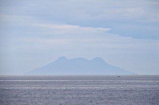
Molokini is a crescent-shaped, partially submerged volcanic crater which forms a small, uninhabited islet located in ʻAlalākeiki Channel between the islands of Maui and Kahoʻolawe, within Maui County in Hawaiʻi. It is the remains of one of the seven Pleistocene epoch volcanoes that formed the prehistoric Maui Nui island, during the Quaternary Period of the Cenozoic Era.

Recreational dive sites are specific places that recreational scuba divers go to enjoy the underwater environment. They include recreational diver training sites and technical diving sites beyond the range generally accepted for recreational diving. In this context all diving done for recreational purposes is included. Professional diving tends to be done where the job is, and with the exception of the recreational diving service industry, does not generally occur at specific sites chosen for their easy access, pleasant conditions or interesting features.

The environmental impact of recreational diving is the effects of recreational scuba diving on the underwater environment, which is largely the effects of diving tourism on the marine environment. It is not uncommon for highly trafficked dive destinations to have more adverse effects with visible signs of diving's negative impacts due in large part to divers who have not been trained to sufficient competence in the skills required for the local environment, an inadequate pre-dive orientation, or lack of a basic understanding of biodiversity and the delicate balance of aquatic ecosystems. There may also be indirect positive effects as the environment is recognised by the local communities to be worth more in good condition than degraded by inappropriate use, and conservation efforts get support from dive communities who promote environmental awareness, and teach low impact diving and the importance of respecting marine life. There are also global coral reef monitoring networks in place which include local volunteer divers assisting in the collection of data for scientific monitoring of coral reef systems, which may eventually have a net positive impact on the environment.
Low impact diving is recreational scuba diving that is intended to minimise environmental impact by using techniques and procedures that reduce the adverse effects on the environment to the minimum that is reasonably practicable for the situation. To a large extent this is achieved by avoiding contact with sensitive reef life, but it also applies to diving on historical wrecks and in caves with delicate rock formations. It is in the interests of diving tourism service providers to help protect the condition of the dive sites on which their businesses rely. They can contribute by encouraging and teaching low impact diving and following best-practice procedures for diving in sensitive areas. Low impact diving training has been shown to be effective in reducing diver contact with the bottom, the most common cause of reef damage.

Blue Hole is a blue hole dive site off the western coast of Guam. It is variously described as "Guam’s signature natural feature dive," "the most requested dive site on Guam," and "one of Guam’s most popular divesites". It is located in northern Agat Bay, just south of the entrance to Apra Harbor. Despite being very close to the southern coast of the Orote Peninsula, sheer cliffs mean that it is done exclusively as a boat dive, typically out of Cabras Marina in Apra Harbor, located 20 minutes away. The top of the underwater sinkhole begins at about 60 ft (18 m) and drops to more than 300 ft (91 m). However, the sinkhole is located next to a wall and there is an opening that allows exit at about 130 ft (40 m), putting it just within the limits of an advanced recreational dive, depending on certifying agency. The opening of the sinkhole appears to be a heart shape to divers within it. While entry to the site is done while the dive boat is hooked into a mooring buoy, exit typically requires deploying a surface marker buoy in east-to-west current and pickup in the open ocean.
References
- ↑ "Sund Rock Conservation Area". Washington Administrative Code 220-16-480. Retrieved 2012-08-05.